


At 05:00 the first Arakawa mountain bus pulls out of the car park of the Yakusugi Museum, above the port of Anbo, in full darkness. On Saturday 21 November 2026, 336 people set off from the Arakawa trailhead that morning, 239 of them off that bus and the rest by taxi or charter. Nearly all of them were walking 11 kilometres into the mountains of Yakushima (屋久島) to look at one tree from a wooden deck, and then walking 11 kilometres back.
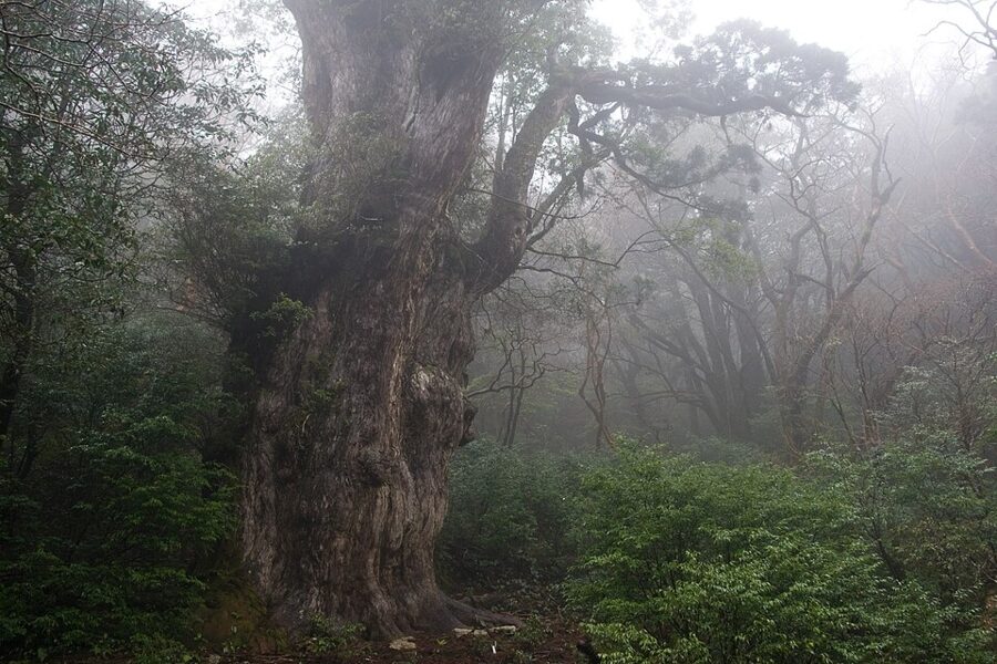
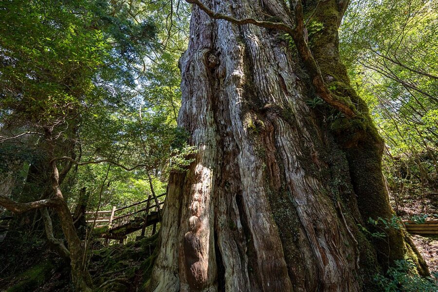
The tree is Jomon Sugi (縄文杉), a Japanese cedar with a trunk about 16 metres round, and nobody agrees how old it is. The island lies about 60 kilometres south of Cape Sata, the tip of mainland Kyushu, in Kagoshima Prefecture (鹿児島県). It is a round block of granite of 504 square kilometres, home to 11,858 people at the 2020 census, and it rises to 1,936 metres, higher than anything on the main island of Kyushu.

Three facts explain most of what you will see. The granite made the mountains, the mountains make the rain, and rain on poor granite soil made cedars that live for thousands of years. Then people spent four centuries cutting them down, and since 1993 the island has been a World Heritage site that tries to manage the people who come to look at what is left.

In this guide
How a granite island got so high
About 15.5 million years ago a body of molten granite some 25 kilometres across pushed up into the seabed sediments that now form the island’s rim. It cooled underground and the land has been rising ever since, so the coast is old sedimentary rock and the interior is granite. Granite cracks along widely spaced joints, which is why the summits carry house-sized boulders and towers, and why the valleys run in straight lines along the joint pattern.
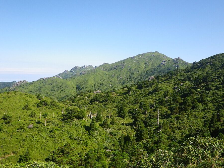

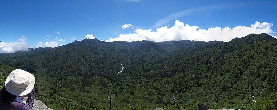
The highest point is Miyanoura-dake (宮之浦岳), 1,936 metres, the top of Kyushu and of every island south of it; on the Kyushu mainland nothing beats Nakadake in the Kuju range, at 1,791 metres. For decades the map said 1,935, and islanders remembered it with a pun, itsumo kumotte mien de gozaru, “it’s always cloudy, you can’t see it”. A 2001 survey found a rock 5.3 metres from the old survey point that stood a metre higher, and the figure changed that December.
More than 30 peaks pass 1,000 metres, hence the island’s nickname, the Alps on the ocean. Islanders split them in two. The maedake, front peaks such as Motchomu-dake, rise straight behind the villages; the okudake, inner peaks, hide behind them, and apart from Nagata-dake none can be seen from anywhere people live.
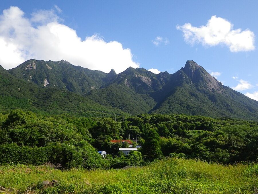

One event shaped the forest more than any other. About 7,300 years ago the Kikai caldera, under the sea to the northwest near Satsuma-Iojima, erupted so violently that its pyroclastic flow is thought to have crossed the water and buried most of the island. That date matters to the argument about Jomon Sugi’s age.
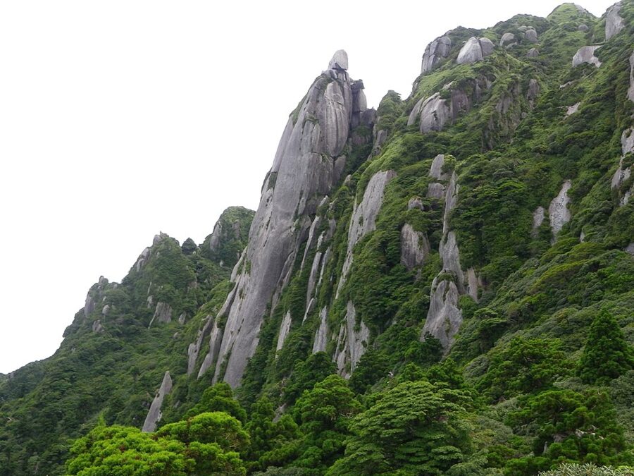

Thirty-five days of rain a month
The line everyone quotes comes from a novel. In Hayashi Fumiko’s Ukigumo (Floating Clouds), written between 1949 and 1951, a character says that on Yakushima it rains, so they say, 35 days a month. The Japan Meteorological Agency’s station on the northeast coast averages 4,651.7 millimetres a year (1991–2020), one of the highest normals in Japan, with 860 millimetres in June alone.
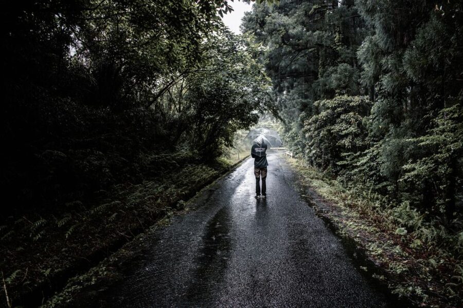
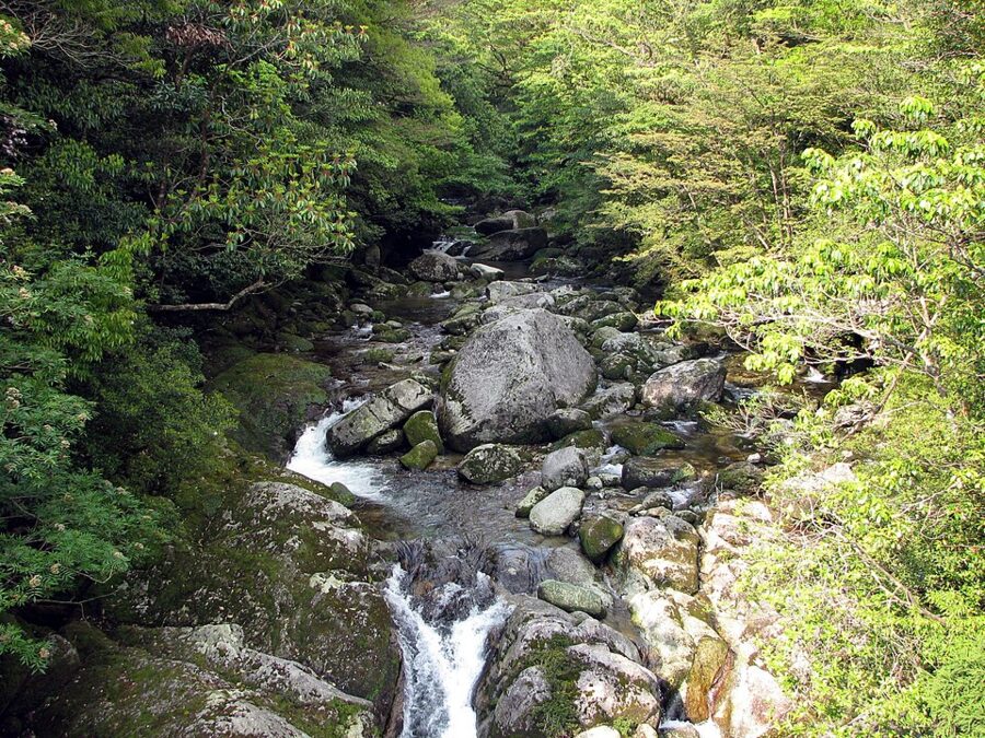
And the coast is the dry part. Wet air off the sea hits the mountains and is forced up, so the gauge at Yakusugi Land, at 1,000 metres, averages about 10,000 millimetres a year; on 18–19 May 2019 it caught 1,676 millimetres in 24 hours. The water leaves by about 140 rivers that run out from the centre like spokes, which is why the island is ringed with waterfalls.
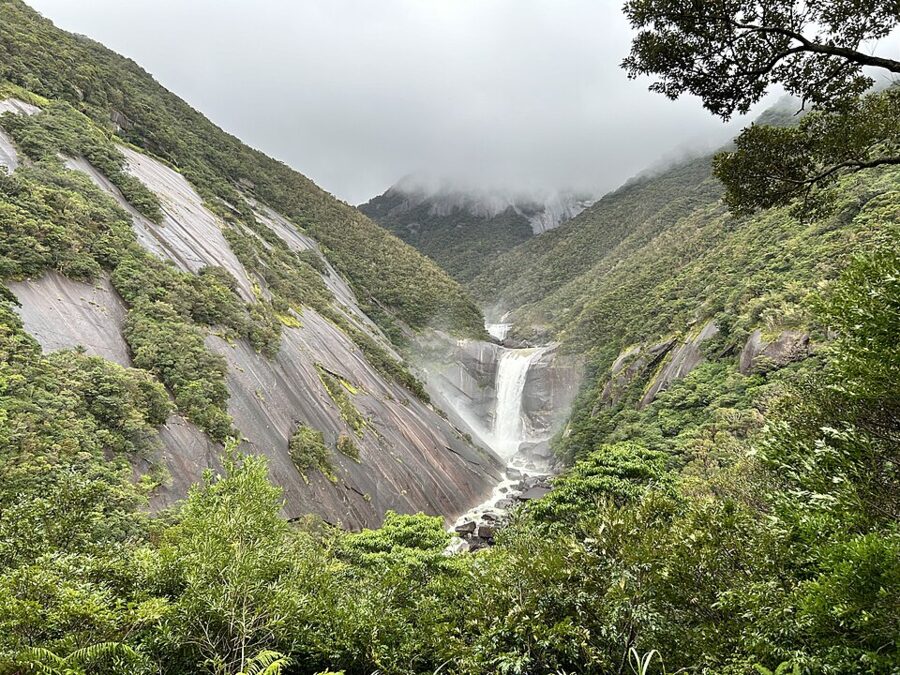
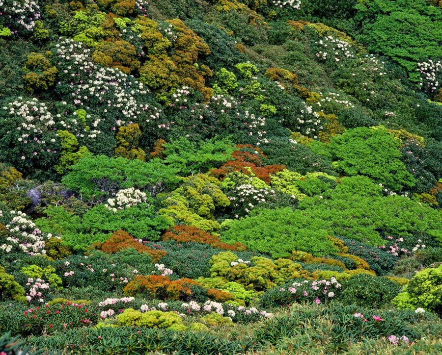
Climb from the shore and you pass through most of Japan’s climates in a day. Banyans and wild figs grow on the coast, where the yearly mean is 19.6°C. Evergreen oaks cover the slopes to about 500 metres, a mixed belt follows, cedar and fir take over from about 1,000 to 1,600 metres, and above that the ridges are dwarf bamboo, yakuzasa, with the pink Yakushima rhododendron.
There is no beech zone, as there would be on a mainland mountain this high. Snow lies metres deep on the summits in winter, above a coast that averages 11.8°C in January.

The cedars
What counts as a yakusugi
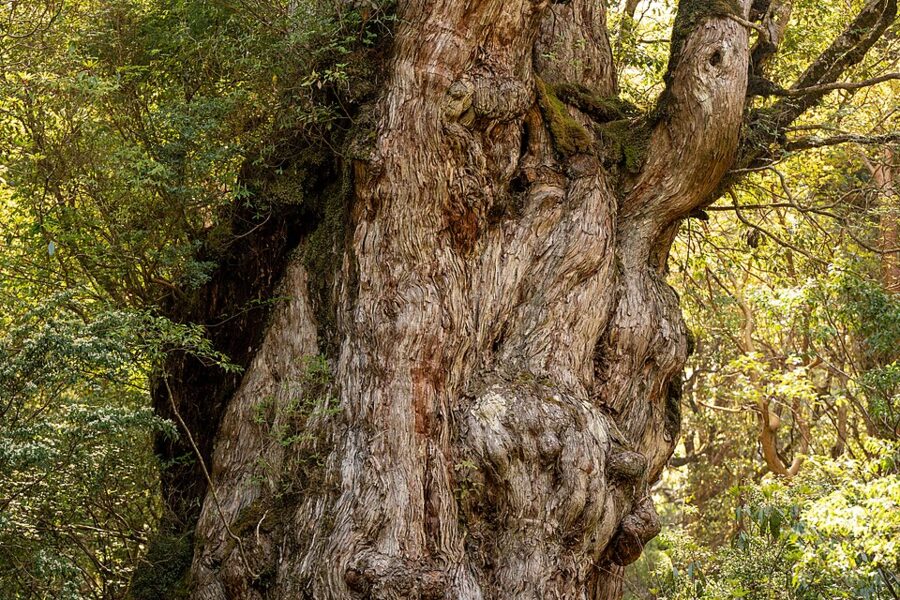
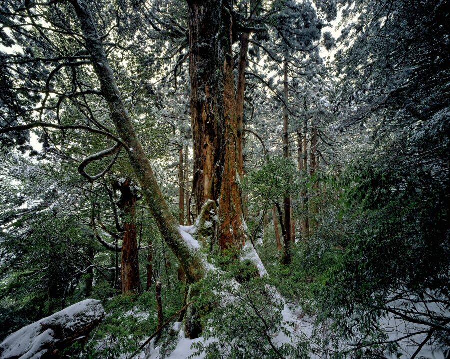
The trees are ordinary Japanese cedar, Cryptomeria japonica, the species planted across half of Japan. What differs is how they grow. Granite makes thin, poor soil, so the trees grow slowly with tight rings, and the wet air makes them produce more resin, which keeps rot out. A cedar elsewhere rarely lives past 500 years; here many have passed 1,000, and a few 3,000.
Islanders sort them by age. A yakusugi (屋久杉) is a mountain cedar over 1,000 years old; younger wild trees are kosugi, small cedars, and planted ones are jisugi, local cedar. Genetically they are the same tree. The difference shows in the timber, where planted wood has wide rings and sells as a separate product.
Shingles for Satsuma: the logging and the stumps
The first recorded use of the wood is about 1560, when island cedar went into rebuilding the Osumi Shohachiman shrine, now Kagoshima Jingu. Around 1590 Toyotomi Hideyoshi is said to have had cedar shipped to Osaka for the Great Buddha Hall of Hoko-ji in Kyoto, and the island’s largest stump is said, without proof, to be one of those trees.
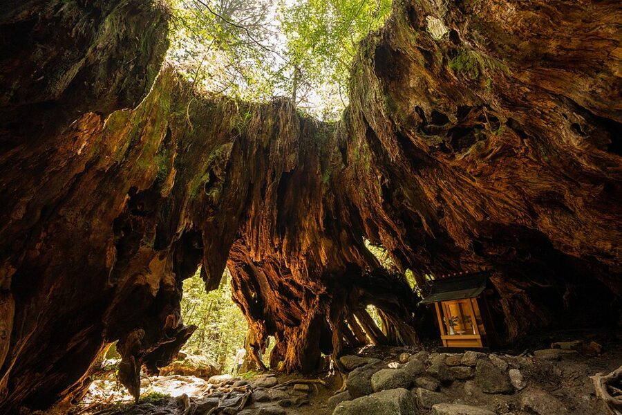

Large-scale cutting began around 1640. The usual story credits Tomari Jochiku (1570–1655), a Nichiren monk and Confucian scholar born in Anbo, who saw how poor the islanders were and persuaded the Shimazu lords of Satsuma to log the interior. Rice barely grows here, so the domain took its tax in hiraki, thin cedar roof shingles; by one account each man owed six bundles of a hundred a year.
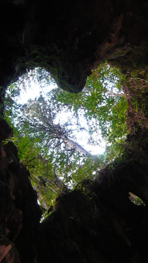

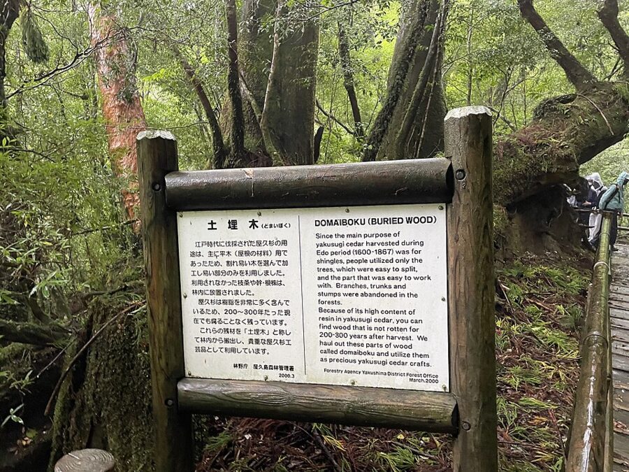
The loggers split straight-grained trunks into shingles on the spot. Giants with twisted grain could not be split, so they were left standing, and many of the old trees you will see survive because they were useless. Unworkable felled trunks were left on the slopes. That wood, domaiboku, buried wood, does not rot, and for decades it was the only yakusugi that could legally be sold.
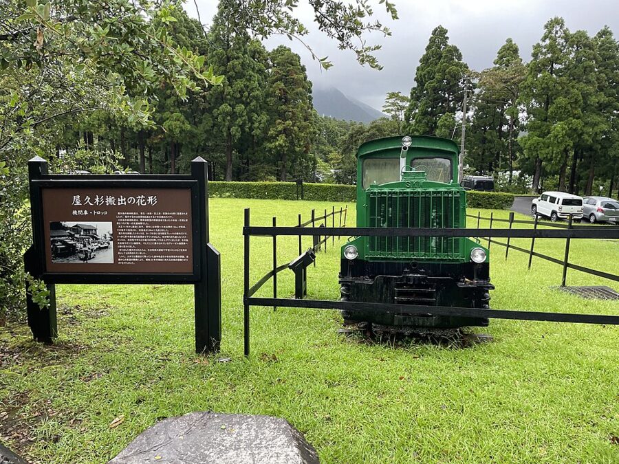
After 1873 the Meiji land-tax reform made more than 90 percent of the island national forest, and islanders who had always cut firewood there became trespassers. They sued the state in 1904 and lost 16 years later, but the outcry produced a 1921 charter for the island’s forests that locals called the Yakushima Constitution. It brought roads and, in 1923, the Anbo forest railway. Chainsaws arrived in 1955 and the second-growth forest went fast.
Felling trees over 1,000 years old was banned in 1982, and the last standing timber outside the protected areas was cut in 2001.

Jomon Sugi and the argument about its age
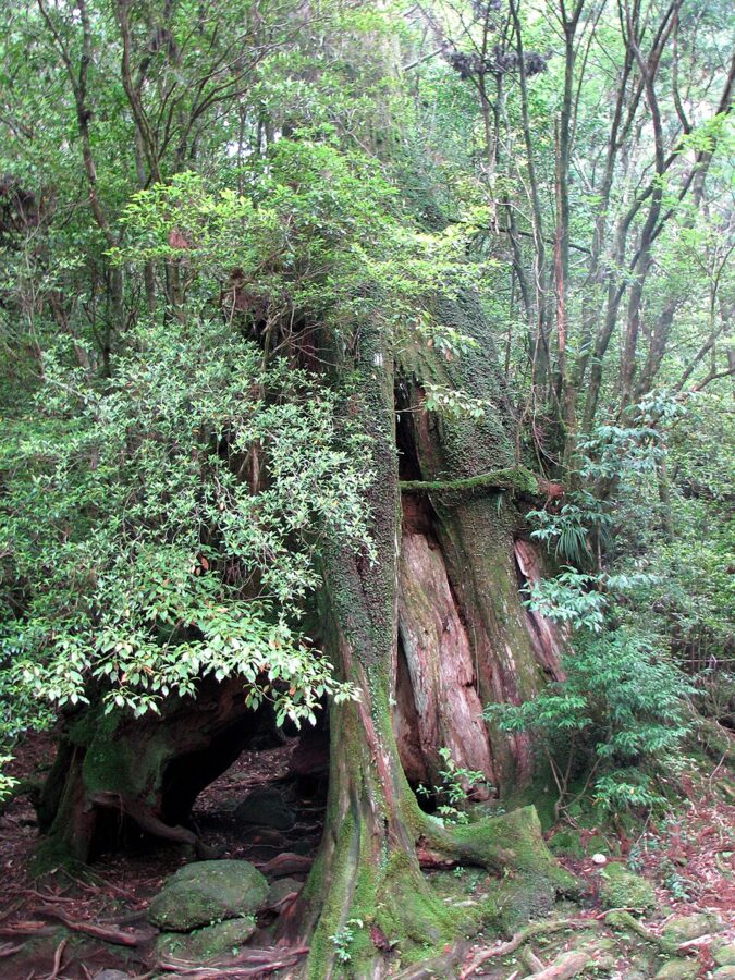
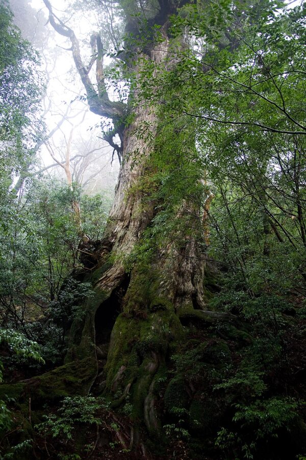
The tree was made famous in 1966 by Iwakawa Teiji, head of tourism at the old Yaku town office; at first it was called Oiwa-sugi, big-rock cedar. Its present name means Jomon cedar, either because it was thought to have been alive in the Jomon period, which on the traditional dating ended about 2,300 years ago, or because the swirling trunk resembles Jomon cord-marked pottery.
In 1976 Manabe Daikaku of Kyushu University put its age at over 7,000 years from its girth, and an Environment Agency poster introduced it as “7,200 years old”. Radiocarbon dating by Professor Kigoshi of Gakushuin University gave about 1,920 years, plus or minus 150, so 2,170 at most. Some argue the trunk is several trees fused together; enzyme analysis suggested a single tree. The Kikai eruption sets a rough ceiling, and the town now gives the age as 2,170–7,200 years, a fair statement of how little is settled.
Sources disagree on its size too. The town lists it as 22.2 metres tall with a girth of 16.1 metres at chest height; other references give 25.3 metres and 16.4 metres. You see it from a raised deck about a dozen metres away, built to keep boots off the roots.

1993 and after
On 11 December 1993, at the World Heritage Committee in Cartagena, Colombia, Yakushima became one of Japan’s first four World Heritage sites, with the beech forest of Shirakami-Sanchi in Tohoku and two cultural sites in Kansai, Horyu-ji and Himeji Castle. The listed area is 107.47 square kilometres, about a fifth of the island, chosen for its natural beauty and for an ecosystem that runs from subtropical coast to subalpine summit. Japan has added three natural sites since, among them the Ogasawara Islands in 2011.
The listing brought crowds. About 90,000 people walked to Jomon Sugi in 2010, nearly three times the number of ten years earlier, and the mountain toilets could not cope: waste was buried until it fouled the water, then carried down by hand. In 2012 the island and its neighbour Kuchinoerabujima became Yakushima National Park, separate from the Kirishima park on the mainland.
Getting there
Everything leaves from Kagoshima, the southern gateway of Kyushu. From Kagoshima Chuo station a bus for the high-speed ship terminal reaches Kagoshima Main Port, South Pier, in about 20 minutes; from Kagoshima airport a shuttle takes about 55 minutes.
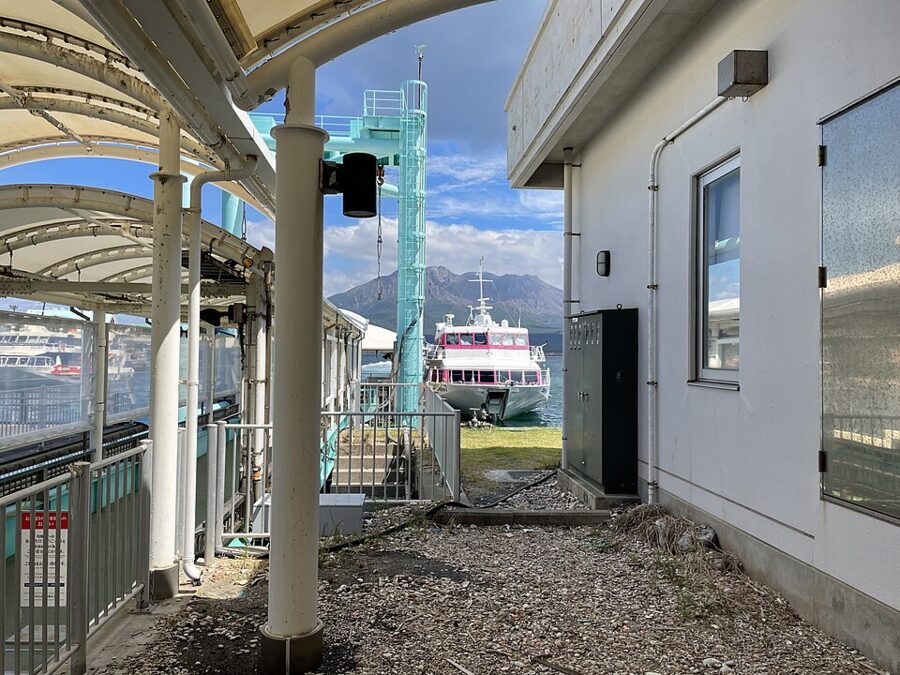
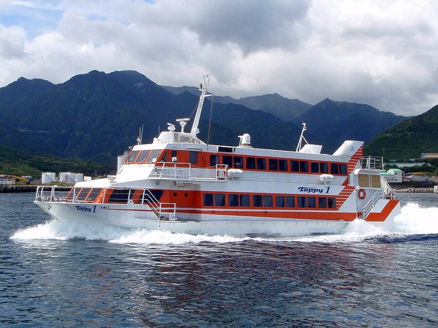
The fast way across is the Toppy and Rocket jetfoils of Tanegashima Yakushima Kousokusen: about six sailings a day, taking 1 hour 50 minutes to 3 hours depending on whether they call at Tanegashima. Some land at Miyanoura and some at Anbo, so check which. Since 11 May 2026 the adult fare is ¥14,000 one way and ¥25,900 return. In a heavy swell they do not sail.

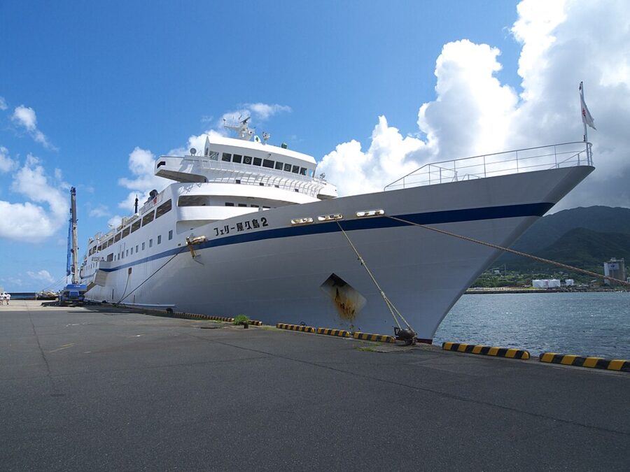
The slow way is Orita Kisen’s Ferry Yakushima 2, once a day: Kagoshima 08:30 to Miyanoura 12:30, back at 13:30 to reach Kagoshima at 17:40. Second class is ¥7,000 one way, it carries cars, and from its viewing deck you watch Sakurajima shrink behind you and the island’s front peaks rise ahead. I’d take it out and the jetfoil back. The overnight Ferry Hibiscus from Taniyama port spends the night at Tanegashima and docks at Miyanoura early next morning.

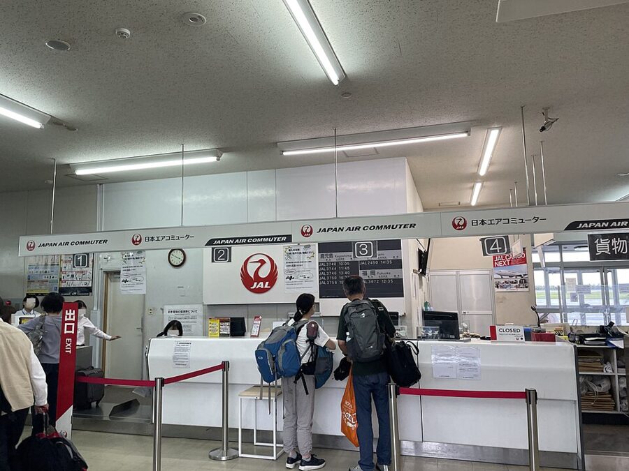
Japan Air Commuter flies to Yakushima airport, between Miyanoura and Anbo: four to eight flights a day from Kagoshima (about 40 minutes) and one a day each from Fukuoka (about 1 hour 10 minutes) and Osaka Itami (about 1 hour 50 minutes). The propeller aircraft are small and fill early in spring and autumn.
Getting around
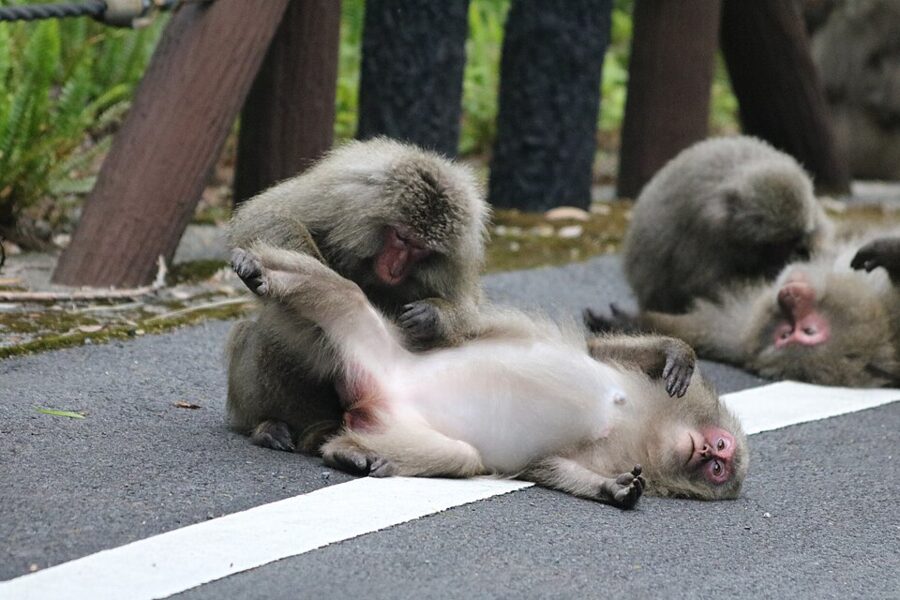
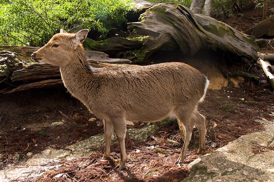
One road follows the coast all the way round, but buses do not. The western stretch, the Seibu Rindo forest road, is 17 kilometres of narrow, winding lane through one of the largest evergreen broadleaf forests left in Japan, with no mobile signal, no large vehicles and no bus between Nagata and Ohko Falls. Here you meet the island’s macaques and its small sika deer, yakushika, on the tarmac; feeding them is banned.


Two companies, Tanegashima Yakushima Kotsu and Matsubanda Kotsu, run the buses. They suit the coast and Shiratani Unsuikyo, which gets seven buses a day from Miyanoura, but only two a day climb to Yakusugi Land. With three days or more I would hire a car for at least one of them, though not on the Jomon Sugi day.


The walks
Every walk asks for a contribution. Shiratani Unsuikyo and Yakusugi Land charge ¥800 each at the gate, up from ¥500 in April 2026. The mountain area, which covers the Jomon Sugi trail and Miyanoura-dake, asks ¥1,000 for a day walk and ¥2,000 if you sleep in the mountains; the money pays for trail repair and for carrying the toilet waste out.
Beyond the short loops the town recommends a guide, and it certifies its own: Yakushima-certified guides have passed a town exam in island studies and carry insurance and first-aid training. After the typhoon of early September 2026 the council that manages the mountains also advised a guide while slopes were unstable, and asked walkers to carry a portable toilet bag because several mountain toilets were out of action.
Shiratani Unsuikyo
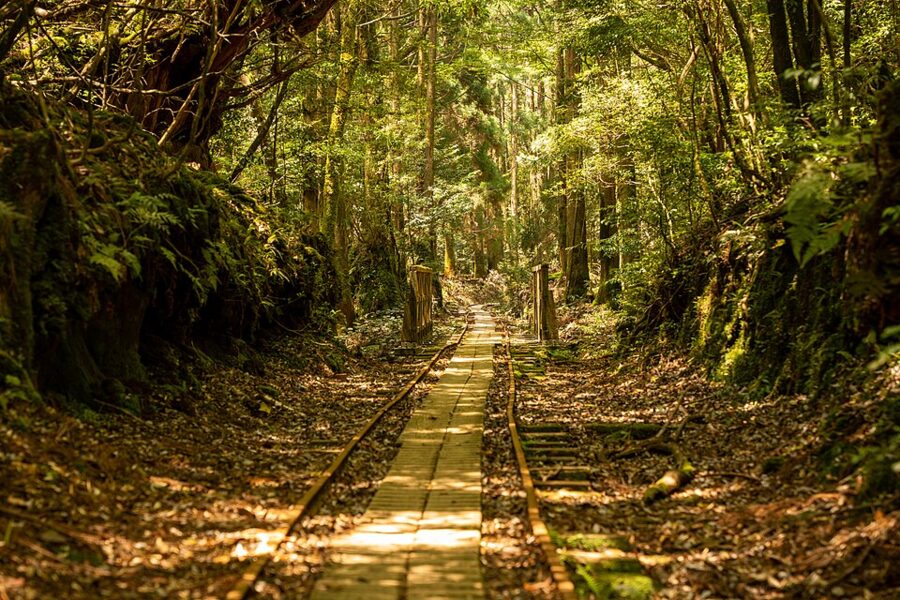
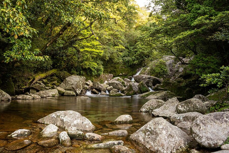
Shiratani Unsuikyo (白谷雲水峡), the white-valley ravine of cloud and water, is a recreation forest on the Shiratani river between 600 and 1,050 metres, about 25 minutes by car above Miyanoura. Three marked courses start at the gate: Yayoi-sugi (about an hour), Bugyo-sugi (about three hours) and Taiko-iwa (about four hours). Part of the way follows the Kusugawa path, paved with granite slabs in the Edo period, when this valley was logging country; stumps cut then still line the trail.
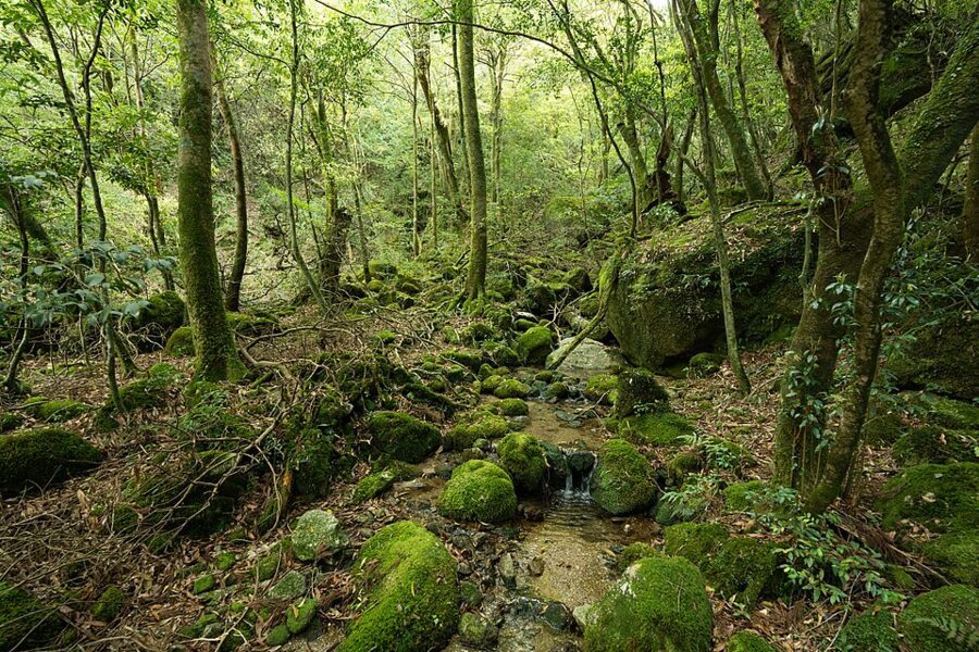

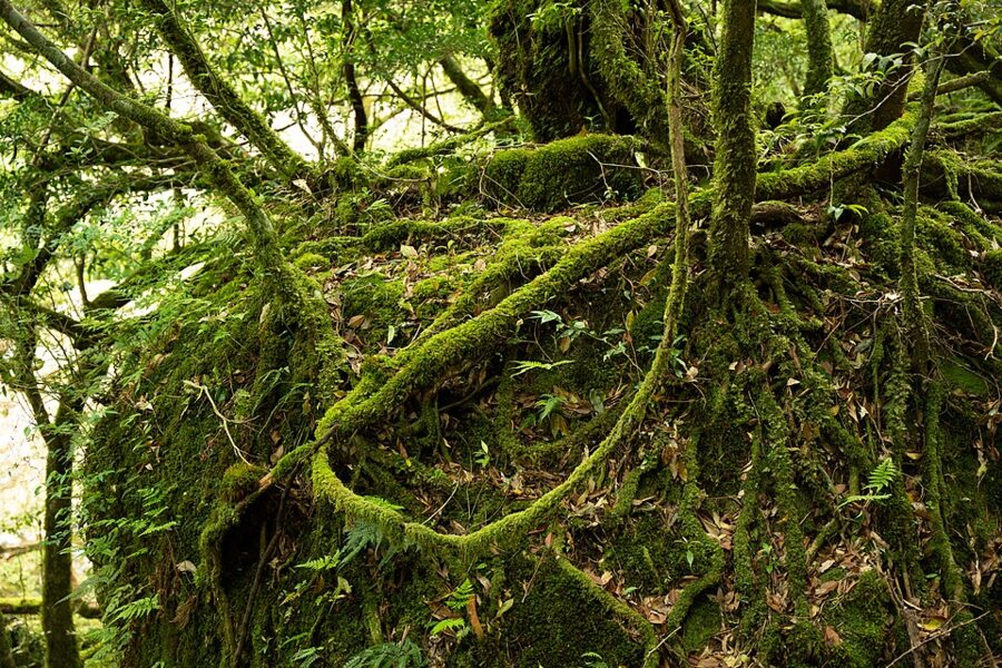
Take the Taiko-iwa course if your legs allow. It climbs through the moss forest to Tsuji pass and on to Taiko-iwa, the drum rock, a bare granite outcrop that looks across to the inner mountains and Miyanoura-dake. Yayoi-sugi, the 3,000-year-old cedar on the short course, had its trunk snapped by Typhoon Shanshan in August 2024 and has been left as it broke. In 2026 the ravine was shut for six weeks after the September typhoon and reopened on 18 October with some courses restricted.


Yakusugi Land
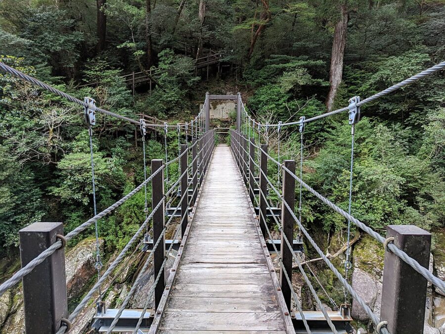
Yakusugi Land (ヤクスギランド) sounds like a theme park and is a 270-hectare forest at 1,000 to 1,300 metres, about half an hour’s drive above Anbo. Boardwalk loops of 30 and 50 minutes pass named giants such as Sennen-sugi, Butsuda-sugi and Kugurisugi; longer courses of 150 and 210 minutes go into rougher forest. It is the place to see old yakusugi without a full day’s walk, and to see the logging: stumps with test cuts and domaiboku left where it fell.
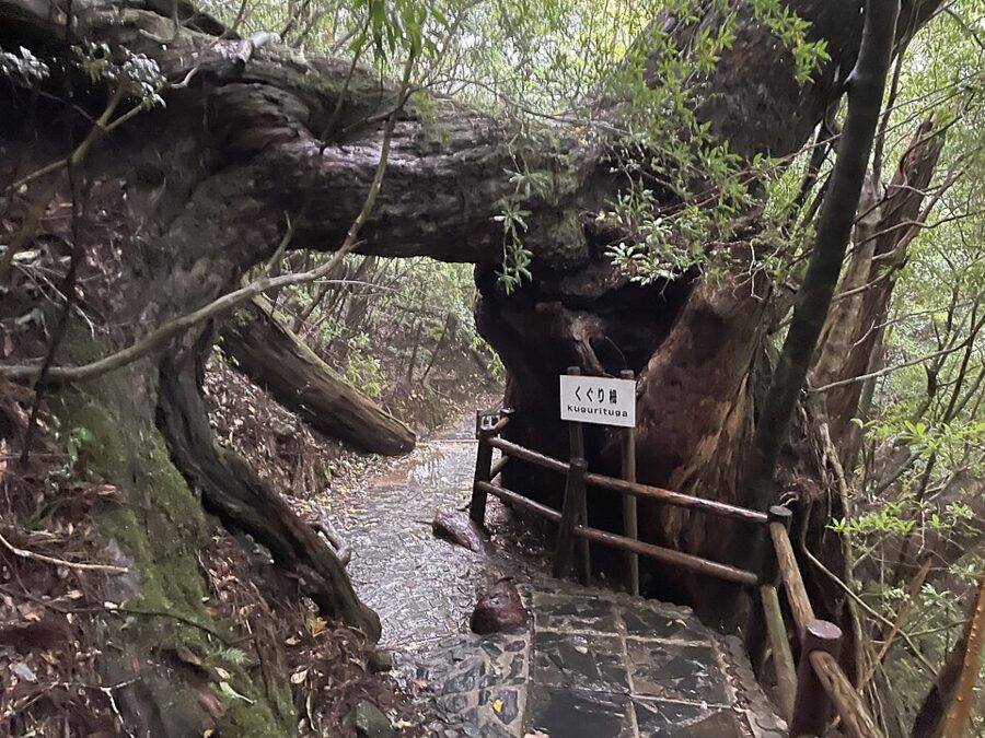
Only two buses a day reach it, on the line that continues to Kigen-sugi, a cedar of about 3,000 years beside the road, and the same road goes on to the Yodogawa trailhead for Miyanoura-dake.


The Jomon Sugi trail
From 1 March to 30 November private cars, rental cars and bicycles may not use the road to the Arakawa trailhead. You park at the Yakusugi Museum, or come by bus to its stop, and take the Arakawa mountain bus, about 35 minutes. A return ticket costs ¥3,000, including the ¥1,000 mountain contribution (one way ¥2,000). Buy it by the day before at a tourist association counter in Miyanoura, Anbo or at the airport; seats cannot be reserved.
Buses go up at 05:00, 05:20 (not in June), 05:40 and 14:00, and come down at 15:00, 16:00, 16:30 (not in June), 17:00 and 17:45. Miss the last one and you pay for a taxi.
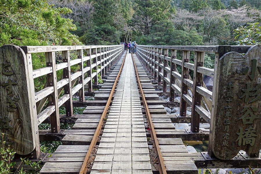

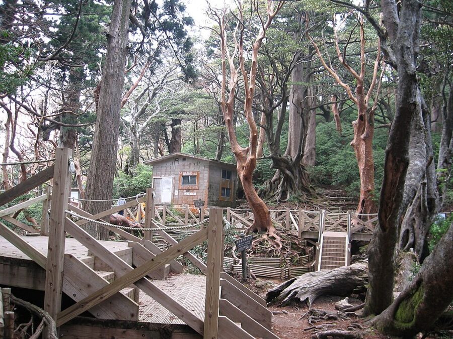
The walk is about 11 kilometres each way, 4 to 5 hours up and 8 to 10 in all, with about 700 metres of climbing. The first two-thirds or so follow the railway up the Anbo valley, flat and long; small trains still use it now and then, mostly in winter, to carry toilet waste and old stumps down. Then the Okabu trail climbs steeply on roots and steps past Wilson’s Stump, Daio Sugi and Meoto Sugi to the deck below Jomon Sugi.
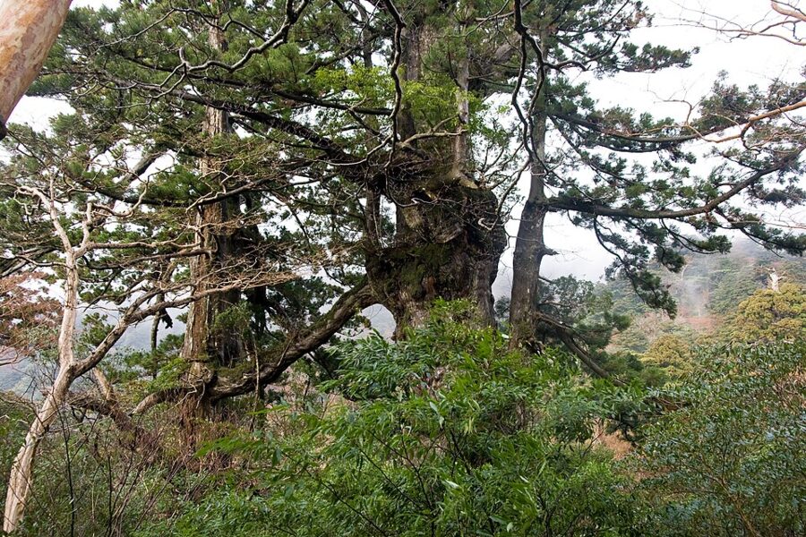

Leave Arakawa by about 06:00, carry rain gear on a fine morning, and bring all your food. Since a typhoon in August 2026 the toilets at Kosugidani and at the end of the railway have been out of use, so the toilet bag is not optional. Late in the year it is cold: in late November 2026 the bus operators were warning of sleet and temperatures under 5°C on the trail.

Two unstaffed refuge huts lie beyond the tree: Takatsuka, which sleeps about 17, and Shin-Takatsuka, about 40. They cannot be booked, but a trial calendar lets you declare your night in advance and shows how full they are likely to be.

Miyanoura-dake and the inner mountains
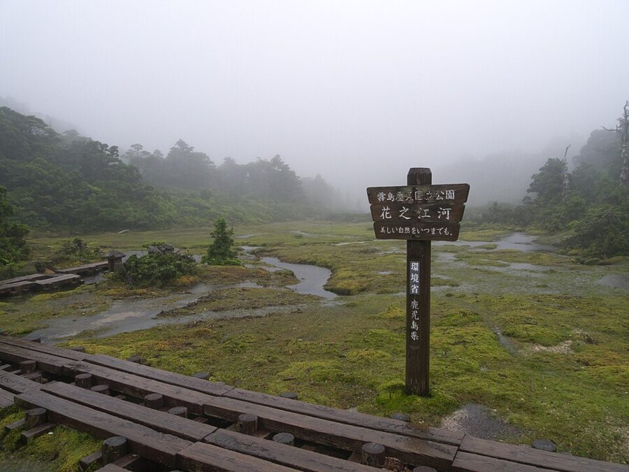
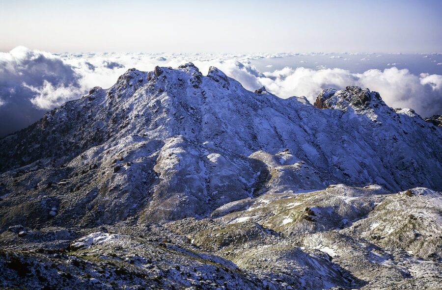
The usual route to the summit starts at the Yodogawa trailhead at 1,360 metres, 1.7 kilometres beyond the Kigen-sugi bus stop or about an hour’s drive from Anbo, with parking for five or six cars. It is about 8 kilometres each way and 9 to 10 hours return, past Yodogawa hut and across Hananoego (花之江河), a high moor at about 1,600 metres, the southernmost in Japan. Above it the forest ends, and the last climb is over granite and dwarf bamboo.

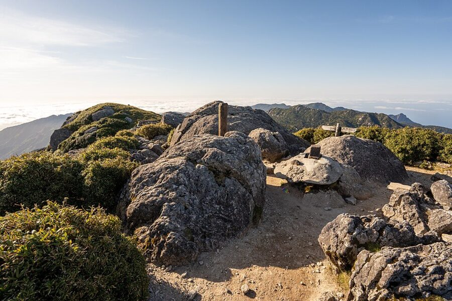

The name comes from the town. Miyanoura, shrine harbour, grew up around Yaku-jinja, which holds the mountain deity worshipped on the peaks, and its villagers climbed this one on dake-mairi, pilgrimages to the small summit shrines. Fukada Kyuya, who put it in his One Hundred Mountains of Japan, climbed it in 1939 from the logging camp near Kosugidani by a route now abandoned.
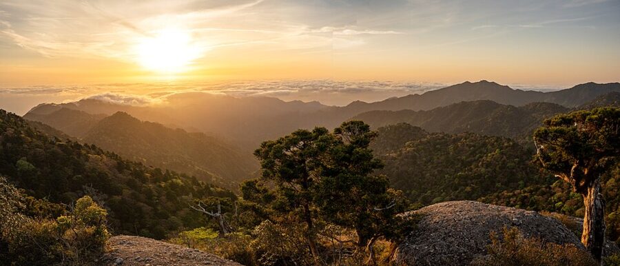

The finest walk on the island is the traverse: Yodogawa to Miyanoura-dake, down to Shin-Takatsuka hut for the night, then past Jomon Sugi at first light and out along the railway to Arakawa. It takes two days and real fitness. The link over Tsuji pass to Shiratani was closed after the September 2026 typhoon, so check it before you plan on it. In winter the summits take metres of snow and the Yodogawa road can close; leave the inner mountains to experienced winter walkers from December to March.
The coast
Nagata and the turtles
Nagata-hama, on the northwest coast, is the collective name for three beaches below the village of Nagata: Maehama, Inakahama and Yotsusehama. Inakahama runs about 800 metres to the Yotsuse headland. Together they are the busiest turtle-nesting beach in Japan and among the largest loggerhead nesting grounds in the North Pacific, and they have been a Ramsar wetland since 2005. Turtles come ashore to lay from May to July.
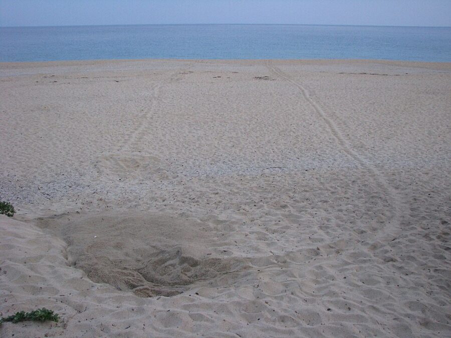

The rules are strict. From 1 May to 30 September the beach is closed from 20:00 to 05:00, and the only way to watch a turtle lay is the observation session run by the local turtle council, booked ahead and held from 20:30 to 23:00 between early May and mid-July. The 2026 sessions ended on 10 July, and no hatchling sessions were held. There are no buses or taxis at night, so you need a car.

The falls
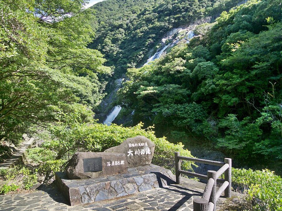
Ohko no Taki (大川の滝) drops 88 metres over a granite cliff near Kurio on the southwest coast, about 55 minutes from Anbo, and is one of the Top 100 Waterfalls of Japan. A level path from the car park leads almost to the plunge pool, close enough to get soaked. It is also the southern end of the Seibu Rindo, so it pairs with a drive up the west coast to Nagata.

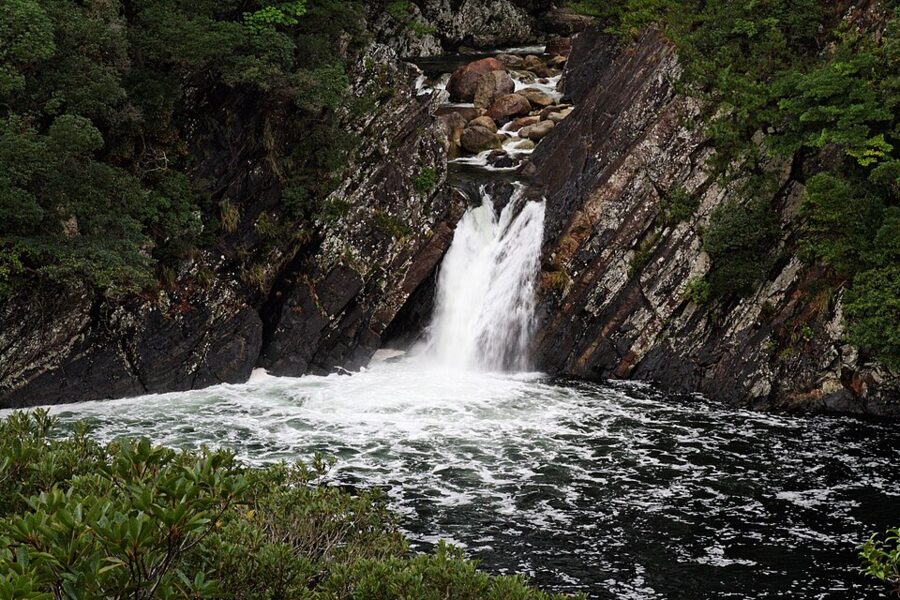
On the southeast coast Senpiro no Taki pours down its granite trough near Hara. Close by, at the mouth of the Tainokawa, Toroki no Taki is one of very few waterfalls in Japan that fall straight into the sea; the viewpoint is five minutes on foot from the Pontan-kan farm shop.

Hot springs at the tideline
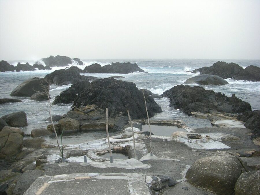
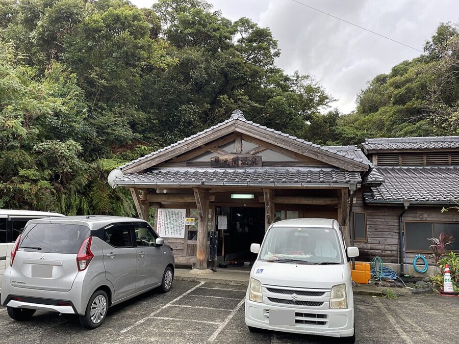
Hirauchi Kaichu Onsen (平内海中温泉), the hot spring in the sea, sits on the rocks below the village of Hirauchi and is under water except for about two hours either side of low tide, twice a day. The water rises at about 46°C into two rock pools. Bathing is mixed; swimsuits and underwear are not allowed, a wrapped towel or bathing robe is, and the fee is a ¥300 donation.

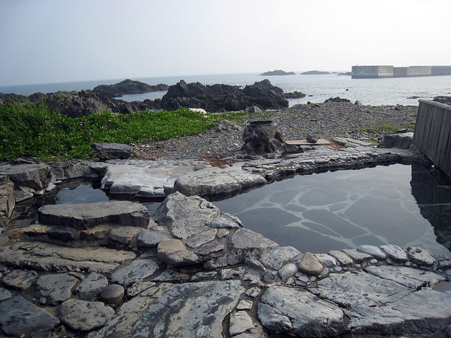
A little further west, Yudomari Onsen is open day and night for a ¥300 contribution. Its main pool, Hamayu, is split into men’s and women’s sides with the same no-swimsuit rule; the smaller Saki-no-yu, 30 metres along the shore, allows swimwear. Back east at Onoaida, the village bath of Onoaida Onsen is a sulphur spring where, the story goes, a deer shot by a hunter about 350 years ago came to heal its wound; it is open 07:00–21:00 except Mondays, for ¥300.

Where to stay and what to eat
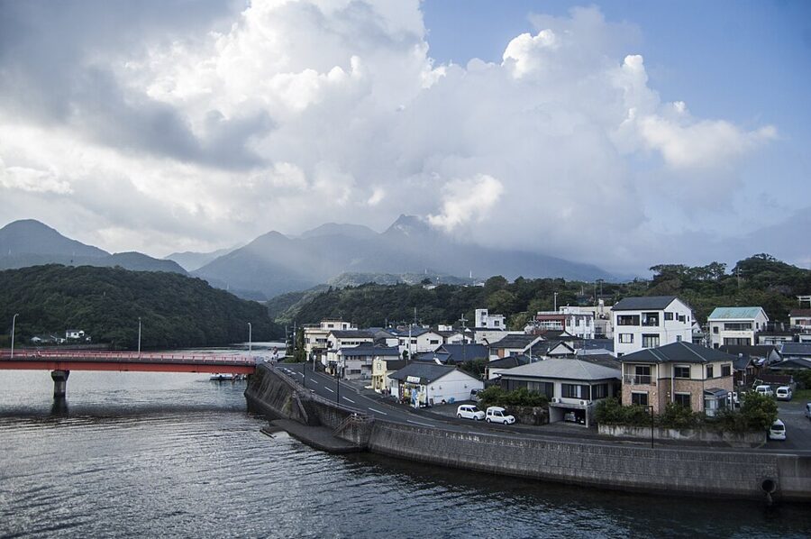
Base yourself by what you plan to walk. Miyanoura, on the north coast, has the car ferry, most of the shops and the shortest drive to Shiratani, and several of its hotels sell Arakawa bus tickets. Anbo, on the east coast, is the jetfoil port nearest the Yakusugi Museum, which makes it the sensible base for the 05:00 bus. The south coast is warmer and quieter and has the hot springs; the Yakushima Iwasaki Hotel is at Onoaida, and sankara hotel & spa, a small luxury resort, is at Mugio.
Beds run short in Golden Week, the Obon week in mid-August and on autumn weekends, so book the bed before the boat.


Flying fish, broken-neck mackerel and tankan
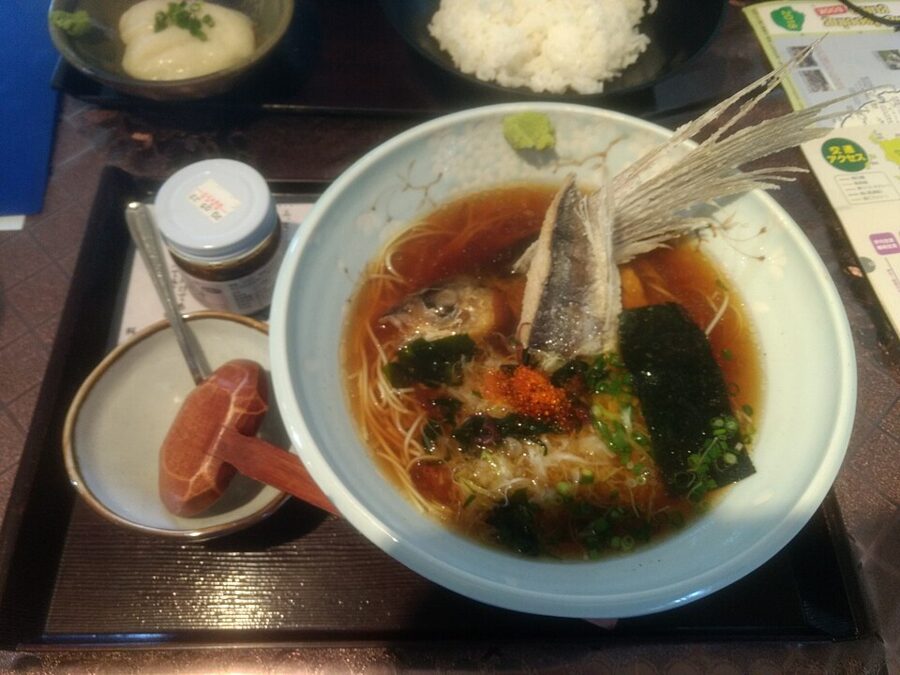
The island’s fish is tobiuo, flying fish, landed in some ten species through the year. The fattest are the autumn fish, akimaru, caught from after Obon until about December and best as sashimi with the skin on, dipped in sweet Kyushu soy sauce. The other local catch is kubiore saba, broken-neck mackerel: blue mackerel line-caught off Issou on the north coast and killed by snapping the neck so the blood drains, a Meiji-era method that keeps it fresh enough to eat raw. It is landed only at Issou.

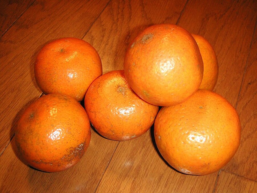
From 1 November to about March fishmongers sell asahigani, the bright red frog crab, best steamed. The island’s fruit is tankan, a tangor that ripens in February and March, with ponkan mandarins in December from trees brought from Taiwan about a century ago. Drink potato shochu: the best-known island label is Mitake, written with the same characters as the three peaks, and Hombo’s Yakushima Densho-gura distillery in Anbo, working since 1960, runs tours of its clay-pot cellars.

Seasons, and plans for two to four days
Spring, March to May, is mild, though snow can linger on the summits into March and Golden Week in early May fills every bed. The Yakushima rhododendron flowers on the high ground from late May into June, the rainiest month, when the moss is greenest and trails run like streams. July and August are hot, with turtles at Nagata; typhoons from August into October close ferries and, as in 2024 and 2026, the mountain roads.
October and November bring clearer air and the autumn flying fish. Winter is quiet on the coast and properly alpine above 1,500 metres.
Two days. Arrive on the morning jetfoil, walk the Taiko-iwa course at Shiratani in the afternoon, and sleep in Miyanoura. On day two drive the south coast: Senpiro and Toroki falls, Hirauchi at low tide, Ohko no Taki, then out. Two days are not enough for Jomon Sugi, and I would not squeeze it in.
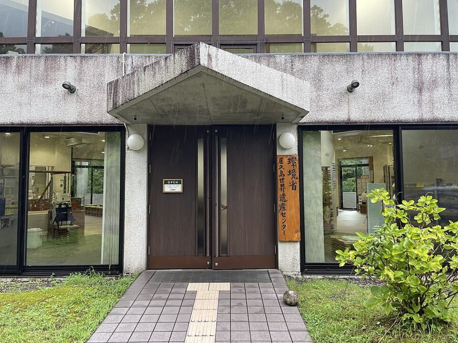
Three days. Day one: arrive, visit the Yakusugi Museum and the World Heritage Conservation Center, buy your bus ticket and sleep in Anbo. Day two: Jomon Sugi on the 05:00 bus. Day three: Yakusugi Land on the morning bus, or a car for the Seibu Rindo and the hot springs, to let your legs recover.
Four days. Add Shiratani on the first afternoon, and swap the Jomon Sugi day walk for the two-day traverse from Yodogawa, or add a day on Miyanoura-dake. Keep the last day loose: if a swell cancels the jetfoil, you will need it.
The neighbours
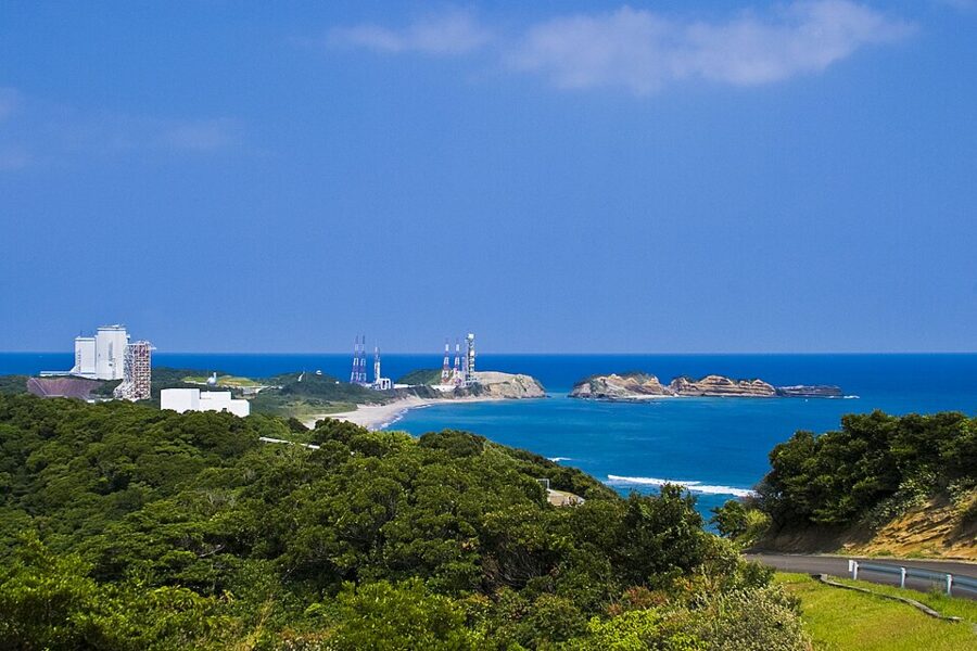
Tanegashima (種子島), low and flat across the strait to the east, is a different island: sugar cane instead of cedar, the place where Portuguese guns reached Japan in 1543, and home to JAXA’s space centre, whose launches can be seen from Yakushima. Some jetfoils link the two, for ¥6,200 one way.

Kuchinoerabujima (口永良部島), off the west coast and part of Yakushima town, is an active volcano. Its Shindake crater erupted on 29 May 2015, sending a pyroclastic flow to the sea; the alert went to level 5, and that afternoon the town ferry carried the whole population to Miyanoura. On 28 September 2026 the Meteorological Agency lowered its alert from level 2 to level 1, and the ferry Taiyo II sails there from Miyanoura. Further south, the subtropical forests of Amami and northern Okinawa became a World Heritage site of their own in 2021.
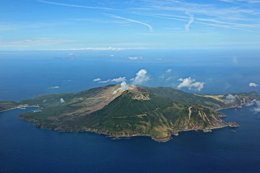

The last Arakawa bus leaves the trailhead at 17:45. By then the people who left the museum car park in the dark are coming down the railway in the half-light with wet boots, past stumps that Satsuma’s shingle-cutters left nearly 400 years ago. Back on the coast, the mountains they walked into are out of sight again behind the front peaks, as the old rhyme for Miyanoura-dake has it: itsumo kumotte mien de gozaru.