

There are almost no foxes on Shikoku (四国), and the island has a story to explain why. Kukai, the monk who was born here in 774 and whose footsteps the pilgrims still follow, is said to have banished them until the day an iron bridge should cross the sea. The first part is roughly true: the red fox does live on Shikoku, but it is scarce.
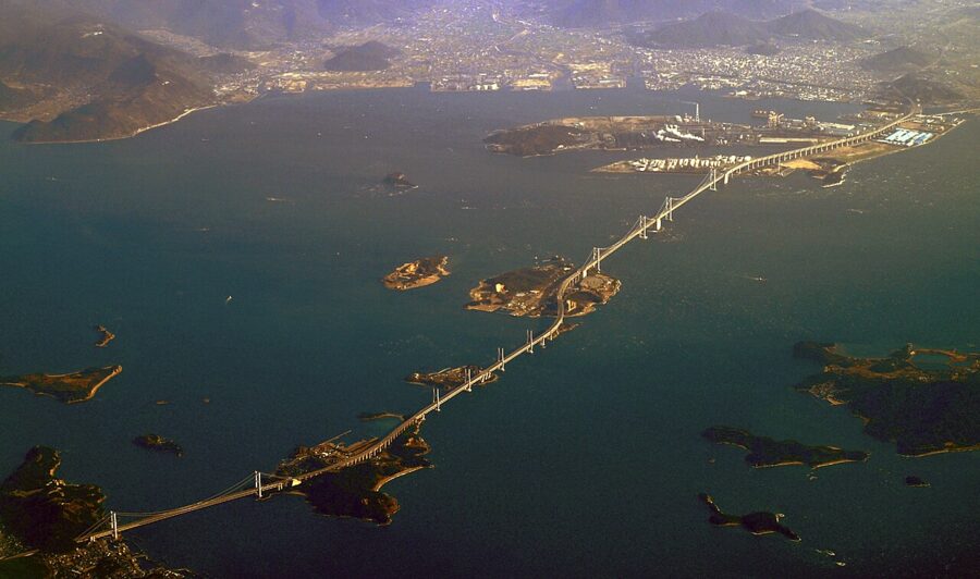
The iron bridge arrived on 10 April 1988, when the first trains ran across the Seto-Ohashi from Okayama. Until then Shikoku had been the only one of Japan’s four main islands with no fixed link to the others, and it had paid for that in time, in money and, on one morning in 1955, in lives. Two more bridge routes followed within eleven years, and the island that had always faced outwards across the water began, slowly, to talk to itself.
It is the smallest of the four main islands, 18,296 square kilometres with about 3.5 million people in 2025, split between four prefectures: Kagawa, Tokushima, Ehime and Kochi. It has no shinkansen and no city big enough to be a designated city, and what most people in Japan associate with it is a walk of more than a thousand kilometres round eighty-eight Buddhist temples.

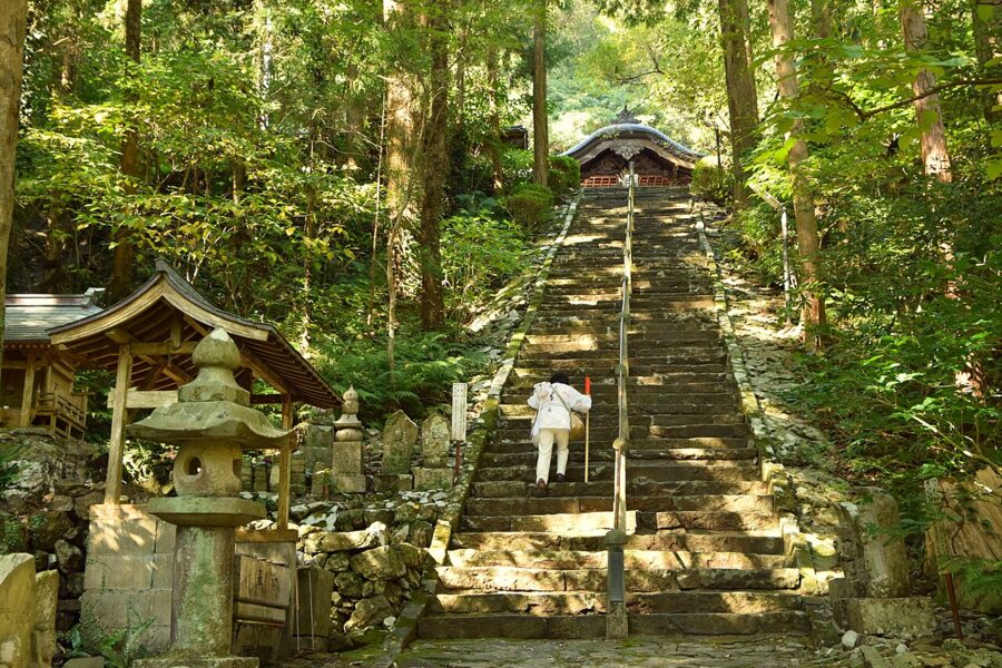
That walk explains a good deal of what you will see: white-clad figures on the shoulder of a coast road, small inns in villages that would otherwise have none, strangers pressing a mandarin into a walker’s hand. The mountains explain most of the rest. I’d give Shikoku a week at least, because the island rewards slowness and punishes a tight schedule.

In this guide
- Four countries on one island
- Kukai and the eighty-eight temples
- The pilgrimage in practice
- Getting there and getting around
- Kagawa (香川): udon, gardens and the art islands
- Tokushima (徳島): dance, whirlpools and the Iya Valley
- Ehime (愛媛): a castle, a bathhouse and citrus
- Kochi (高知): a castle, Ryoma and the last clear river
- What to eat on Shikoku
- When to go
- Plans for five and ten days
Four countries on one island
Shikoku means “four countries”, and the four were the old provinces of Awa, Sanuki, Iyo and Tosa, now Tokushima, Kagawa, Ehime and Kochi. The Kojiki of 712 describes the island being born with one body and four faces, and gives each face a name. The face of Iyo was Ehime, “lovely princess”, and in 1873 the new prefecture took it, which makes Ehime the only prefecture named after a deity.
The four faces look in different directions, and for most of history that was literal. The Shikoku Mountains run east to west down the middle and the Sanuki range blocks the north-east, so Tokushima traded with Osaka, Kagawa with Okayama, Matsuyama with Hiroshima and Oita, and Kochi looked out at the Pacific. People called the island “one by one”, four places sharing a coastline.
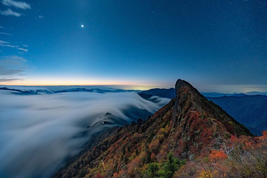
The geology splits it too. The Median Tectonic Line, Japan’s longest fault system, runs along the north bank of the Yoshino River and out along the thin Sadamisaki Peninsula. North of it the Inland Sea coast is dry and sheltered; south of it the mountains come straight down to the Pacific and the rain is heavy. Kochi is about 84 percent forest, the highest share of any prefecture, with only 16 percent of its land fit to live on.
Cut off until 1988
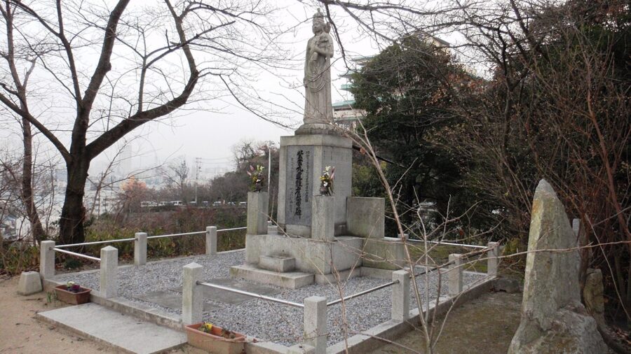
Before the bridges, the main way onto Shikoku was the national railway’s ferry from Uno in Okayama to Takamatsu. On 11 May 1955 the ferry Shiun Maru collided with another ship in fog off Takamatsu and sank, and 168 people died, many of them primary school children on school trips. It was the ship’s fifth accident in nine years, and it turned a bridge that politicians had talked about since 1889 into a national project.
It still took three decades. The Onaruto Bridge between Awaji Island and Naruto opened in 1985 with space in its girders for a shinkansen that never came. The Seto-Ohashi, the only route with trains, opened in 1988, the same year as the Seikan Tunnel to Hokkaido, so that all four main islands were joined by rail for the first time. The Akashi-Kaikyo Bridge completed the Kobe to Naruto road in April 1998, and the Shimanami Kaido from Onomichi to Imabari opened on 1 May 1999 with a path for bicycles built in.
Shikoku is usually counted as one of the eight regions of Japan, though under the old provinces it was simply part of the Nankaido, the “southern sea road” from the capital.
Kukai and the eighty-eight temples
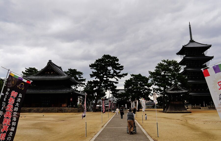
Kukai was born in 774 in Sanuki, on the site of Zentsuji, temple 75, into a family of local officials. He went to the capital to study the Chinese classics, dropped out at about nineteen to practise as a wandering ascetic, and in his own early writing describes training on a mountain in Awa and at Cape Muroto in Tosa. In 804 he sailed to Tang China with an embassy, returned two years later with the esoteric teachings that became the Shingon school, and spent the rest of his life between the court and his mountain monastery at Koyasan.

He was an engineer too: in 821 the court sent him home to repair Mannoike, a Sanuki reservoir whose dam had burst, and he finished in about three months where the official in charge had made no progress. It is still the largest irrigation pond in Japan, about 20 kilometres round. In 823 the emperor gave him Toji, the temple at the south gate of the capital, now one of the 17 Historic Monuments of Ancient Kyoto. He died at Koyasan in 835, or, as his followers hold, entered eternal meditation there, which is why pilgrims go to Koyasan at the end to tell him they have finished.
How a circuit became eighty-eight temples
Wandering monks were walking the coasts of Shikoku by the 12th century, on a route known as the Shikoku hechi, the “remote edges”, and by the 17th century the number of temples was settled. In 1687 a monk named Shinnen published the first guidebook, the Shikoku Henro Michishirube, which numbered the temples, gave distances and listed places to sleep, and he set up stone waymarkers, some of which still stand.
The numbering runs clockwise from Ryozenji in Naruto, and the four provinces became four stages on the path to enlightenment. Awa’s 23 temples are the place of resolve; Tosa’s 16, strung along a very long coast, the place of austerity; Iyo’s 26 the place of enlightenment; and Sanuki’s 23 nirvana. Anyone who has walked the Kochi coast in the rain will understand why Tosa got austerity.
The founding legend belongs to Emon Saburo, a rich and greedy man of Iyo who knocked a begging monk’s bowl to the ground and broke it into eight pieces. His eight children died one by one; realising the monk had been Kukai, he set out round the island to apologise, circled it twenty times without catching up, and at last tried going the other way. He met Kukai as he lay dying near temple 12, which is why some pilgrims walk anticlockwise, the gyaku-uchi, especially in leap years, when it is said to count three times over.
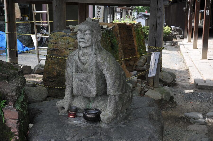

Osettai, and walking as two
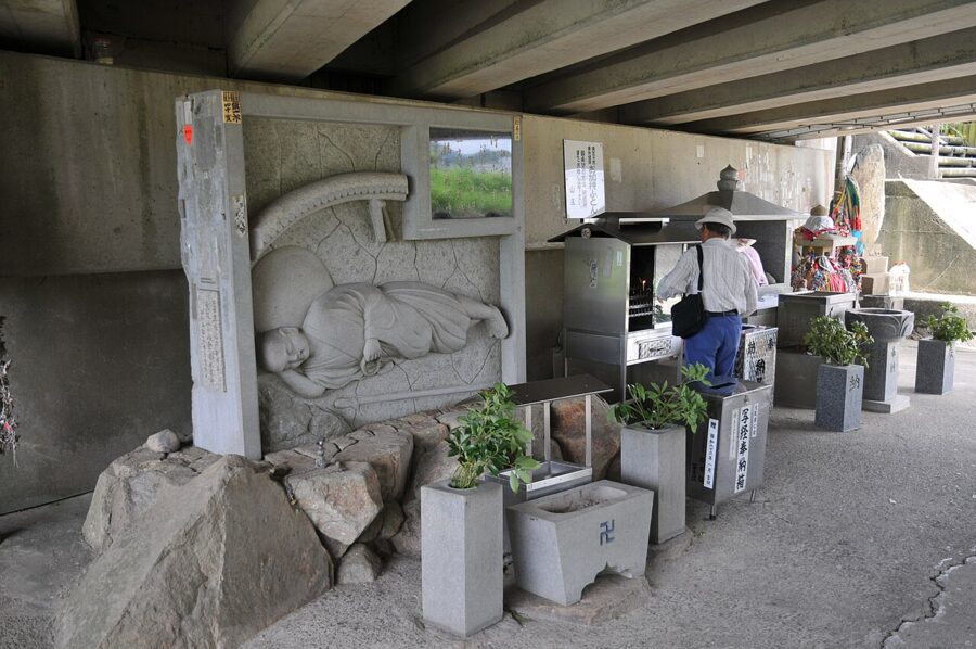
Pilgrims on Shikoku receive osettai, gifts made to the walker as a way of giving to Kukai: a can of coffee from a stranger in a car park, fruit, a lift in a storm, a night in a farmhouse. It is the oldest part of the pilgrimage that you can still watch working, and the right response is thanks and one of your name slips, not a refusal.
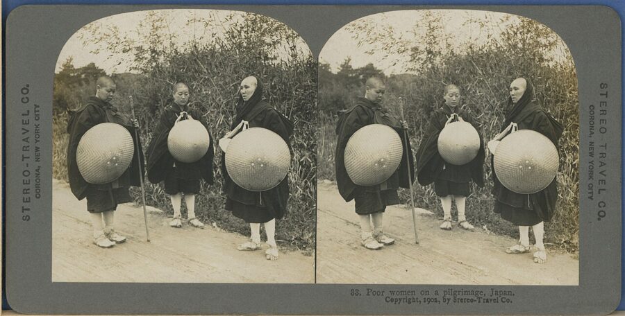
The words on the pilgrim’s hat and robe, dogyo ninin, mean “two travelling together”: the walker and Kukai, who is present in the staff. Pilgrims wash its foot at the end of the day as they would a companion’s feet. On bridges they lift it rather than tap it, because Kukai is said to have spent a cold night sleeping under a bridge at Ozu, and nobody wants to wake him.

The pilgrimage in practice
The circuit is about 1,200 kilometres on foot, depending on the route, and nobody issues permits. You can start at any temple, go either way and do it in one go or in pieces over years. Estimates of those who complete it run from 100,000 to 300,000 a year, most by car or coach; walkers are reckoned at 2,500–5,000.
On foot, by car, by coach
The regional tourism organisation’s estimates are useful as orders of magnitude. Walking takes about six weeks at 30 kilometres a day and costs about ¥400,000 for lodging, food and the rest while on Shikoku. A chartered coach tour with a licensed guide, a sendatsu, takes 9–12 days and about ¥250,000; driving yourself takes about ten days and about ¥140,000. Cyclists usually finish in 10–14 days.
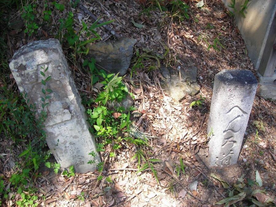

The walking route crosses passes on old pilgrim paths, then joins national roads for long stretches, especially on the Kochi coast. Volunteers have restored and waymarked many old sections since the late 1970s, and their map book, published in English too, is the one to carry. The climb to Shosanji, temple 12, at about 700 metres, is the first henro korogashi, “where pilgrims fall over”, and Unpenji, temple 66, is the highest at 912 metres.
Spring and autumn are the walking seasons, and lodging is what to book ahead: the small inns along the route often have only a few rooms, and some temples run lodgings, shukubo, with vegetarian dinners and morning services. Many people walk one province at a time and come back the next year, and there is a word for it, kugiri-uchi.
The book, the robe and the staff
Nobody needs special clothing, but most pilgrims buy the white robe, sedge hat, staff, stole and stamp book at the first temple; the set costs about ¥10,000. The stamp book, nokyocho, is the heart of it. After praying at the main hall and at the hall of Kukai, you take it to the temple office, where the temple’s name and its main deity are written in brush and ink and three red seals are pressed over the writing, for a fee of a few hundred yen.
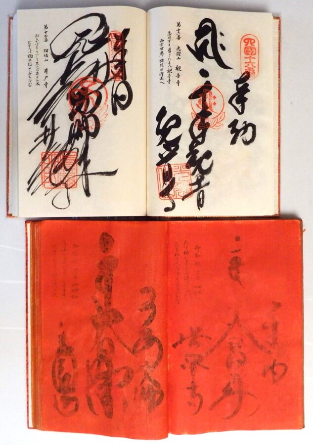

The temple offices are open 08:00–17:00 under the temples’ association rules, and walkers plan their days around that last hour. The seal is not a souvenir stamp but a record that you have offered a sutra, so pray first and collect it afterwards. At the end, Okuboji in the Sanuki hills takes in the staffs of those who have finished.
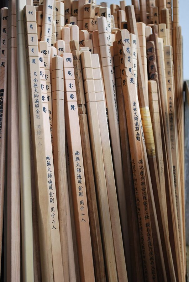

Temples worth a detour if you are not walking
Ryozenji, temple 1, a short walk from Bando Station in Naruto, is where most pilgrims buy their kit, and you can watch first-day nerves there. In Kochi, Chikurinji, temple 31, sits on Godaisan above the city beside the Makino Botanical Garden, and Kongofukuji, temple 38, is on Cape Ashizuri at the island’s south-western tip.
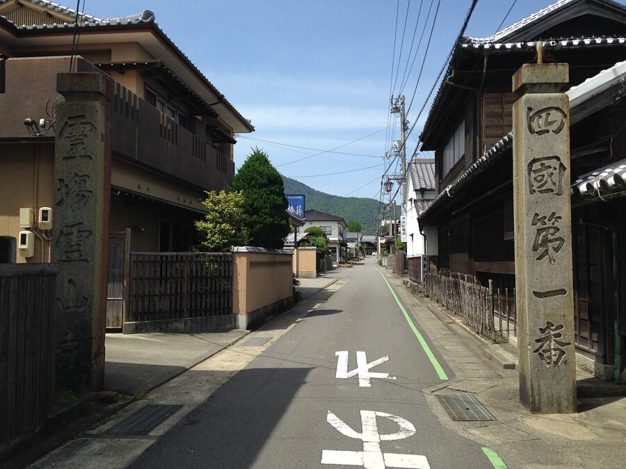

In Matsuyama, Ishiteji, temple 51, is a short walk from Dogo Onsen and has a gate that is a National Treasure. Iwayaji, temple 45, in the mountains south of Matsuyama, is built into the foot of a cliff and reached by a stiff walk through cedars.
Getting there and getting around
Shikoku is easy to reach and slow to cross. Most people arrive by train over the Seto-Ohashi, by highway bus over the Akashi and Naruto bridges from Kansai, or by air.
Across the bridges
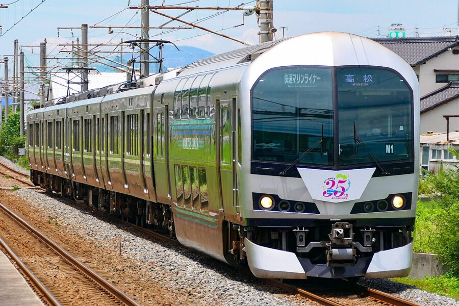
The Marine Liner rapid runs from Okayama, on the Sanyo Shinkansen, to Takamatsu about twice an hour and takes 52–63 minutes. From Okayama the limited express Shiokaze goes to Matsuyama in about 2 hours 45 minutes and the Nanpu to Kochi in about 2 hours 40 minutes; JR Shikoku plans to make both all-reserved in spring 2027. The Sunrise Seto sleeper leaves Tokyo late each evening and reaches Takamatsu early the next morning.
Highway buses from Osaka and Kobe cross the Akashi-Kaikyo and Onaruto bridges to Tokushima in two to three hours and are often quicker than the train to eastern Shikoku, because the railway goes the long way round through Okayama. The ferries never stopped: Jumbo Ferry still sails between Kobe and Takamatsu, Shikoku Orange Ferry runs overnight from Osaka to Toyo in eastern Ehime, and from Yawatahama on Ehime’s west coast a ferry crosses to Usuki in Oita, the easiest way to combine Shikoku with Kyushu. Flights from Tokyo Haneda reach all four airports in about 1 hour 15 minutes to 1 hour 30 minutes.
Trains on the island
JR Shikoku’s limited expresses link the four capitals: the Ishizuchi from Takamatsu to Matsuyama in about 2 hours 30 minutes, the Uzushio to Tokushima in a little over an hour, the Shimanto to Kochi, and on from there the Uwakai to Uwajima and the Ashizuri to Nakamura. Much of the network is single track, and on rural lines local trains can be two hours apart.
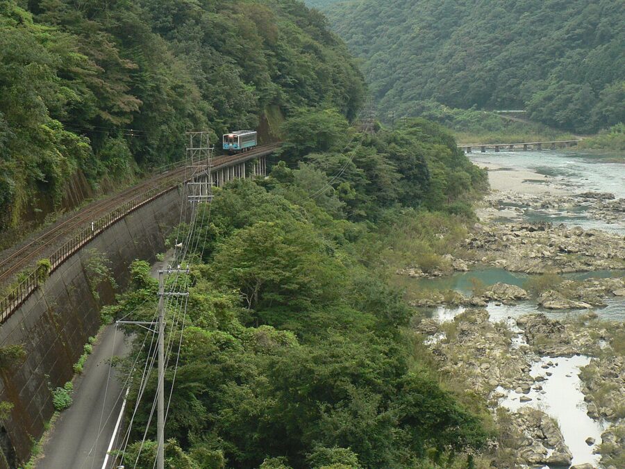
Three smaller lines are worth riding for their own sake. The Yodo Line follows the Shimanto River through the mountains between Kubokawa and Uwajima. The Asa Coast Railway in southern Tokushima runs a dual-mode vehicle, a minibus that drives onto the rails at one station and off again at another. And the Kotoden rattles from central Takamatsu to Kotohira in about an hour.
The All Shikoku Rail Pass
The national Japan Rail Pass rose sharply in October 2023, and for a trip based on Shikoku the regional pass usually pays where the national one does not. The All Shikoku Rail Pass is sold to visitors on a temporary visitor stay, and its terms change on 1 December 2026: from then it comes in two lengths, three days for ¥15,000 and seven days for ¥23,000, and includes reserved seats. It covers JR Shikoku, the Tosa Kuroshio Railway, the Asa Coast Railway, the Kotoden and the Tosaden trams in Kochi.
It no longer covers the Iyotetsu trains and trams in Matsuyama, which left the pass in March 2026, and it has never covered buses or the Sunrise Seto. Whether it pays depends on distance: three days of long limited express runs repay it easily, three days pottering round Takamatsu do not.
By car, and by bicycle across the sea
For the Iya Valley, the capes and the upper Shimanto, a car turns a two-day expedition into a day. The mountain roads are narrow and single-track in places, so allow far more time than the map suggests. Trains between the cities and a car for two or three days in the mountains is the combination I’d choose.
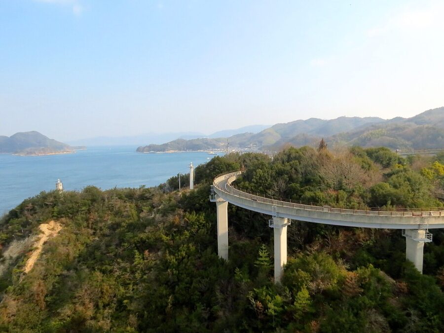
The Shimanami Kaido is the other way across, and the one to take if you have a free day and reasonable legs. The cycle route runs about 70 kilometres from Onomichi in Hiroshima to Imabari in Ehime over six islands and their bridges, with gentle spiral ramps up to each deck. Bicycle tolls have been waived since 2014, currently until 31 March 2028, and the official rental network has ten terminals where you can return a bike, including both ends.
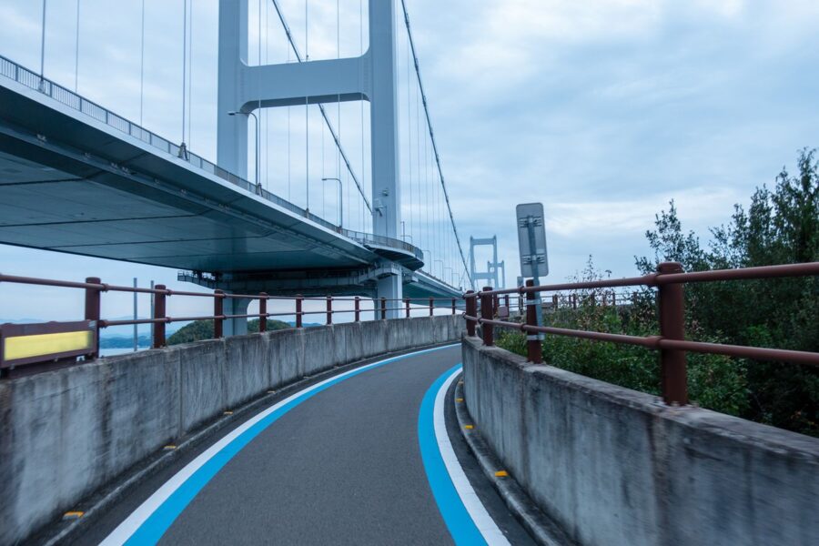
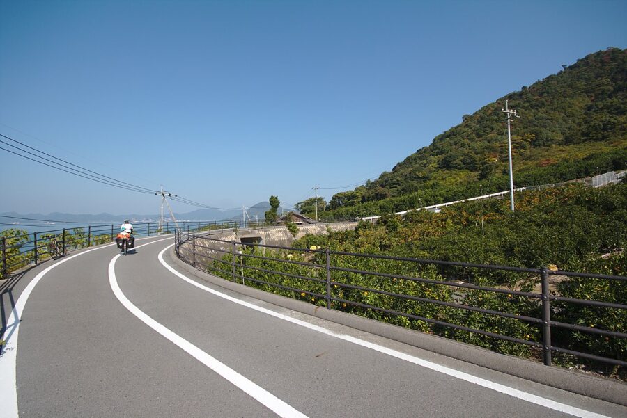

A fit rider does it in a day; I’d take two, with a night on Omishima or Ikuchijima. The last crossing, about four kilometres over the three suspension spans of the Kurushima-Kaikyo Bridge, runs high above a strait where the tide races through the narrows, and drops you into Imabari.

Kagawa (香川): udon, gardens and the art islands
Kagawa is the smallest prefecture in Japan, and one of the driest. Takamatsu gets about 1,150 millimetres of rain a year, less than half of what falls on Kochi across the mountains, and its rivers are short. For more than a thousand years farmers have stored water in ponds, and the prefecture has more than 12,000 of them, scattered across the Sanuki plain like spilt coins.
The dry climate is the reason for the udon. Rice fields drained after the autumn harvest grew a winter crop of wheat; the sunny coast made salt; soy sauce came from Shodoshima and dried sardines, iriko, from the islands of the Inland Sea. A painted screen of the Konpira festival from about 1700 already shows three udon shops among two hundred buildings. Kagawa has called itself “Udon Prefecture” since 2011, and nobody there thinks this is a joke.
Takamatsu and Ritsurin Garden (栗林公園)
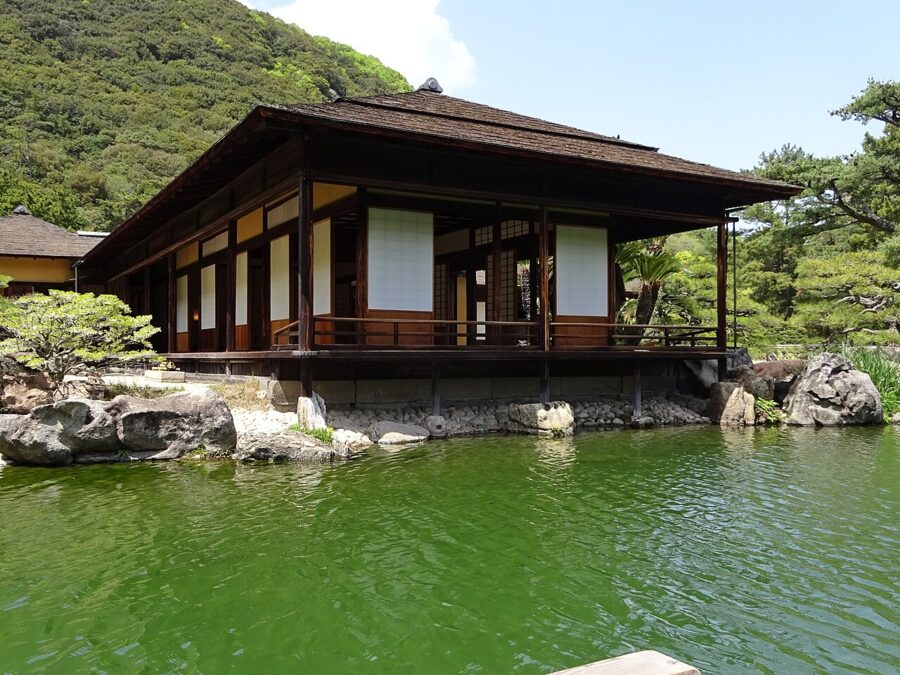
Takamatsu, rebuilt after the bombing of 1945, is the prefectural capital and the ferry port for the art islands. Its reason to stay a day is Ritsurin Garden, a daimyo garden of about 75 hectares at the foot of Mount Shiun. The site was an old riverbed: in the early 17th century an engineer diverted the eastern channel of the Koto River, and the springs that feed the garden’s six ponds are that river’s water coming up through the gravel.
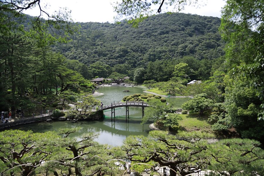

The Matsudaira lords of Takamatsu spent more than a century on it, and the fifth lord named its sixty views in 1745. Admission is ¥500, and the gates open at roughly sunrise and close at roughly sunset, 05:30–19:00 in midsummer and 07:00–17:00 in midwinter. Take the short boat round the South Pond, and climb the Hiraiho mound for the view the garden was designed around.

Kotohira-gu (金刀比羅宮)
Kotohira-gu, Konpira-san to everyone, is the shrine of seafarers, halfway up Mount Zozu, “elephant’s head”, above the small town of Kotohira. The approach is famous for its stone steps, 785 to the main shrine and 1,368 to the inner shrine, past lanterns paid for by shipping companies and a hall hung with pictures of ships. Until the separation of Shinto and Buddhism after 1868 it was a sanctuary of Konpira, a crocodile god of the Ganges who had become a protector of sailors.
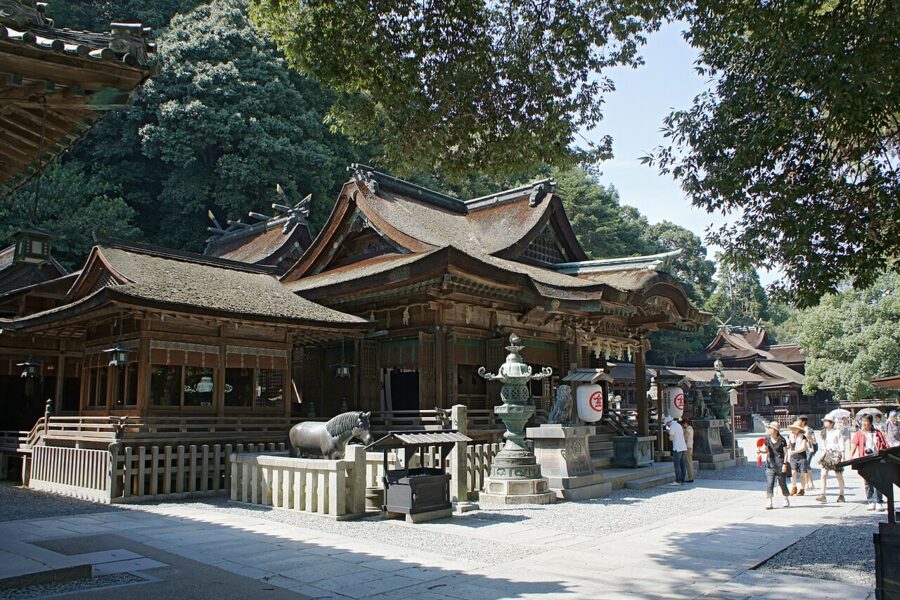

In the Edo period, people who could not make the journey sometimes sent a dog instead, with money and a note tied round its neck, passed from traveller to traveller. Kotohira’s other relic of the pilgrim trade is the Kanamaru-za, a wooden kabuki playhouse completed in 1836, the oldest of its kind still standing in Japan. Zentsuji is two stops away on the Dosan Line, and Mannoike, Kukai’s reservoir, is a short drive into the hills.
Naoshima and Teshima
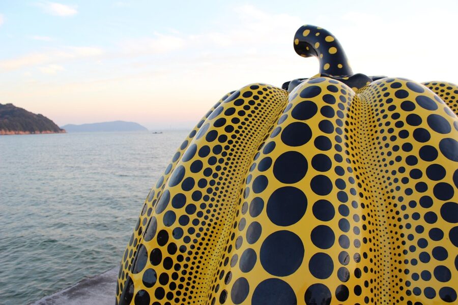
Naoshima and Teshima belong to Kagawa, and the art on them is the reason many people come to Shikoku at all. Naoshima has had a Mitsubishi copper smelter since 1917, still working in the north; from the late 1980s the Benesse company and the architect Ando Tadao turned the south into a set of museums and outdoor works, including the Chichu Art Museum, built almost entirely underground. Ferries leave Takamatsu port for Naoshima’s Miyanoura in about an hour, and the Benesse sites sell tickets online; book the popular ones ahead.
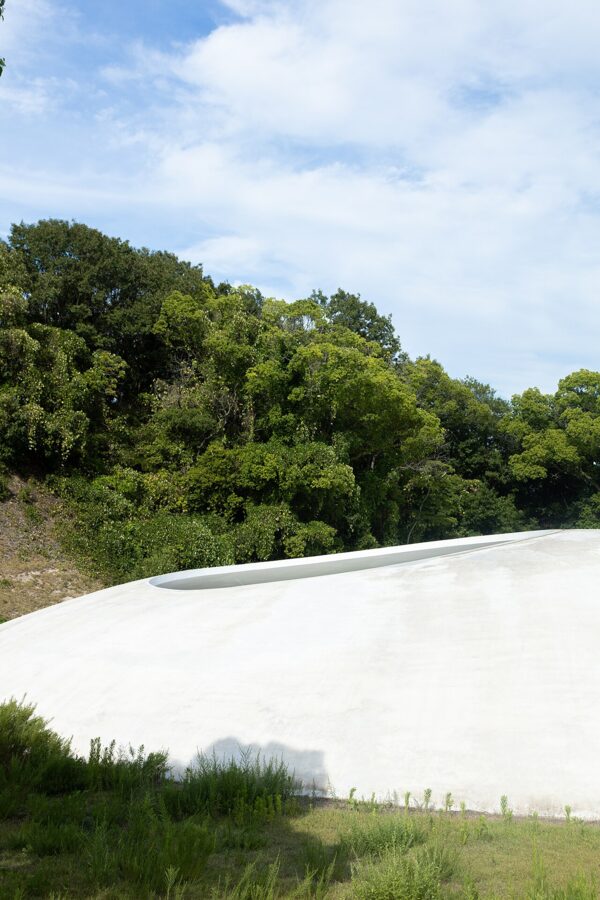
On Teshima, the Teshima Art Museum, a single concrete shell by Nishizawa Ryue and Naito Rei with no columns and two open holes in the roof, opened in 2010 among rice terraces restored for the purpose. If you have time for only one of the art buildings, I would make it this one.

Tokushima (徳島): dance, whirlpools and the Iya Valley
Tokushima was the province of Awa, and for two centuries it was rich on blue. The Yoshino River, called Shikoku Saburo, “third son of Shikoku”, flooded the plain most years and ruined the rice. Indigo could be harvested in summer before the typhoons, and the floods laid down fresh silt that let farmers grow it on the same fields year after year. Awa indigo dominated the national market in the 18th century and reached 15,000 hectares in 1903, before imported indigo and synthetic dyes ended it.
The Awa Odori
The indigo merchants’ city gave Japan its best-known summer dance. The Awa Odori fills central Tokushima for four nights, 12–15 August, with groups called ren dancing through the streets to shamisen, flutes, bells and drums. Women dance upright in straw hats with small steps; men dance low, knees bent, hands above their heads. The chant that goes with it says, roughly, that dancers and watchers are both fools, so you might as well dance.
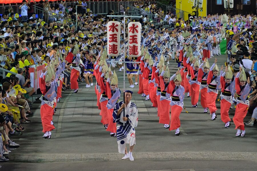

Out of season, the Awa Odori Kaikan at the foot of Mount Bizan has a resident troupe that dances four times a day (¥1,300) and at 20:00 (¥1,600), with a few minutes at the end when the audience is taught the steps.
The Naruto whirlpools
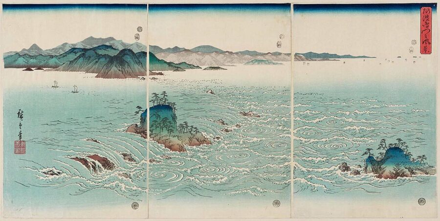
Twice a day the tide fills the Seto Inland Sea and twice a day it drains, and much of that water goes through the Naruto Strait, 1.3 kilometres wide, between Shikoku and Awaji Island. The level on the two sides can differ by 1.5 metres, the current runs at 13–15 kilometres an hour and faster at spring tides, and where it meets the slack water near the shore it spins off whirlpools that can reach 10–20 metres across in spring and autumn.
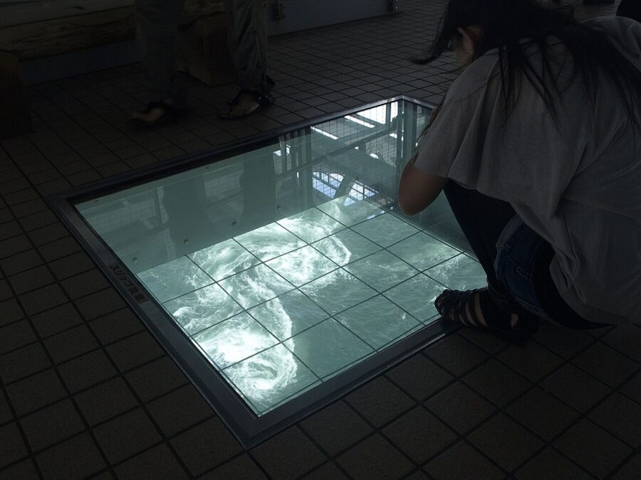

Everything depends on the tide, so aim for the hour around maximum flow. You can watch from the sightseeing boats out of Naruto, which go right into the race, or from the Uzu-no-Michi, a walkway built into the underside of the Onaruto Bridge with glass panels in the floor (¥510; 09:00–18:00 in March–September, to 17:00 in winter).
The Iya Valley and its vine bridges
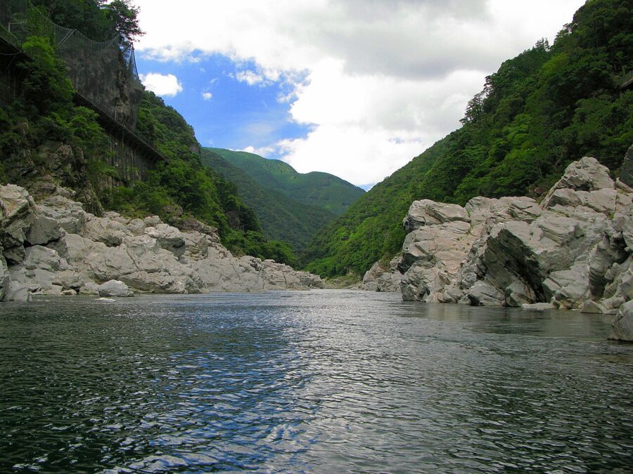
West of Tokushima the Yoshino cuts back into the mountains, and at Oboke and Koboke the gorge walls close in. The usual story is that the names mean “dangerous even with big steps” and “dangerous even with small ones”, but hoke is an old word for a cliff over a river, and the characters were picked for their sound in the 19th century. Boats run through Oboke past folded schist that is a national natural monument.

The Iya Valley runs off to the east, a side gorge so deep and remote that it is said to have sheltered survivors of the Taira clan after their defeat in 1185. Iya was famous for its kazurabashi, bridges woven from vines that could be cut if enemies came; records from 1646 list seven of them and from 1657 thirteen. Iya also claims the Konaki-jiji, a goblin who cries like a baby until you pick him up and then grows heavier and heavier.
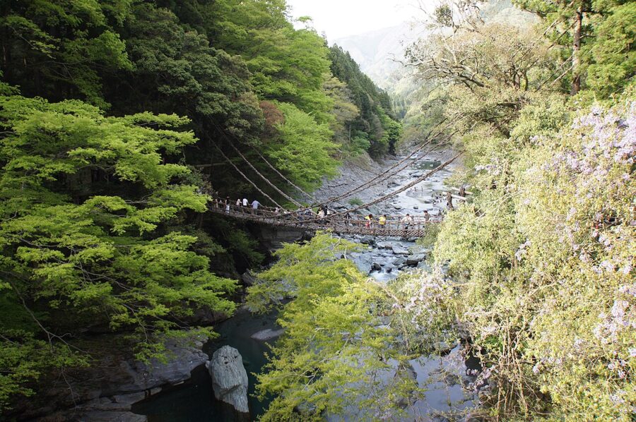

The bridge at Zentoku was rebuilt in vine in 1928 to draw visitors, after some years as a wire suspension bridge, and a national rail poster campaign in 1970 made it famous. Crossing is one way only, for a fee of about ¥550. Further up the valley in Higashiiya, the Oku-Iya double vine bridges see far fewer people. Buses run from Oboke Station to the Kazurabashi in about half an hour; to go further you need a car or a night in the valley.
Ehime (愛媛): a castle, a bathhouse and citrus
Ehime takes the north-western quarter of the island, a long coast on the Inland Sea and a ragged one on the Uwa Sea facing Kyushu. Iyo was never ruled by one lord in the Edo period, as the other three provinces were, but split between eight domains, which is why Ehime has so many small castle towns. Matsuyama, with about half a million people, is the largest city on Shikoku.
Matsuyama Castle (松山城)
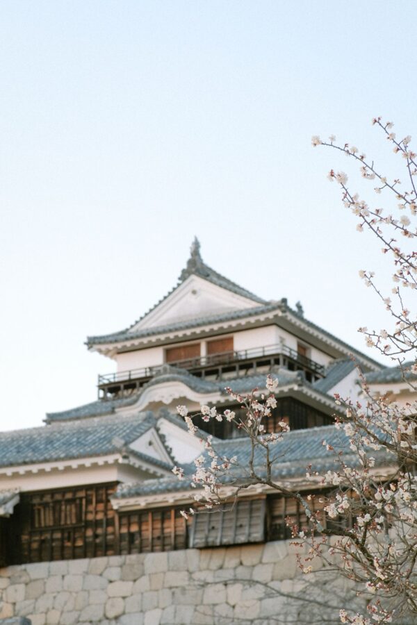
Kato Yoshiaki, rewarded for fighting on the winning side at Sekigahara, began building on Katsuyama hill in January 1602 and renamed the place Matsuyama the next year. The keep was burnt by lightning on New Year’s Day 1784, rebuilding took decades, and the present keep was finished in 1854, the youngest of the twelve original keeps that survive in Japan.
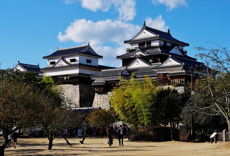

A ropeway and a single-seat chairlift run up from the Shinonome entrance (¥520 return, either way up), and the keep costs ¥520; the walk up through the woods takes about twenty minutes. On 12 July 2024, after heavy rain, part of the north-east slope of the castle hill collapsed and a mudslide destroyed a house below, killing three people; the slope repairs were completed on 29 May 2026.
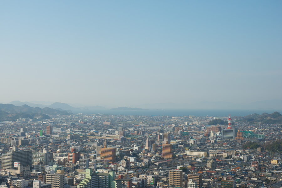

Dogo Onsen Honkan (道後温泉本館)
Dogo Onsen has the best claim of any spring in Japan to great age: the Nihon Shoki records emperors bathing at Iyo’s hot spring in the 7th century, and poets of the Man’yoshu came too. The Honkan, the three-storey wooden bathhouse at its centre, was built in 1894, and in 1994 it became the first public bathhouse listed as an Important Cultural Property. It still opens at 06:00 to a queue of locals.
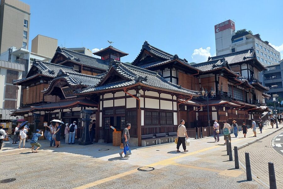
A restoration that kept the baths partly open began in January 2019 and was finished on 20 December 2024. The plainest ticket, the ground-floor Kami-no-Yu, costs ¥700 (06:00–23:00, last entry 22:30). ¥1,300 adds a yukata, tea and a sweet in the big second-floor hall; ¥2,000 and ¥2,500 buy the smaller Tama-no-Yu bath and quieter rooms upstairs. Two newer bathhouses nearby take the overflow, and a two-day ticket for all three costs ¥1,440.
Natsume Soseki taught English at Matsuyama’s middle school in 1895, and his comic novel Botchan of 1906, about a hot-tempered Tokyo teacher who hates the town and loves the bath, is why the replica steam tram that runs to Dogo is called the Botchan Ressha. Masaoka Shiki, who remade the haiku, was born in Matsuyama, and the city still keeps haiku post boxes for anyone’s verses.
Uchiko
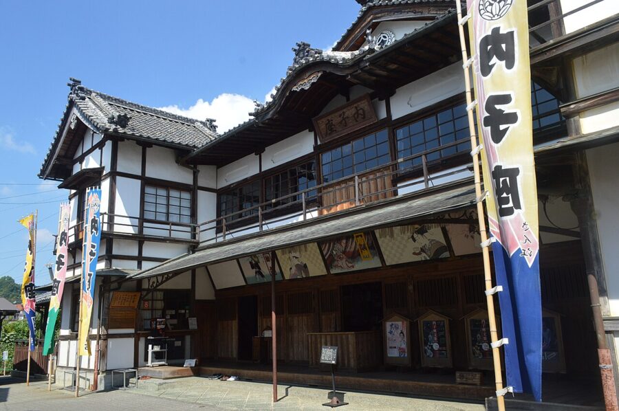
Uchiko, about 25 minutes south of Matsuyama by limited express, grew rich in the late 19th century on vegetable wax pressed from the berries of the wax tree for candles and hair oil. The Yokaichi-Gokoku street, about 600 metres of merchant houses with plastered walls in cream and ochre, is a protected district, and the wax trade’s collapse when electric light arrived is why it was never rebuilt.
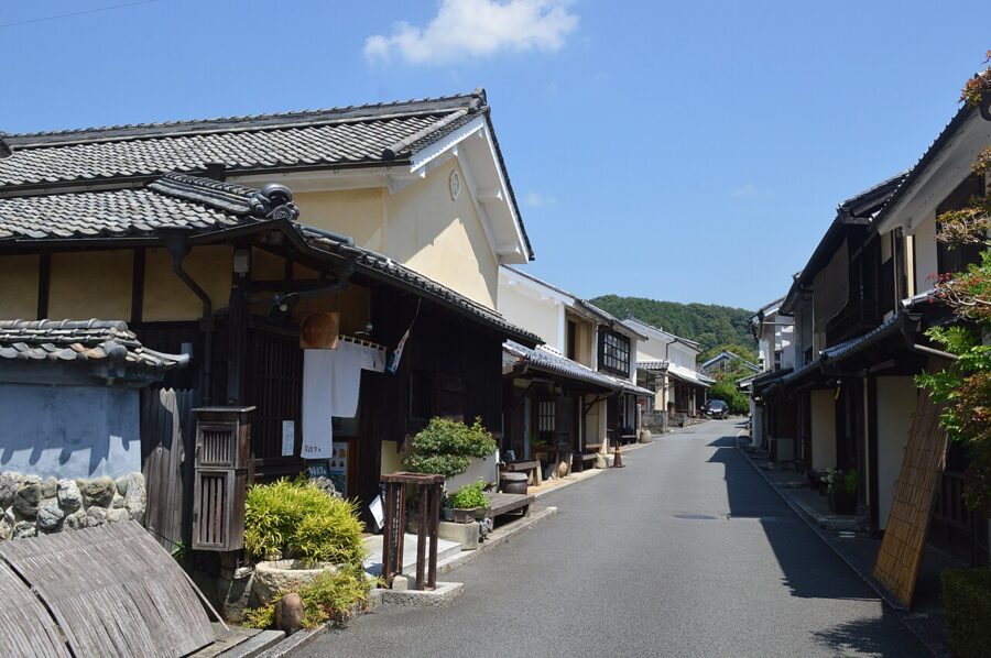

The town’s pride is Uchiko-za, a wooden theatre built by local subscribers in 1916, with a revolving stage and box seating. It closed on 2 September 2024 for about four years of structural repairs, so for now you see it from outside only, but the street alone is worth a half-day stop between Matsuyama and the south.

Kochi (高知): a castle, Ryoma and the last clear river
Kochi is the largest of the four prefectures and the most cut off, a long arc of Pacific coast walled in by mountains. The city gets about 2,670 millimetres of rain a year, more than twice Takamatsu, and more than 2,000 hours of sunshine. The castle gave the city its name: the first lord called his hill Kochiyama, “mountain between rivers”, after the two rivers that flooded round it, and a monk later changed the characters to 高智, “high wisdom”, so as not to invite the floods.
Kochi Castle (高知城) and the Sunday market
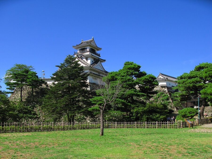
Yamauchi Kazutoyo was given Tosa in 1601 for his part in the Sekigahara campaign and built the castle on a 45-metre hill in the middle of the plain. A fire in 1727 burnt almost everything, and the present keep dates from 1747. Kochi is the only castle where both an original keep and an original lord’s palace survive. They are open 09:00–17:00, and the ticket costs ¥500; under-18s go free.

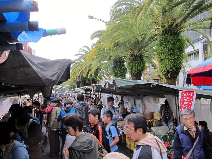
Below the castle on Otesuji, every Sunday from about 06:00 to 15:00, some 300 stalls line a kilometre of road for the Sunday market, which has run since at least 1690. It is a working market: vegetables from the hills, Tosa knives, citrus, country sushi and saplings. It pauses only for New Year and the Yosakoi festival.

Sakamoto Ryoma and Katsurahama
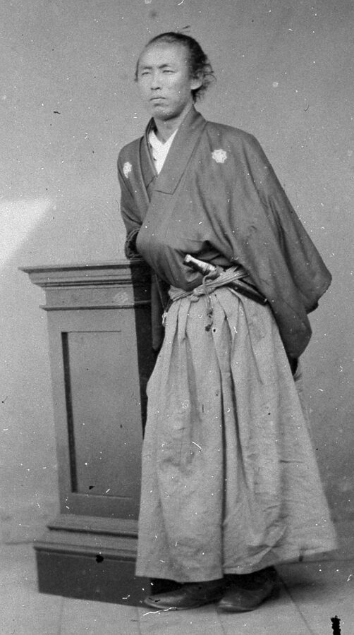
Sakamoto Ryoma, born in Kochi in 1836 to low-ranking samurai with merchant money, left the Tosa domain without permission in 1862, ran a trading company out of Nagasaki and helped broker the 1866 alliance between Satsuma and Choshu that brought down the shogunate. He was assassinated in Kyoto in December 1867, weeks before the restoration of imperial rule was proclaimed, and Kochi has never let him go.
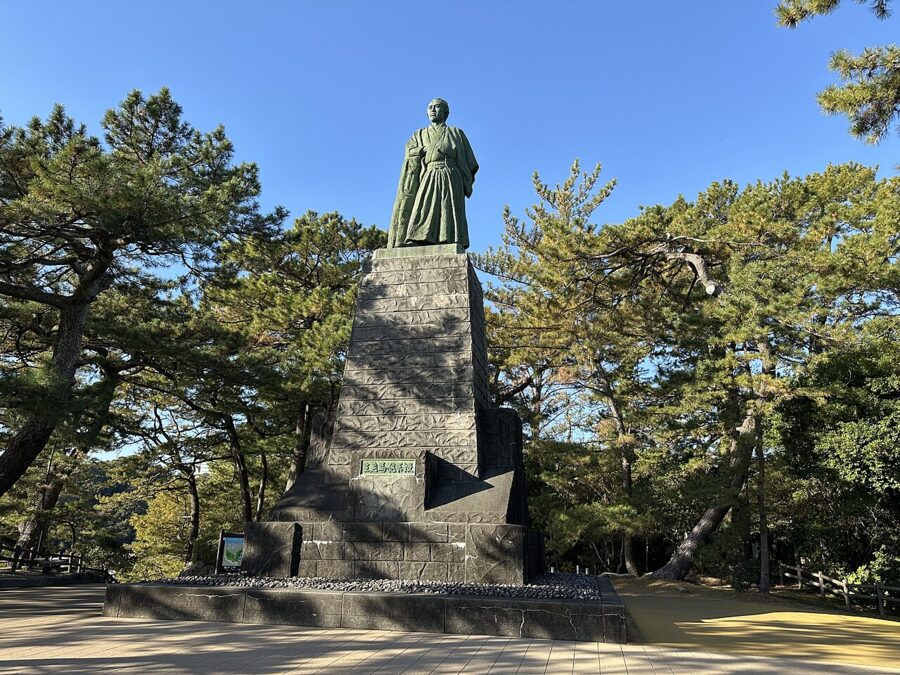
His statue stands at Katsurahama, a curved beach of coloured pebbles south of the city, looking out to sea. Young people across the prefecture raised the money and it was unveiled in May 1928; the figure alone is 5.3 metres high. The Kochi Prefectural Sakamoto Ryoma Memorial Museum on the headland, open 09:00–17:00, holds his letters; admission was ¥900 in November 2026 and varies with the exhibition. Swimming at Katsurahama is forbidden, because the currents kill.

Muroto and Ashizuri
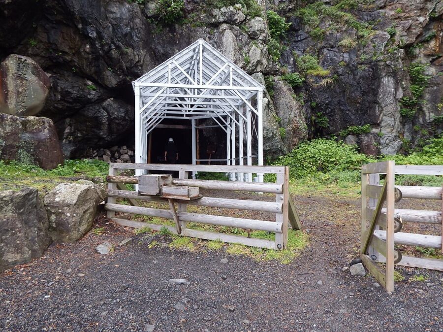
Kochi’s coast ends in two long capes. Cape Muroto in the east is a UNESCO Global Geopark, land still rising out of the sea with each great earthquake, and at its tip are the caves where Kukai is said to have meditated as a young man. By tradition he took his name, “sky and sea”, from the view out of the Mikurodo cave. The caves closed after rockfalls in 2015 and reopened in April 2019 under steel canopies, 08:00–17:00.

Cape Ashizuri in the far south-west is a granite cliff with temple 38 on top and a lighthouse looking straight out at the Kuroshio current. Neither cape is quick: Muroto is about two and a half hours from Kochi by train and bus, Ashizuri longer. Pick one, and if you have a car, make it Ashizuri, for the upper Shimanto on the way.
The Shimanto River
The Shimanto, 196 kilometres long, is the longest river on Shikoku and has no large dam on its main stream, which is why it is called the last clear river in Japan. Until 1994 its official name was the Watarigawa; Shimanto was a local name, and the government changed the legal one only after a television documentary in 1983 made the river famous.
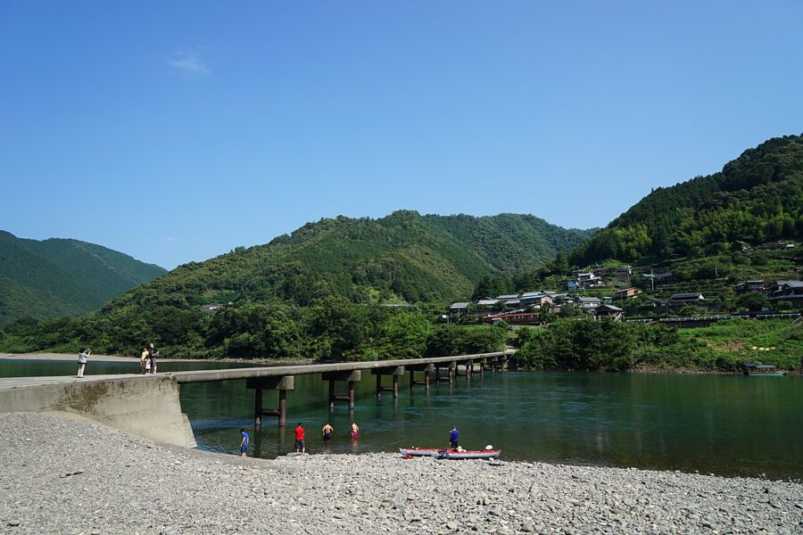

Its symbols are the chinkabashi, low concrete bridges without railings that sit two or three metres above normal water and simply go under in a flood. There are 47 of them on the river and its tributaries, 22 on the main stream, and the prefecture decided in 1993 to keep them. Hire a bicycle or a canoe in Shimanto City, or ride the Yodo Line, which follows the river upstream for much of its route.

What to eat on Shikoku
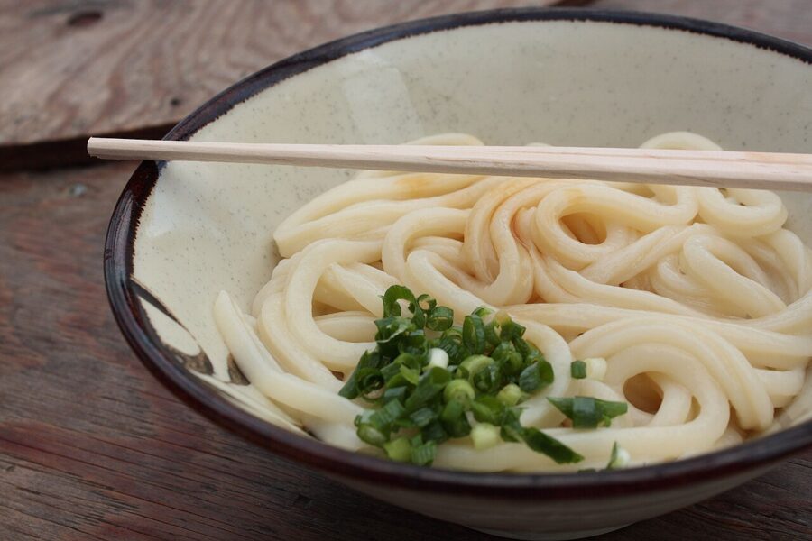
In Kagawa it is Sanuki udon: thick, square-edged wheat noodles with a firm bite, eaten at breakfast and lunch, often at self-service shops. The format appeared in the mid-1960s: take a tray, ask for a small or large bowl, hot or cold, add tempura from the counter, ladle on the broth and pay at the end. Many of the best shops are attached to noodle makers in the countryside and close when the dough runs out, often by early afternoon.

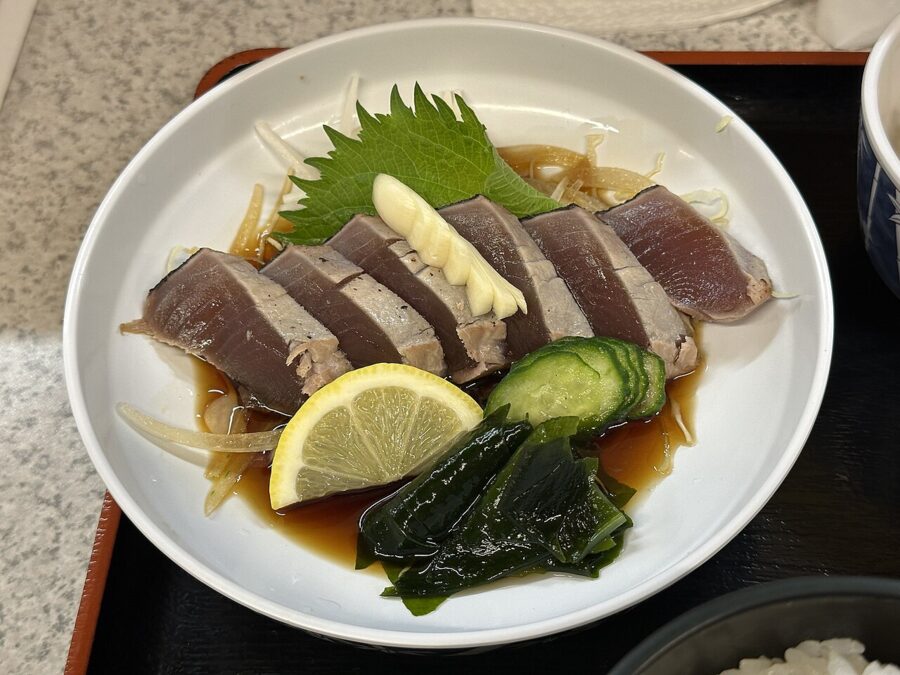
In Kochi it is katsuo no tataki, bonito seared over a fierce fire of rice straw so that the skin blisters and the inside stays raw, sliced thick and eaten with garlic, spring onion and either salt or a citrus and soy dressing. Nobody agrees where it came from. One story says the first Yamauchi lord banned raw bonito after food poisoning and the people of Tosa seared the outside so it counted as cooked; others credit fishermen’s cooking or the making of bonito flakes.

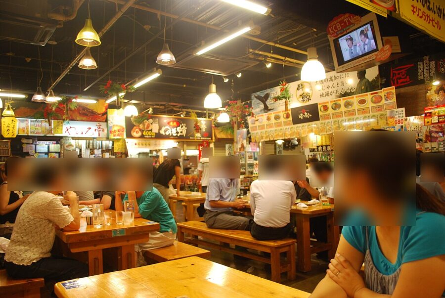
The place to eat it is Hirome Ichiba in central Kochi, a covered hall of food stalls and long shared tables, opened in 1998 and named after Fukao Hirome, a senior retainer of the domain whose mansion stood on the site.

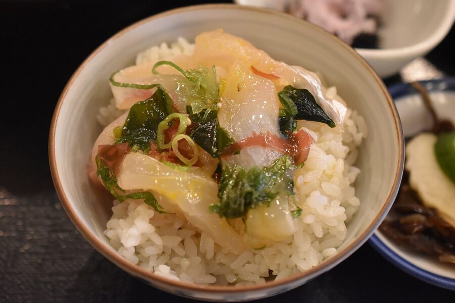
Ehime is citrus country, with terraced orchards along the Uwa Sea growing mandarins, the iyokan that takes the old province’s name and a run of newer hybrids. It also has two dishes called taimeshi, sea bream rice. In Matsuyama and the north it is a whole bream cooked with rice in the pot. In Uwajima it is raw bream in a sauce of soy, raw egg and sesame, tipped over hot rice, and the two have nothing in common but the fish.

Tokushima adds sudachi, a small green citrus squeezed over almost everything, and in the mountains Iya soba, coarse buckwheat noodles that break easily because the flour is barely bound. Kochi’s other contribution is yuzu, from the hill villages of the east.
When to go
Spring is the pilgrims’ season. Henro is a spring word in haiku, and from March to May the temples are busiest and the paths dry, with cherry blossom at temples and castles from late March. Autumn, October and November, is the other good season, clear and cooler, with the maples turning in the Iya Valley in November.
Summer is hot and humid, and it is festival season. Kochi’s Yosakoi festival, founded in 1954, fills the city with dance teams on 10–12 August after a night of fireworks on the 9th, and Tokushima’s Awa Odori follows straight after; hotels in both cities fill early.
August and September are also typhoon months, and Kochi, facing the Pacific, takes the brunt. A typhoon can stop the ferries and trains for a day or two, so build in slack. In winter the Inland Sea side stays mild, while the Iya Valley and Ishizuchi get snow.
Plans for five and ten days
Both plans start from Okayama on the Sanyo Shinkansen and use trains, with a car for the mountains if you drive.
Five days
Day 1. Marine Liner to Takamatsu. Ritsurin Garden in the morning, udon for lunch, Yashima or the Naoshima ferry in the afternoon.
Day 2. Kotoden or JR to Kotohira and the shrine steps early; Zentsuji in the afternoon, then on to Oboke and a night in the valley.
Day 3. The Oboke boat and the Iya Kazurabashi by bus or car. Late train to Kochi.
Day 4. Kochi Castle (on a Sunday, the market first), Katsurahama in the afternoon, Hirome Ichiba in the evening.
Day 5. The Nanpu back over the mountains to Okayama, or, with a night to spare, the long way via Matsuyama and Dogo.
Ten days
Days 1–2. Takamatsu and Ritsurin; a full day for Naoshima and Teshima.
Day 3. Kotohira and Zentsuji, then Tokushima for the night.
Day 4. Naruto: Ryozenji, the whirlpools at the right tide, the Awa Odori Kaikan in the evening.
Days 5–6. The Iya Valley, with a night there and the double vine bridges in Higashiiya if you have a car.
Day 7. Kochi: castle, Sunday market if the calendar allows, Katsurahama.
Day 8. West to Kubokawa and the Yodo Line along the Shimanto to Uwajima, with taimeshi for dinner.
Day 9. North to Uchiko, then Matsuyama: the castle at dusk and a late bath at Dogo.
Day 10. Leave by bicycle over the Shimanami Kaido to Onomichi, by the Shiokaze to Okayama, or by the ferry from Yawatahama to Kyushu.
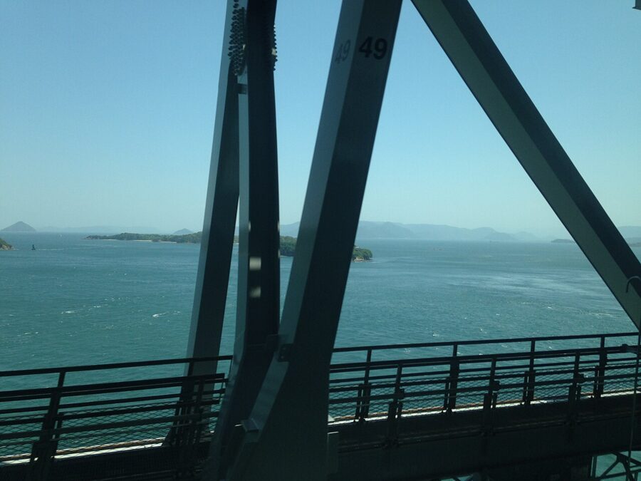
Whichever way you go, the last thing you see of Shikoku is likely to be the sea from a bridge. If it is the Seto-Ohashi, the Marine Liner runs north on the lower deck with the islands passing at eye level, under the road that the old story was waiting for. The foxes have had thirty-eight years to make the crossing, and there is still no sign of them.