
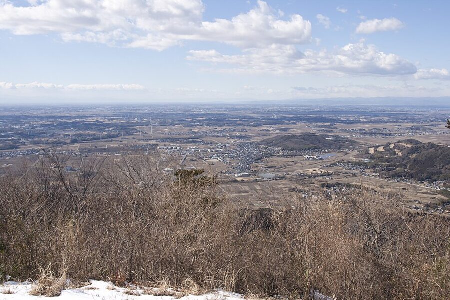

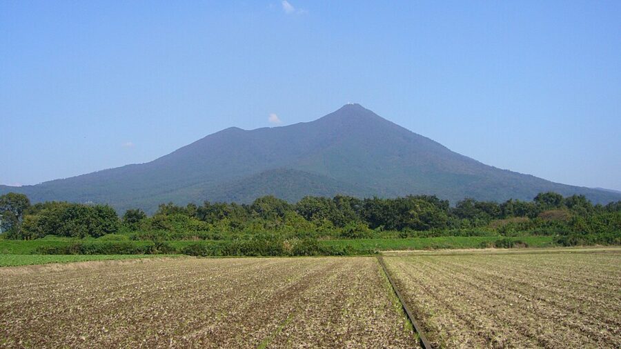
From the top of Mount Tsukuba (筑波山), 877 metres above the rice fields of Ibaraki, the land to the south and west is so flat that the eye has nothing to stop on until the mountains at the far edge. On a clear winter morning Fuji stands above them. Everything in between is the Kanto Plain, about 17,000 square kilometres of river silt and volcanic ash, the largest lowland in Japan and nearly the size of the island of Shikoku.
Kanto (関東) is the seven prefectures on and around that plain: Tokyo, Kanagawa, Saitama, Chiba, Ibaraki, Tochigi and Gunma. About 35 per cent of Japan’s people lived in them in 2023, by the government’s own estimate. Most travellers see exactly one of the seven.
That is a waste, and an easy one to fix. Kamakura, Hakone, Nikko, Kawagoe and the hot springs of Gunma all lie within about three hours of a Tokyo terminal, several of them on a single pass. Each one explains something about the city you came for: where its first warrior rulers came from, where its shoguns are buried, why its great river reaches the sea a hundred kilometres from the bay it used to drain into.


In this guide
- What Kanto is: east of the barrier
- Getting around Kanto
- Tokyo as a base
- Kanagawa: Kamakura, Enoshima, Hakone and Yokohama
- Tochigi: Nikko, Kinugawa, Mashiko and Utsunomiya
- Gunma: Kusatsu, Ikaho, Tomioka and Minakami
- Saitama: Kawagoe and Chichibu
- Chiba: Narita-san, Sawara and the Boso coast
- Ibaraki: Kairakuen, Hitachi Seaside Park and Mount Tsukuba
- What to eat in Kanto
- Kanto through the year
- Plans: day trips and a week beyond Tokyo
What Kanto is: east of the barrier
Kanto means “east of the barrier”. From the late seventh century the court guarded its home provinces with three checkpoints, at Suzuka, Fuwa and Arachi, and the lands beyond them were simply the east.
Over the centuries the word settled on the country east of two mountain crossings: the Ashigara pass on the Tokaido road, near today’s Hakone, and the Usui pass on the inland road to Shinano, today’s Nagano in Chubu. To the north, the barriers of Shirakawa and Nakoso marked the start of Mutsu, the old name for the Pacific side of Tohoku. The western pair also gave the region its older name, Bando (坂東), “east of the slopes”.
The capital the barriers protected was Nara and then Kyoto, and the country around it is still Kansai, “west of the barrier”. The two names have been paired ever since, in dialect jokes, baseball and the way you are expected to stand on an escalator.
The eight provinces
Inside the barriers lay eight provinces, the Kanhasshu (関八州): Sagami, Musashi, Awa, Kazusa, Shimosa, Hitachi, Kozuke and Shimotsuke. The modern prefectures follow them loosely. Musashi became Tokyo, Saitama and most of Kanagawa; Kozuke is Gunma, Shimotsuke is Tochigi, and Hitachi is most of Ibaraki.
Chiba keeps the oddest relic. Its “upper” province, Kazusa, lies south of the “lower” one, Shimosa, and the usual explanation is the road: the old Tokaido crossed the mouth of Tokyo Bay by boat from the Miura peninsula and landed in the south, so the south was nearer the capital. Ministries and companies still draw the edges of the modern region differently, a muddle that runs through all of the regions of Japan.
Kamakura and the first warrior government
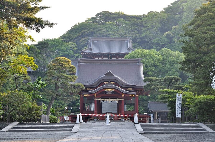
Kanto’s warriors made their first capital at Kamakura (鎌倉), a bay shut in on three sides by low wooded hills. Minamoto no Yoritomo set up his headquarters there in 1180 and moved his clan shrine, Tsurugaoka Hachimangu, from the shore to the head of the new town. When his shogunate began is still argued over. Japanese textbooks long gave 1192, the year he was named shogun; most now teach 1185, and historians have made cases for 1180, 1183 and 1190 as well.
The shogunate fell in 1333, but its men had long since scattered. After the war of 1221 warrior families from the east were sent to hold land all over the west, and they took their home place names with them as surnames. That is why Chiba, Miura and Shibuya turn up on doorplates in Kyushu.
Edo, the Tokugawa, and the river they moved
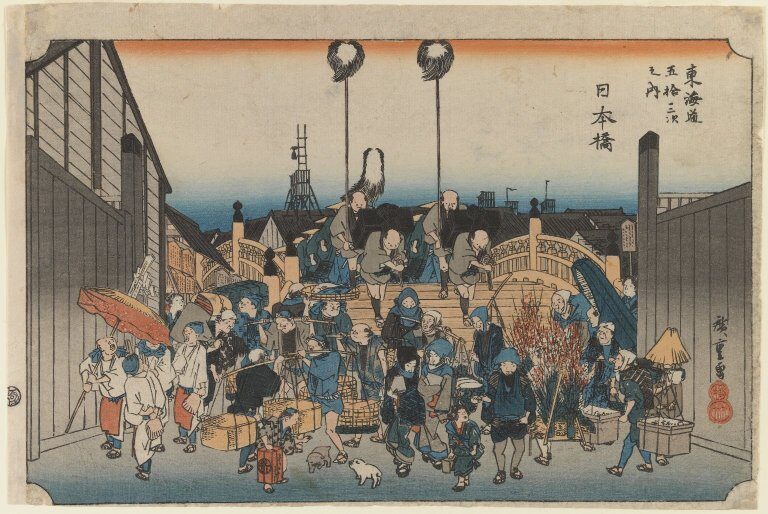
Edo was a small castle on a bluff above a marshy inlet when Ota Dokan built it in 1457. In 1590 Toyotomi Hideyoshi took Odawara from the Hojo family, who had ruled Kanto for a century, and handed their eight provinces to Tokugawa Ieyasu. Ieyasu chose Edo. He became shogun in 1603, the lords of every domain were made to keep households there, and by the early eighteenth century the city had passed a million people.
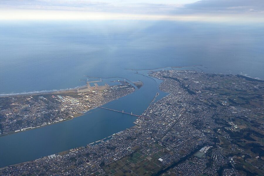
Then the Tokugawa moved a river. The Tone used to empty into Edo Bay, flooding the plain around the young city. From 1621 engineers dug new channels across a low watershed, and in 1654, at the third attempt, the main flow broke through to the east and reached the Pacific at Choshi. Older histories date the work to 1594, when a tributary was dammed near Hanyu, but recent research treats that as a local flood defence.
The results are still on the map. The Tone, 322 kilometres long with the largest catchment in Japan, now runs east along the Chiba and Ibaraki border; the old bed became new rice land; and boats could carry rice, timber and soy sauce from the interior to Edo by river and canal. The breweries of Noda and Choshi grew rich on that traffic.

1923, and the city rebuilt
At 11:58 on 1 September 1923 the Sagami Trough slipped under the bay south of Kamakura. Estimates of the magnitude run from 7.9 to 8.3. The quake came at lunchtime, when cooking fires were lit, with a strong wind blowing from a typhoon near the Noto peninsula, and 136 fires broke out in Tokyo.
About 105,000 people died or went missing, nine in ten of them in the fires. A fire whirlwind crossed a former army clothing depot in Honjo, on the east bank of the Sumida, where crowds had fled with their belongings. The shaking was worst in Kanagawa, nearer the fault, and a tsunami reached about 9 metres at Yuigahama beach in Kamakura.
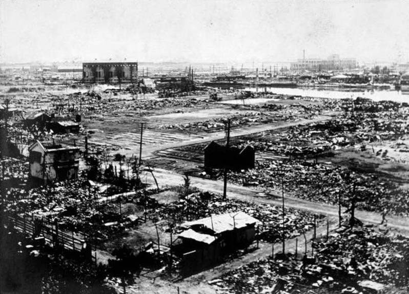
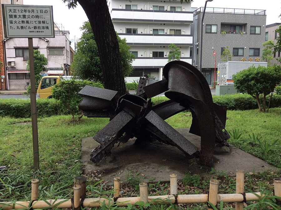
For eighty years the death toll was given as about 140,000. Seismologists found that many victims had been counted twice, and the standard reference tables cut the figure to about 105,000 in 2006. Yokoami Park now covers the depot site, with a memorial hall and, outside, steel melted in the fires.

Getting around Kanto
The railways fan out from Tokyo like spokes, and most of the region is a straight run from one terminal or another. JR East owns the main lines and the shinkansen, about 50 minutes to Utsunomiya or Takasaki. The private railways own the short cuts, often faster, cheaper and nearer the sights.
JR East and the passes
The national Japan Rail Pass rose sharply in October 2023, and for a Kanto trip it rarely pays now. The regional passes do. Prices are for late 2026.
| Pass | Price (adult) | Valid | Covers |
|---|---|---|---|
| JR Tokyo Wide Pass | ¥16,000 | 3 consecutive days | JR East lines in Kanto including shinkansen to Karuizawa and Gala Yuzawa; Fuji Kyuko, Izu Kyuko, Joshin Dentetsu, Tokyo Monorail, Rinkai Line; JR–Tobu through trains to Nikko and Kinugawa. Non-Japanese passports only. |
| Odakyu Hakone Freepass (from Shinjuku) | ¥7,100 / ¥7,500 | 2 / 3 days | Round trip from Shinjuku plus the trains, cable car, ropeway, boats and buses inside Hakone. Romancecar seats ¥1,200 extra each way. |
| Odakyu Enoshima-Kamakura Freepass (from Shinjuku) | ¥1,640 | 1 day | Round trip from Shinjuku and the Enoden line between Fujisawa and Kamakura. |
| Tobu NIKKO PASS all area | ¥8,000 | 1–4 days | Tobu round trip from Asakusa to Shimo-Imaichi, local Tobu lines and buses to the shrines, Lake Chuzenji, Oku-Nikko and Kinugawa. Limited express seats extra. A cheaper World Heritage area version is ¥3,000. |
The Tokyo Wide Pass rose from ¥15,000 to ¥16,000 in March 2026, and it is still the one worth doing the sums for. It pays when the three days include long JR runs, such as Nikko by shinkansen, Kusatsu or Tomioka; for a day in Kamakura it is far too much. It does not touch the Tokaido Shinkansen, Odakyu, Hakone’s mountain railways or the Tokyo subway.
The private railways
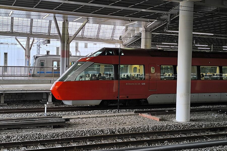
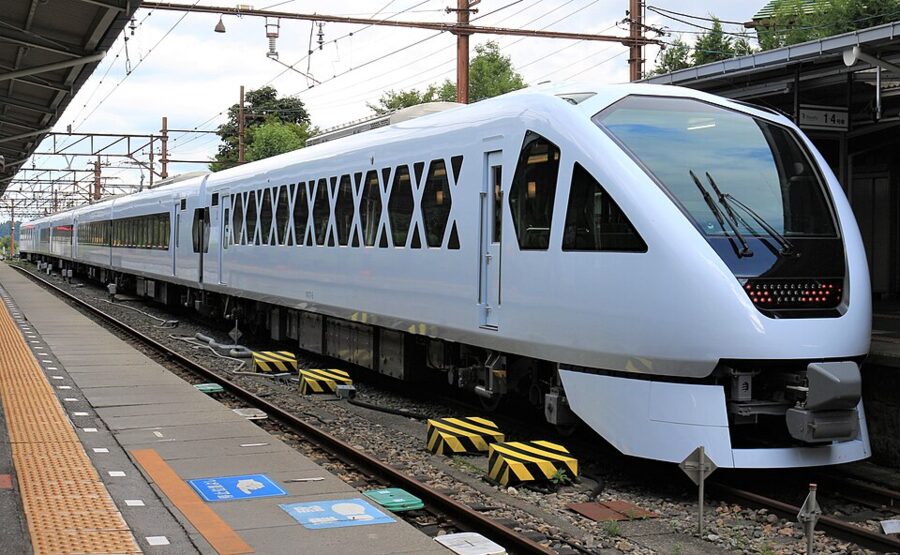
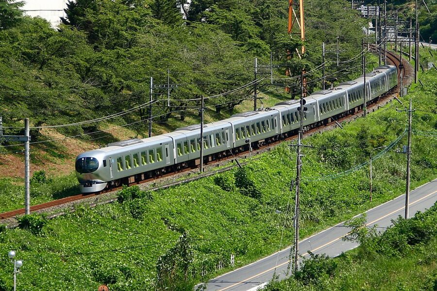
Each private line leaves from its own corner of Tokyo, and each has a flagship limited express with reserved seats. Odakyu’s Romancecar runs from Shinjuku to Hakone-Yumoto in about 80 minutes. Tobu’s SPACIA X leaves Asakusa for Nikko and Kinugawa Onsen, a run of about two hours. Seibu’s Laview takes about 80 minutes from Ikebukuro to Seibu-Chichibu.


Two more lines matter for day trips. Keikyu runs south from Shinagawa through Yokohama to the tip of the Miura peninsula, where Misaki port lands tuna, and sells a Misaki Maguro ticket that bundles the fare with a tuna lunch. Keisei runs from Ueno to Narita, both the airport and the temple town, and its Skyliner covers Nippori to Narita Airport Terminal 2 in 36 minutes.
Suica
One rechargeable IC card covers almost every train and city bus in the region, JR and private alike. Unregistered Suica cards went back on sale in March 2025 after a two-year shortage of chips, and JR East’s Welcome Suica Mobile app for iPhone arrived the same month. The card pays the base fare only: limited express and reserved-seat charges are separate tickets, bought from the operator.
Tokyo as a base
Where you sleep in Tokyo decides how easy the rest of Kanto is, because each terminal faces a different way. I would choose the hotel by the trips, not the neighbourhood.
- Ueno and Asakusa face north and east: Tobu trains to Nikko from Asakusa, JR limited expresses to Kusatsu and the Joban Line to Mito from Ueno, Keisei to Narita.
- Shinjuku faces west and south-west: the Romancecar to Hakone and Enoshima, the Chuo Line, and the highway buses of Busta Shinjuku, including the direct service to Kusatsu.
- Ikebukuro faces north-west: Seibu to Chichibu, Tobu Tojo Line trains to Kawagoe.
- Tokyo Station and Shinagawa are for the shinkansen, the Yokosuka Line to Kamakura and Keikyu to Yokohama and Miura.
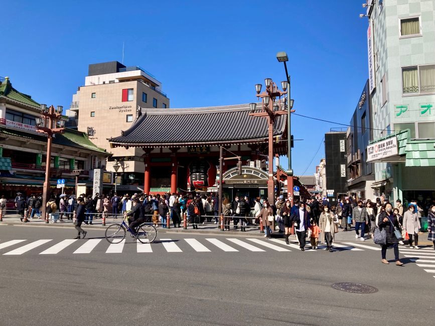
The capital even has its own mountain: Mount Takao, 599 metres, about an hour from Shinjuku on the Keio Line, the easiest walk in the region and on autumn weekends the busiest.
Tokyo also runs a long way out to sea. The Izu Islands and the Ogasawara Islands are both part of the metropolis, strung south for about a thousand kilometres. Izu Oshima, the nearest, is a night ferry or a jetfoil from Takeshiba pier; the Ogasawara Islands, a World Natural Heritage site since 2011, are about 24 hours away by the only ship, and they belong to Tokyo as much as Shinjuku does.
Kanagawa: Kamakura, Enoshima, Hakone and Yokohama
Kanagawa (神奈川県) holds a medieval capital, a volcano and the port that opened Japan to foreign trade, all within an hour of each other. I would give Kamakura a full day and Hakone a night.
Kamakura and Enoshima
The Yokosuka Line reaches Kamakura from Tokyo Station in about an hour. Start one stop early at Kita-Kamakura, where the great Zen temples sit in their side valleys, Kencho-ji among them, founded in 1253 and first of the city’s five ranked Zen houses. Then walk the main valley south to Tsurugaoka Hachimangu and the sea.
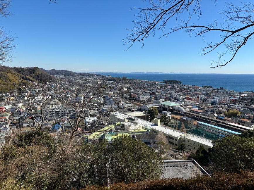
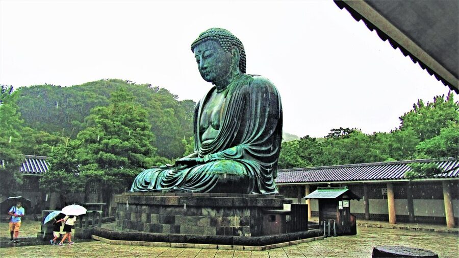
The Great Buddha is at Kotoku-in, near Hase station on the Enoden line. The bronze Amida is about 11.3 metres tall and weighs about 121 tonnes; the chronicle of the shogunate records casting beginning in August 1252. Records mention storm damage to its hall in 1334 and 1369 and in 1498, the year a tsunami is said to have taken the last of it. Entry is ¥300, and another ¥50 lets you climb inside the statue between 08:00 and 16:30.
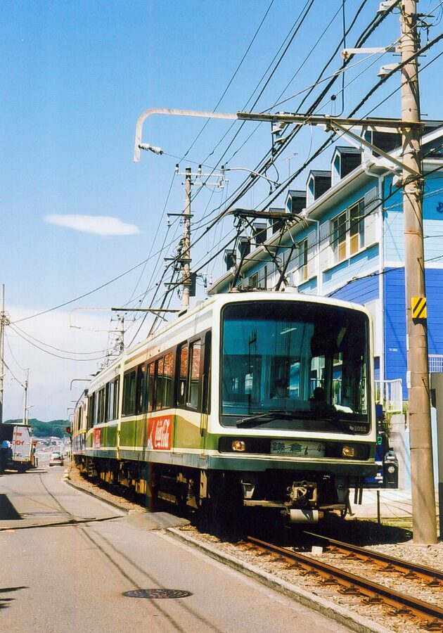
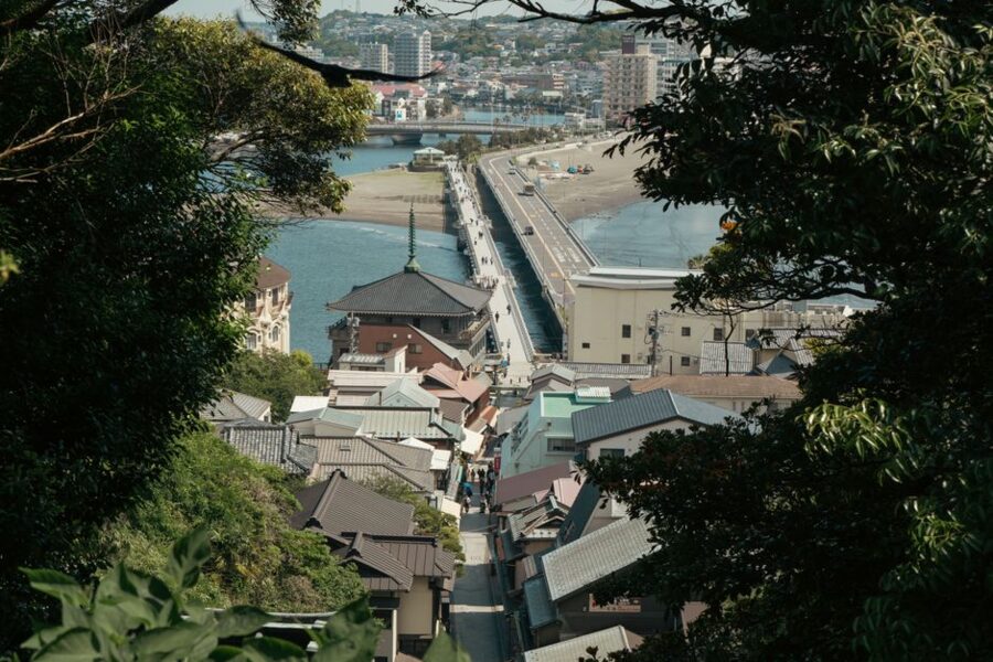
From Hase the four-carriage Enoden trains run west along the shore to Enoshima (江の島), a small island joined to Fujisawa by a road bridge. Its shrine is dedicated to the sea goddess Benzaiten, and the restaurants on the approach serve shirasu-don, rice heaped with tiny boiled sardines landed in the bay. The Odakyu freepass covers the whole circuit.

Hakone
Hakone (箱根) is a volcano you travel through rather than climb. The caldera is about 8 kilometres across and 12 long, with younger cones in the middle. About 3,200 years ago part of Kamiyama collapsed in a landslide that dammed a river and filled the basin now called Lake Ashi, 723 metres above the sea.
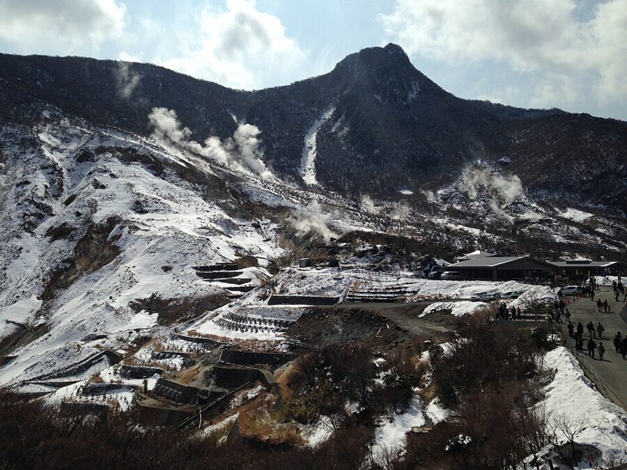

The steam still matters. In June 2015 a very small eruption at Owakudani raised the alert to Level 3 and closed the valley; the ropeway did not run its full length again until July 2016, and a further alert closed it for part of 2019. The Japan Meteorological Agency had Hakone at Level 1, the lowest, in November 2026. Check before you go.
The classic loop uses six kinds of transport on one pass. Romancecar to Hakone-Yumoto, the switchback Hakone Tozan Railway to Gora, a cable car to Sounzan, the ropeway over Owakudani to Togendai, a sightseeing boat down Lake Ashi, and a bus back. Owakudani’s eggs, boiled black in the vents, are the snack.
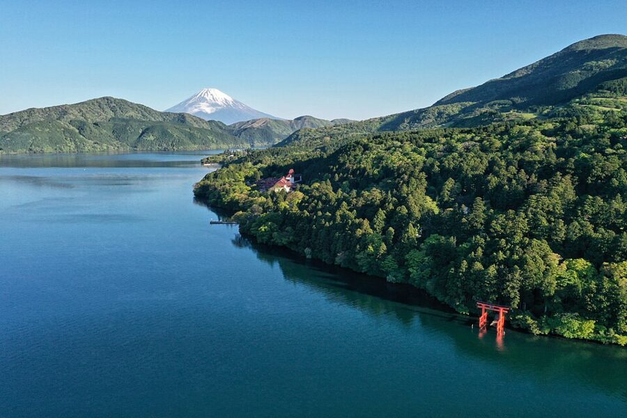

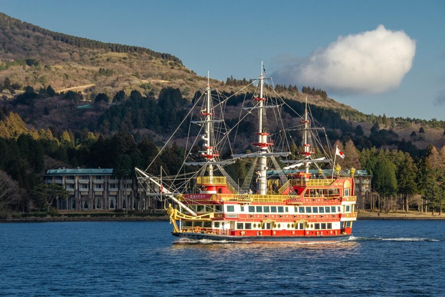
Stay the night. A day trip spends half its hours on transport, and the loop is quietest after 16:00, when the day crowds go back down the hill.
Yokohama
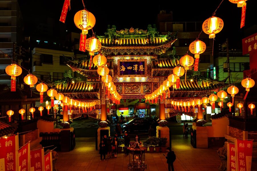
Yokohama was a fishing village until 1 July 1859, when it opened as a treaty port under the agreement with the United States. Chinese merchants came with the Western trading houses, and the quarter they settled is now Yokohama Chinatown, with more than 500 shops in about a fifth of a square kilometre, many of them restaurants.
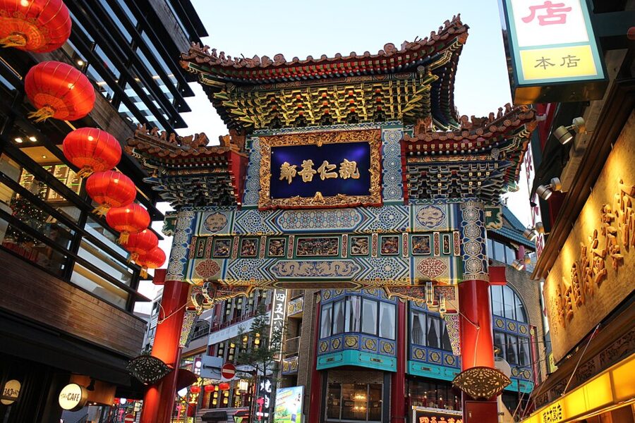

For quiet, take a bus south to Sankeien, a 17.5-hectare garden opened in 1906 by the silk merchant Hara Tomitaro. He collected old buildings the way others collected tea bowls: seventeen stand in the grounds, ten of them Important Cultural Properties, moved from Kyoto, Wakayama, Gifu and elsewhere. Then end the day at Minato Mirai, the waterfront rebuilt on old dockyards, as the lights come on.
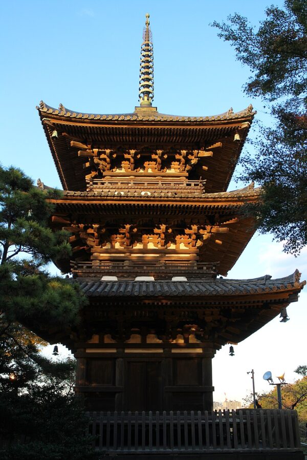

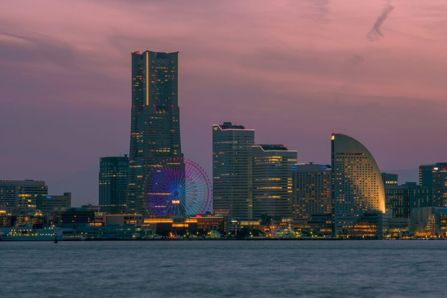
Tochigi: Nikko, Kinugawa, Mashiko and Utsunomiya
Tochigi (栃木県), the old Shimotsuke, means Nikko (日光) to most travellers: shrines, a lake above them and onsen down the valley, a natural two days.
Nikko
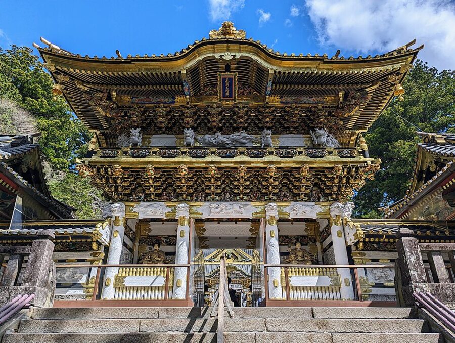
Tokugawa Ieyasu died in 1616 and asked to be enshrined at Nikko. His remains were moved there the next year, and in 1636 his grandson Iemitsu rebuilt the shrine, Toshogu, as the most lavish building of the age. It is a World Heritage site with the shrine of Futarasan and the temple of Rinno-ji, listed together in 1999 as the Shrines and Temples of Nikko.
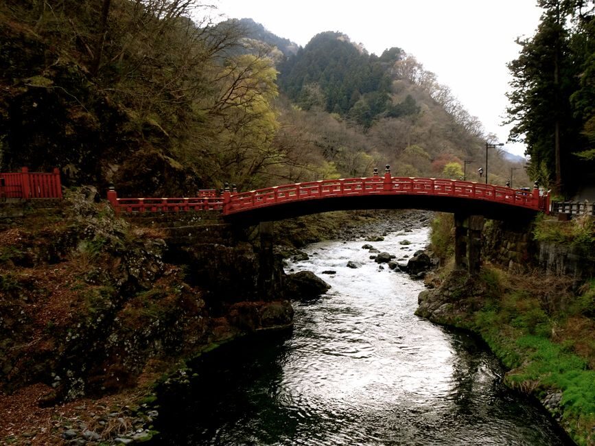
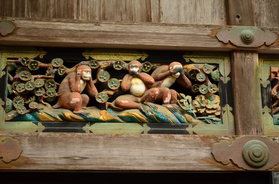
Toshogu is open 09:00–17:00 from April to October and 09:00–16:00 from November to March, with entry closing half an hour earlier. A ticket is ¥1,600. Inside are the carvings everyone knows: the three monkeys on the sacred stable, the sleeping cat over the passage to Ieyasu’s tomb, and the Yomeimon, crowded with more than five hundred figures.
The roads into Nikko are lined by a cedar avenue planted from about 1625. About 12,500 trees survive, and the shrine says around fifty are lost every year to traffic and pollution.
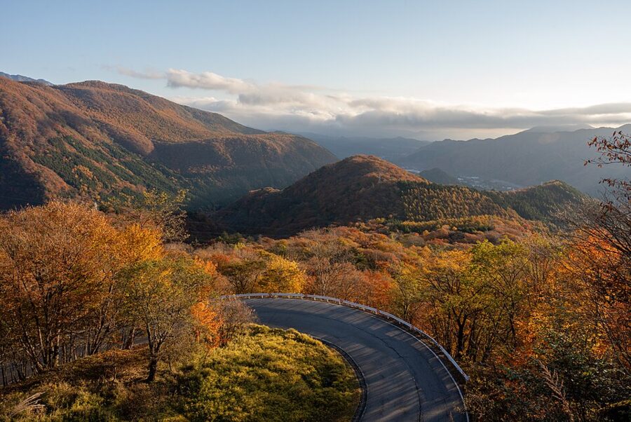
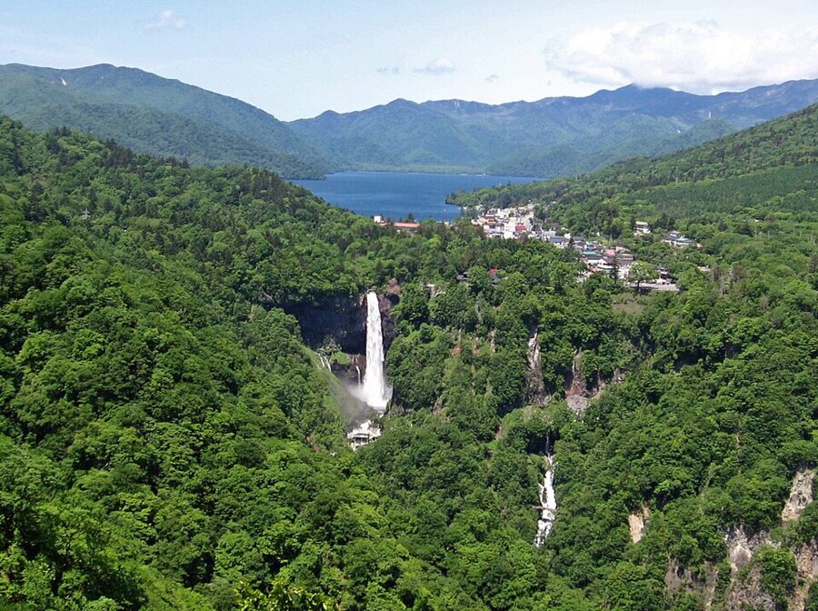
Above the town the Irohazaka climbs to Lake Chuzenji in 48 hairpins, one for each syllable of the old Japanese alphabet, with a separate road for each direction. It was a toll road from 1954 to 1984. The lake at the top, 1,269 metres up, is the highest natural lake in Japan, dammed about 20,000 years ago by lava from Mount Nantai.


Kinugawa Onsen
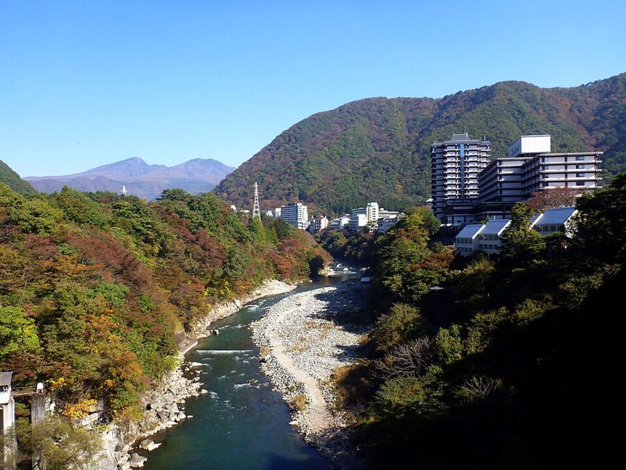
Down the valley, Kinugawa Onsen is a resort of large hotels strung along a gorge, on the Tobu line beyond Shimo-Imaichi. The river’s name looks alarming, written with the characters for “demon” and “anger”. It was first written as the river of Keno, the old name for this part of Kanto; medieval writers used characters for silk or robe, and the demon spelling arrived only in the early Meiji period. The river has earned it in some floods.

Mashiko
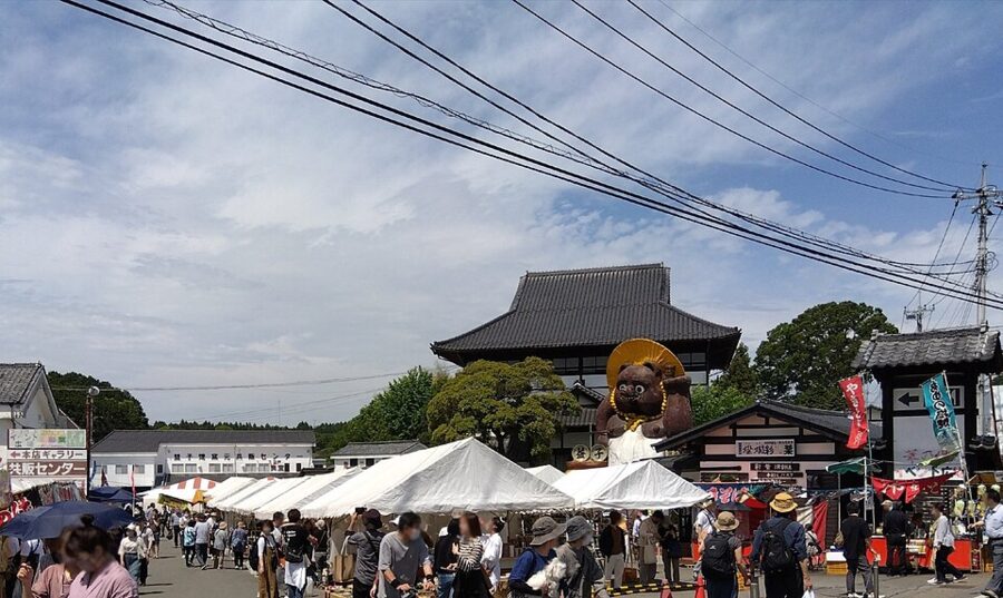
Mashiko (益子), an hour by bus from Utsunomiya, has made pots since the 1850s, when a potter trained in Kasama built a kiln here for water jars and braziers. The clay is coarse, which suited everyday ware. In the 1920s Hamada Shoji settled here and made it the home of the folk-craft movement; he was later named a Living National Treasure, and his friend Bernard Leach often came to work at the kilns. The pottery fairs in spring and autumn fill the town with stalls.

Utsunomiya
Utsunomiya (宇都宮), the prefectural capital, has built an identity on gyoza, pan-fried dumplings, and a long rivalry with Hamamatsu over which city’s households spend most on them. The government’s household survey has Hamamatsu ahead for three years running in the figures published in February 2026. Neither city has conceded anything.
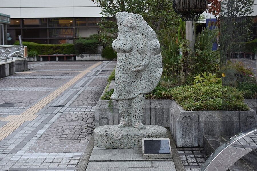

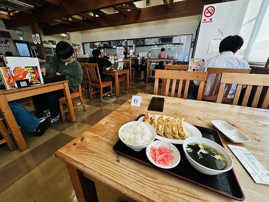

Gunma: Kusatsu, Ikaho, Tomioka and Minakami
Gunma (群馬県), the old province of Kozuke, is the mountain end of Kanto: volcanoes, hot springs and the upper Tone. It is also where Japan’s modern industry began.
Kusatsu Onsen
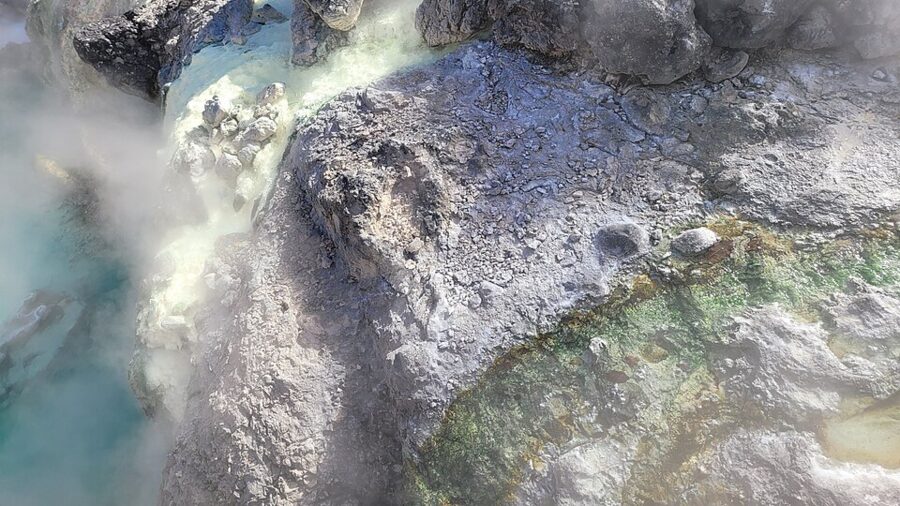
Kusatsu (草津) has the largest natural flow of hot water in Japan, more than 32,300 litres a minute, from springs fed by the volcano Kusatsu-Shirane. The water is strongly acidic, around pH 2, and comes out of the Yubatake source too hot to bathe in. The traditional fix is yumomi: bathers stirred the water with long boards, singing to keep time, until it cooled.
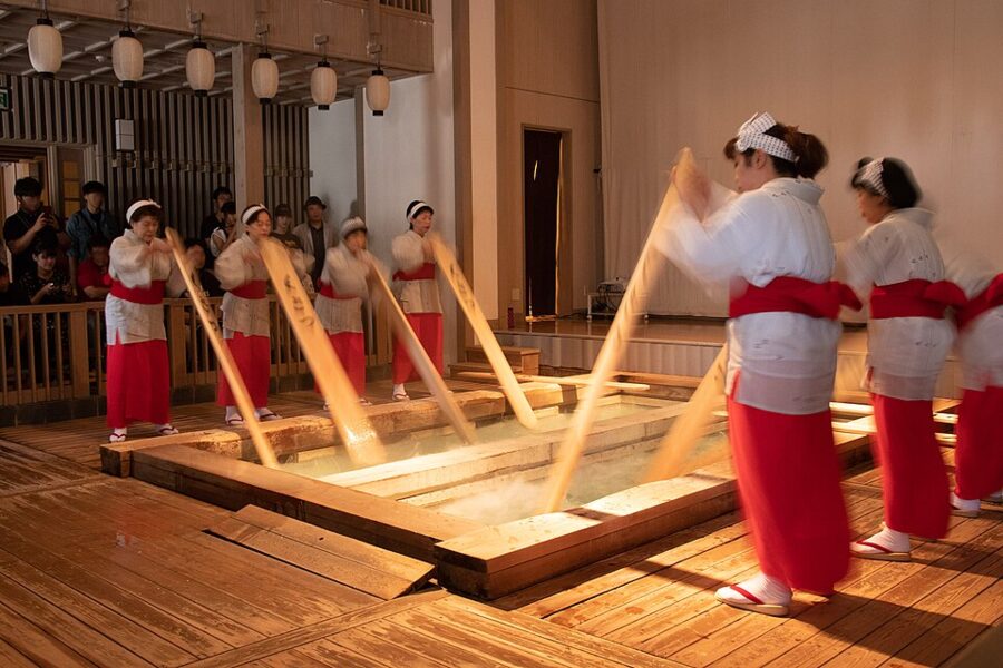

Getting there takes planning. The JR limited express Kusatsu-Shima runs from Ueno to Naganohara-Kusatsuguchi in about 2 hours 20 minutes, only two or three times a day, and a JR bus climbs to the town in about 30 minutes. The railway reached Naganohara only in 1946. Direct highway buses run from Busta Shinjuku and Tokyo Station.
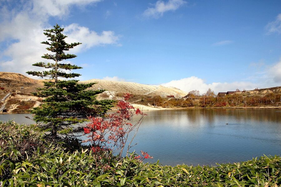
Ikaho Onsen
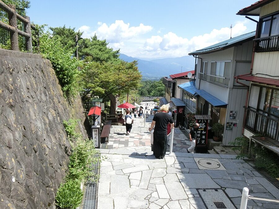
Ikaho (伊香保) is built on a slope, and its main street is a stairway of 365 stone steps lined with inns. Under the steps runs the iron-red “golden water”, shared out to the inns through sixteen wooden channels. A record of 1802 says the lord of the area divided the town among seven families in 1576; other documents suggest some of those families were there earlier.
Tomioka Silk Mill
In 1872 the new Meiji government opened a model silk mill at Tomioka (富岡), with French machinery and a French engineer, Paul Brunat, who brought French women to teach the first workers. Recruits were scarce at first: a rumour went round that the foreigners drank blood, which was their red wine. Within a year silk from the mill won a prize at the Vienna world’s fair.
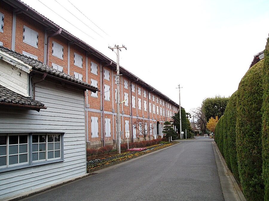
The mill ran until 1987, latterly under the Katakura company, and it became a World Heritage site with related silk sites in 2014. Three buildings are National Treasures. Entry is ¥1,000, 09:00–17:00, and a replica French reeling machine is demonstrated on most days from 10:00 to 11:30 and 14:00 to 15:30.
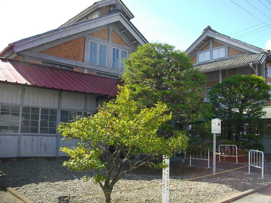
Tomioka is on the Joshin Dentetsu line from Takasaki, covered by the Tokyo Wide Pass.
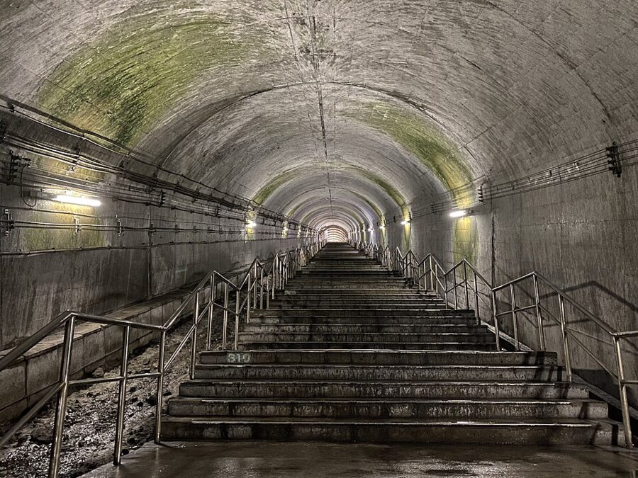
Minakami and Tanigawa-dake
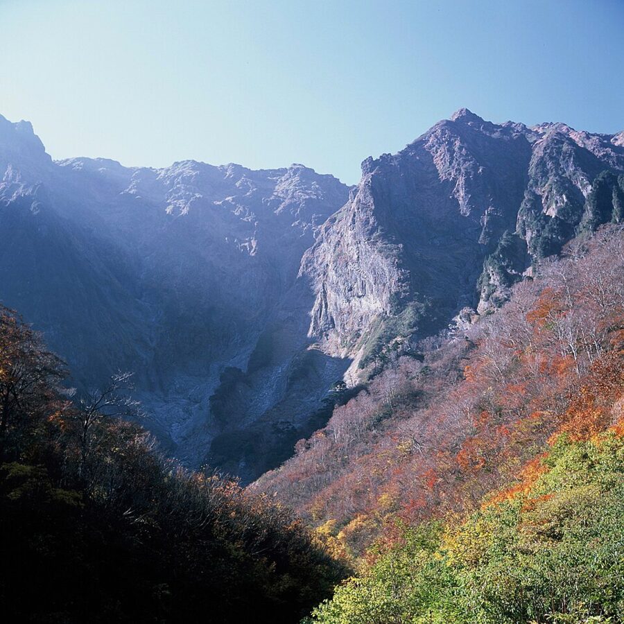
Minakami sits at the head of the Tone, under the border range with Niigata. The Joetsu Shinkansen has stopped at Jomo-Kogen since 1982, and the town lives on onsen, skiing and the river. Above it rises Tanigawa-dake, 1,977 metres, whose Ichinokura-sawa cliffs are counted among Japan’s three great rock walls. More than 40,000 people climb it each year, and the prefecture warns that it is also one of the mountains with the most accidents.


Saitama: Kawagoe and Chichibu
Saitama (埼玉県) is mostly commuter towns, but two places in it reward a day.
Kawagoe
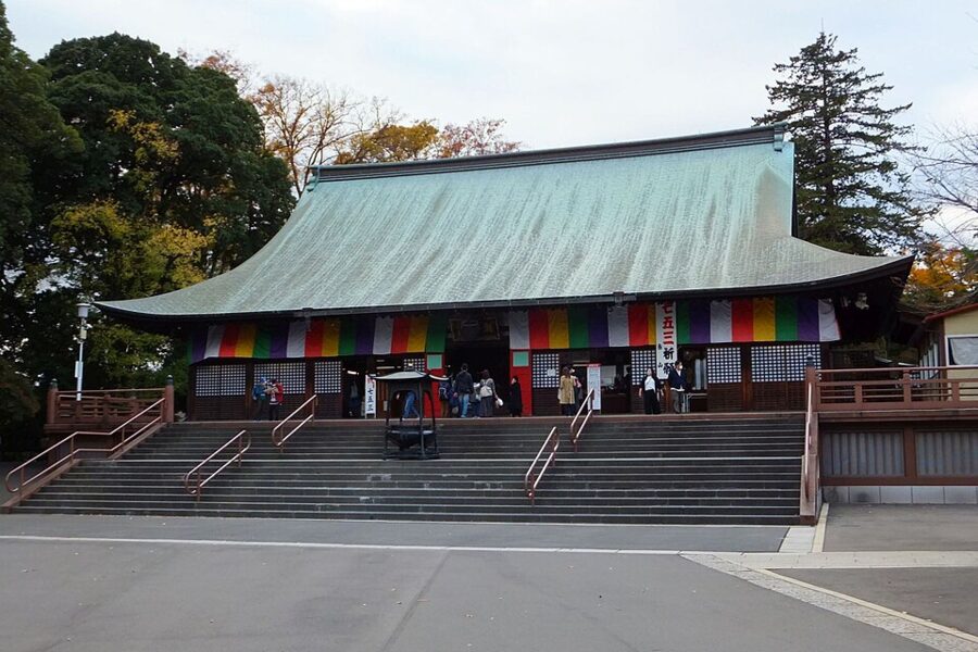
Kawagoe (川越) was a castle town held by senior Tokugawa retainers and linked to Edo by river boats, and it is still called Koedo, “little Edo”. The Kita-in temple has rooms moved from Edo Castle by the third shogun, Iemitsu. Tobu Tojo Line trains from Ikebukuro take about half an hour, and Seibu’s Koedo limited express runs from Seibu-Shinjuku.
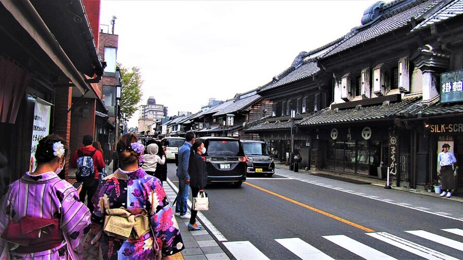

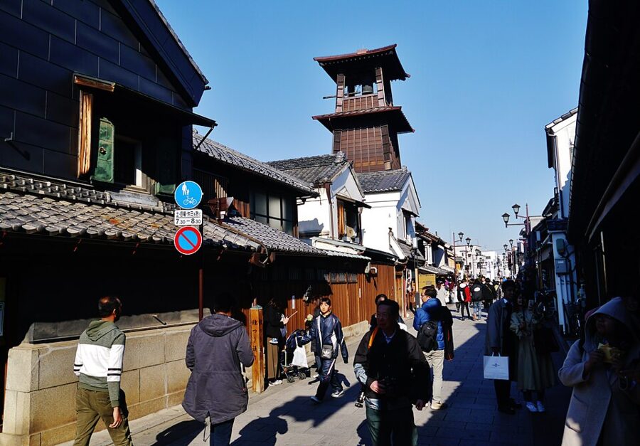
The black storehouse-style shops are a lesson in fire. In 1893 a fire burned about a third of the town; the old kura buildings were among what survived, so the merchants rebuilt in the same style. More than two hundred once lined the streets. The bell tower above them, Toki no Kane, was first built in the Kan’ei era (1624–1644); the present tower was rebuilt in 1894 with donations from Kawagoe merchants and help from Shibusawa Eiichi, now the face on the ¥10,000 note.


Chichibu and Nagatoro
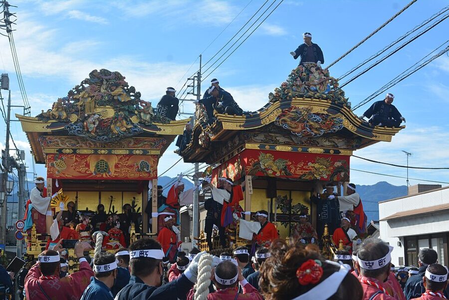
Chichibu (秩父) is a basin at the end of Seibu’s line from Ikebukuro, reached by the Laview in about 80 minutes. Its great night is 3 December, the main day of the Chichibu Night Festival, which has run for more than three hundred years. Six huge floats, lit with lanterns, are hauled up a slope to the shrine’s resting place while winter fireworks go off overhead.


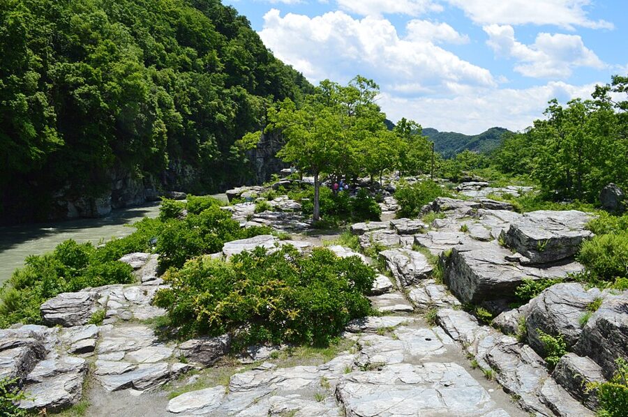
Downstream on the Chichibu Railway, the Arakawa cuts a gorge at Nagatoro. Its Iwadatami, “rock tatami”, is a shelf of flat schist beside the river, a national natural monument; flat-bottomed boats run the rapids below it.
Chiba: Narita-san, Sawara and the Boso coast
Chiba (千葉県) is the Boso peninsula and the plain north of it, and most people see only its airport. Two of the best small towns in Kanto lie within half an hour of the runway.
Narita-san Shinsho-ji
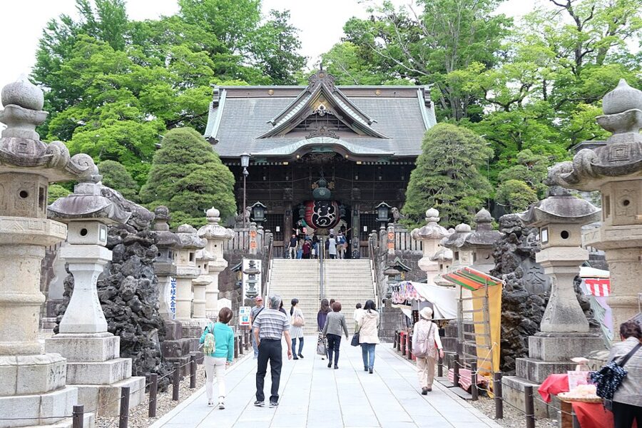
Narita-san Shinsho-ji was founded in 940, in the year the Kanto rebel Taira no Masakado was killed. It draws more people than any temple in the region: about 3.05 million came for New Year in 2020, second only to Meiji Jingu among Japan’s shrines and temples. The fire rite to its Fudo image is performed several times a day in the Great Main Hall.


Sawara
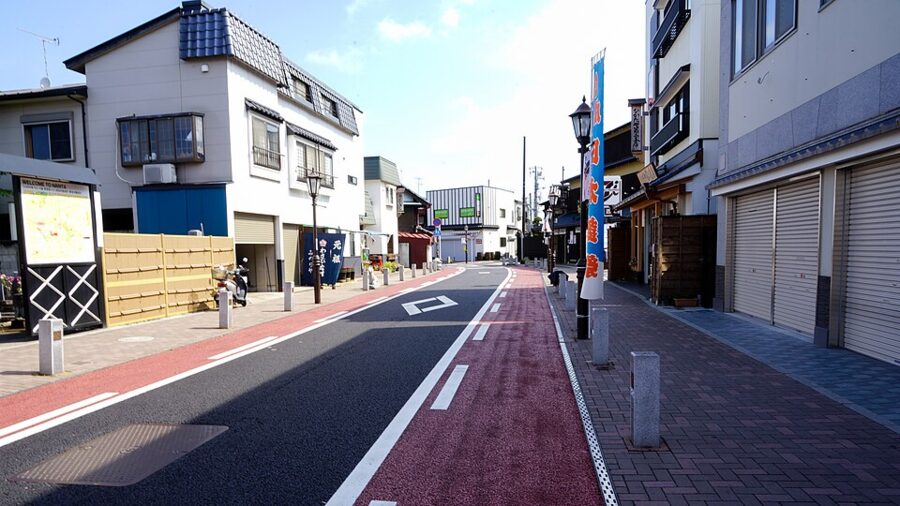
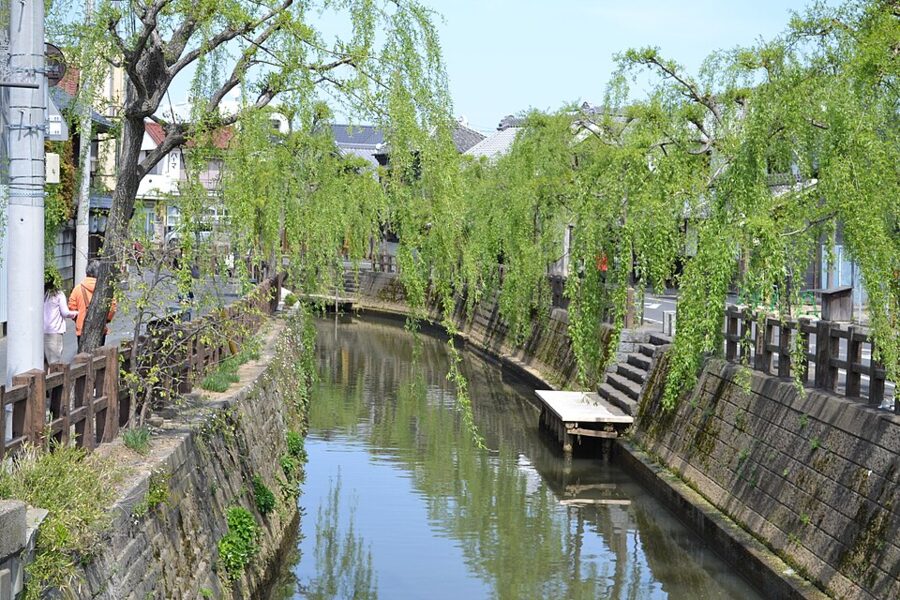
Sawara (佐原), now part of Katori city, was a river port on the Tone that grew rich shipping rice and sake to Edo. Its merchant houses along the Ono River became the first preservation district in Kanto in 1996. The JR Narita Line gets you there from Narita in about half an hour.

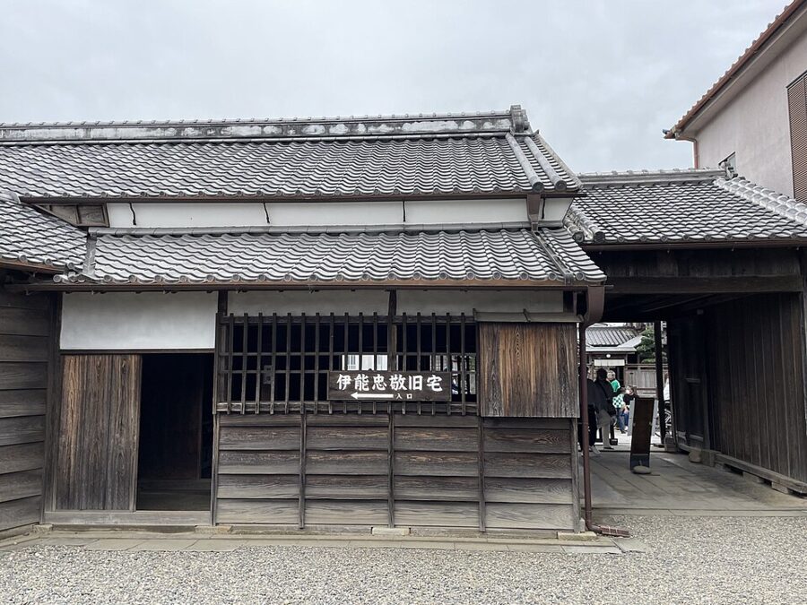
Sawara’s best-known son married into it. Ino Tadataka, born in 1745 on the Kujukuri coast, was adopted into a Sawara merchant family and ran its business for thirty years. In 1800, aged 56, he set out to measure Japan on foot. He spent seventeen years on the coasts, and the maps finished after his death in 1818 were so accurate they stayed in use into the Meiji period.
The Boso coast and Choshi
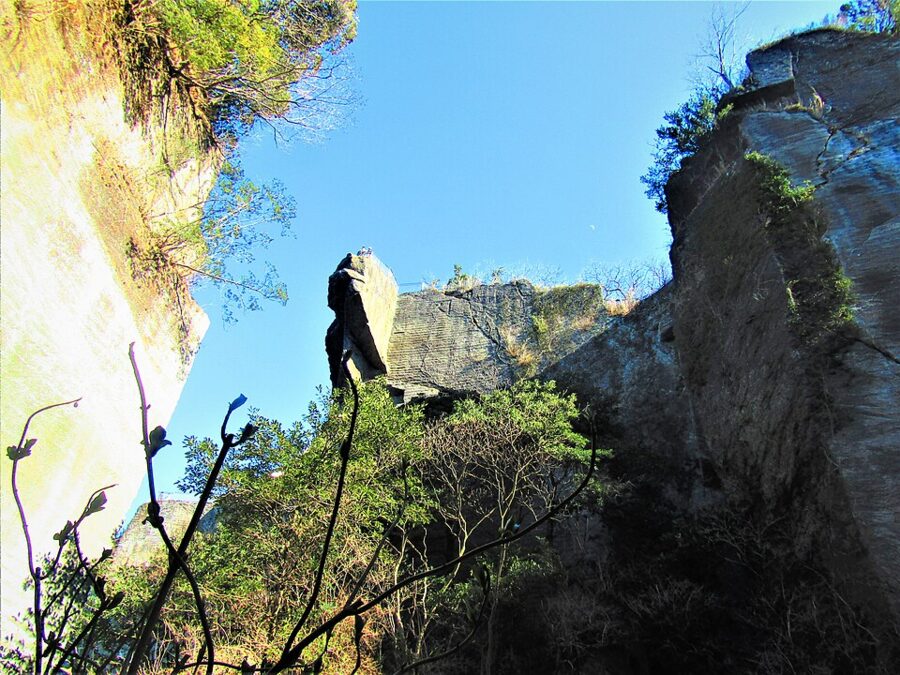
The Tokyo Bay Aqua-Line, opened in 1997, crosses the bay from Kawasaki to Kisarazu in a tunnel and a bridge, and buses from Tokyo Station use it. South of Kisarazu, Mount Nokogiri, 329.5 metres, was quarried for stone for centuries, which left it with the sawtooth ridge of its name. A ropeway climbs from Kanaya, and the Nihon-ji temple fills its slopes with stone Buddhas.

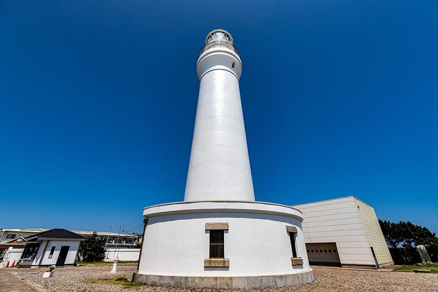
At the other end of the prefecture Choshi sits where the Tone meets the Pacific. It is a fishing port and a soy sauce town, home to the Yamasa and Higeta breweries, and Cape Inubo just east of it is one of the first places in Kanto to see the sunrise.

Ibaraki: Kairakuen, Hitachi Seaside Park and Mount Tsukuba
Ibaraki (茨城県), the old Hitachi, ranks near the bottom of national surveys of attractive prefectures, a fact it mentions more often than anyone else. It has a great garden, the best flower fields in Kanto and Mount Tsukuba.
Kairakuen
Kairakuen (偕楽園) in Mito was laid out in 1842 by Tokugawa Nariaki, ninth lord of the Mito domain, and he opened it to the townspeople as well as his own household: the name means “a garden to enjoy together”. It counts among the Three Great Gardens of Japan. The main garden has about 3,000 plum trees of about a hundred varieties, and the Mito plum festival runs from mid-February into March.
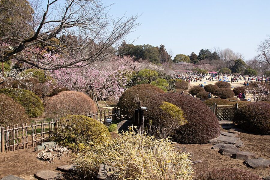

Nariaki’s villa in the garden, the Kobuntei, takes its name from an old literary name for the plum. It burned in an air raid in 1945 and was rebuilt in 1958.
Hitachi Seaside Park
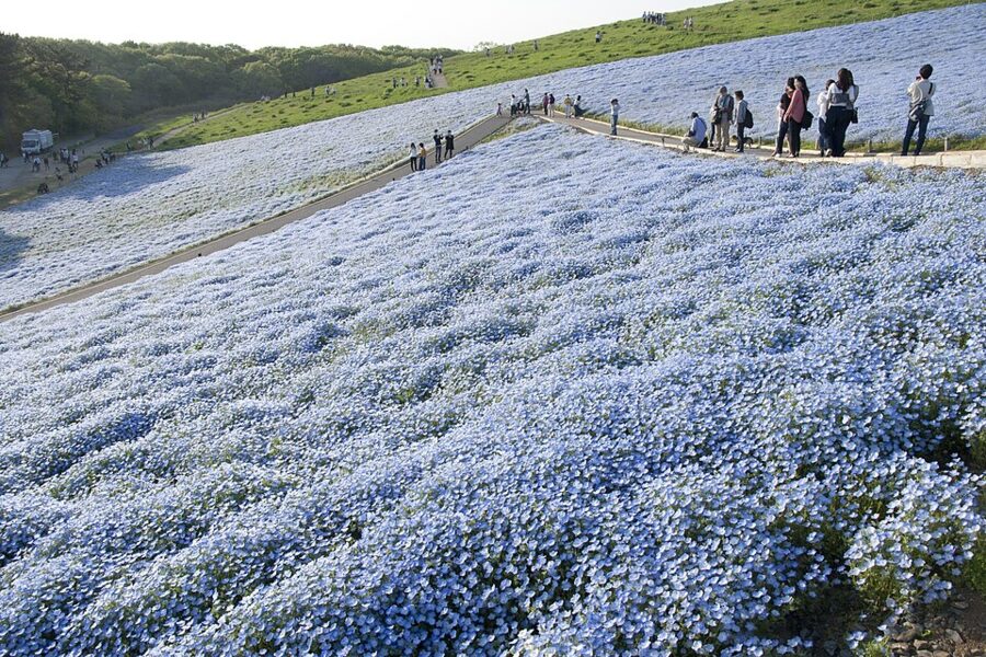
Hitachi Seaside Park, on a former military airfield by the sea at Hitachinaka, is a national government park, planted rather than wild. Since 2002 its Miharashi Hill, at 58 metres the highest point in the city, has been sown each November with nemophila, in rows 20 centimetres apart. From mid-April to early May the hill turns the blue of the sky behind it.

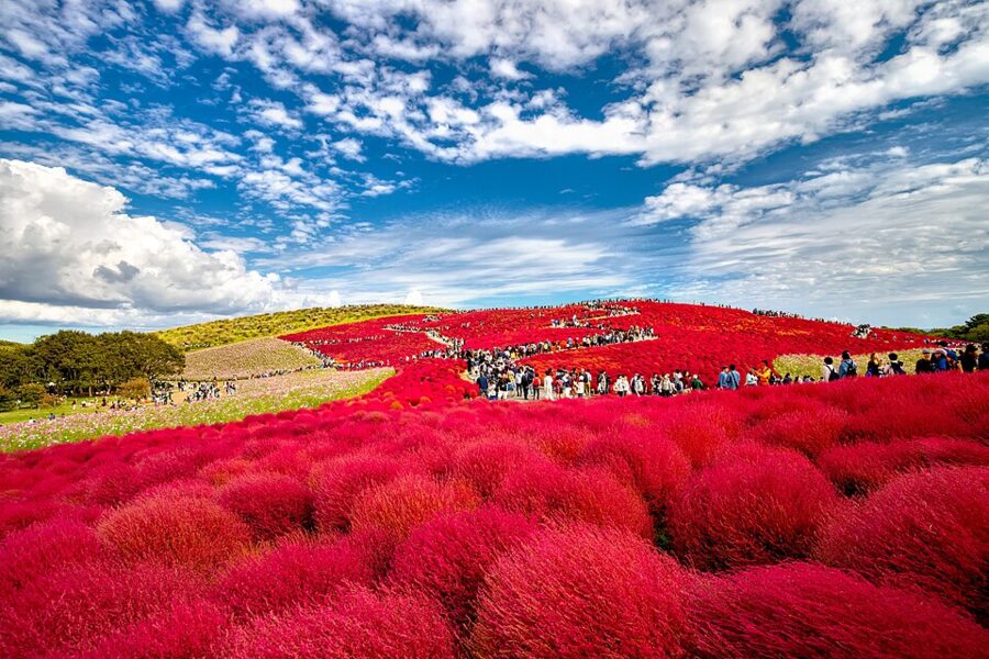
In autumn the same hill is planted with kochia, round bushes that turn from green to red through October. The park is reached by bus from Katsuta station on the Joban Line.

Mount Tsukuba and Fukuroda Falls
Mount Tsukuba has two summits, Nantai at 871 metres and Nyotai at 877, and the whole mountain is the precinct of Tsukuba-san Shrine. It stands alone, which is why the view is so wide. The Tsukuba Express reaches Tsukuba from Akihabara in as little as 45 minutes, and a shuttle bus runs on to the cable car and ropeway.
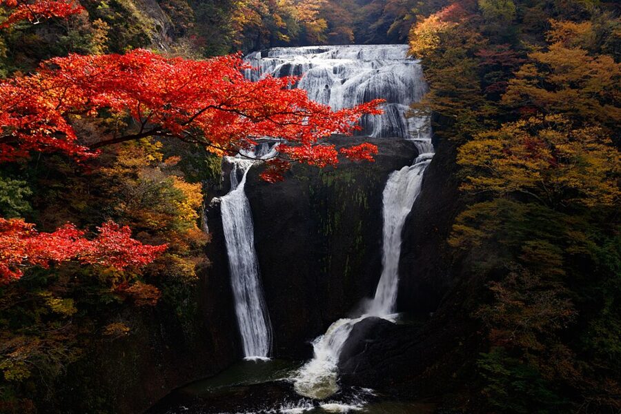
In the far north of the prefecture Fukuroda Falls drops in four steps, about 120 metres long and 73 wide. In a cold winter it can freeze white.

What to eat in Kanto
Much of Kanto’s food began as fast food for working Edo, and four dishes are worth eating where they are claimed.
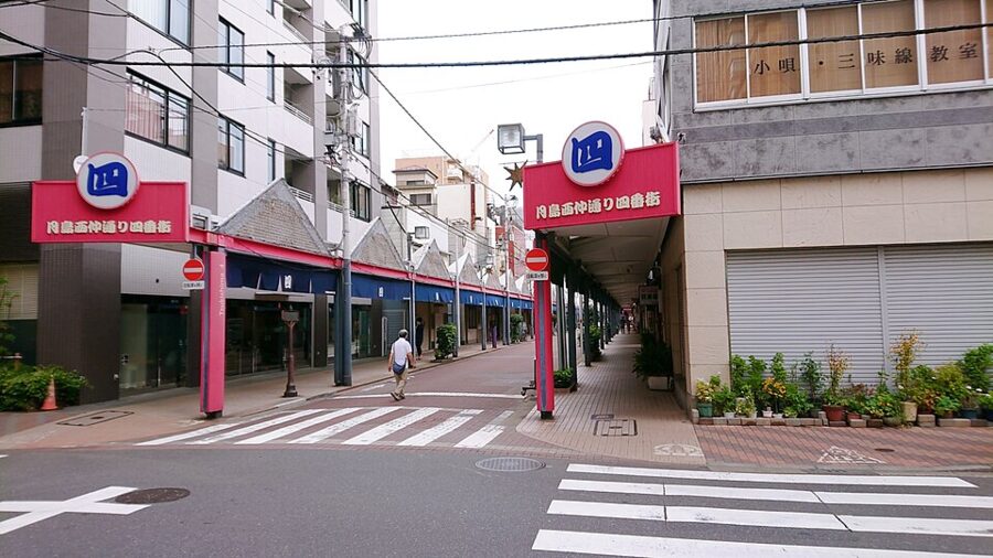
Monjayaki is a runny batter of flour and stock, fried on a griddle with chopped cabbage and whatever else goes in, and scraped up with tiny spatulas as it crisps. It started as a cheap snack in the sweet shops of eastern Tokyo. Nishinaka-dori in Tsukishima, an island of reclaimed land at the mouth of the Sumida, has more than seventy monja and okonomiyaki restaurants on one street.

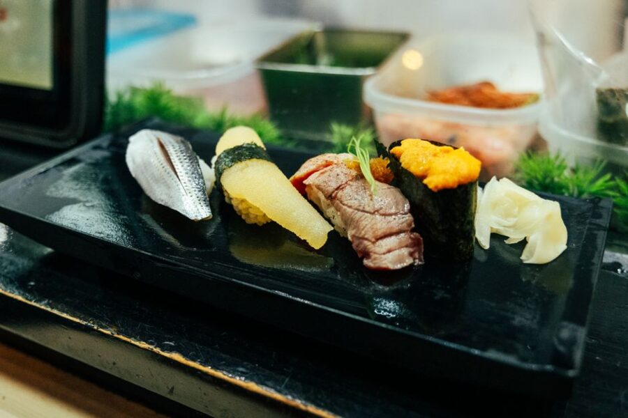
Edo-mae sushi means sushi “in front of Edo”, made from fish caught in the bay. Hand-pressed nigiri began in the early nineteenth century as a snack eaten standing at a street stall, with pieces two or three times today’s size, and the bay fish were often cured or simmered to keep. The bay’s own fishing has largely gone to landfill, but the style stayed.
Utsunomiya’s gyoza and Yokohama’s Chinatown cover the other two. Behind them all is soy sauce: the Kanto taste is the dark, strong koikuchi soy of Noda and Choshi, brewed on the Tone and shipped down the river the Tokugawa moved.
Kanto through the year
The region runs from sea level to over 2,000 metres, so each season arrives in its corners at different times.
- February to March, plum: Kairakuen and the Mito plum festival.
- Late March to April, cherry: Tokyo usually first, late in March; the hills of Gunma and Tochigi follow into April.
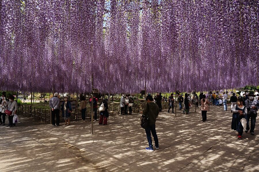
- Mid-April to early May, nemophila and wisteria: Hitachi Seaside Park, and Ashikaga Flower Park in Tochigi, where the entry price rises and falls with the flowers.
- Summer: humid on the plain; go high, to Oku-Nikko, Kusatsu or Tanigawa.
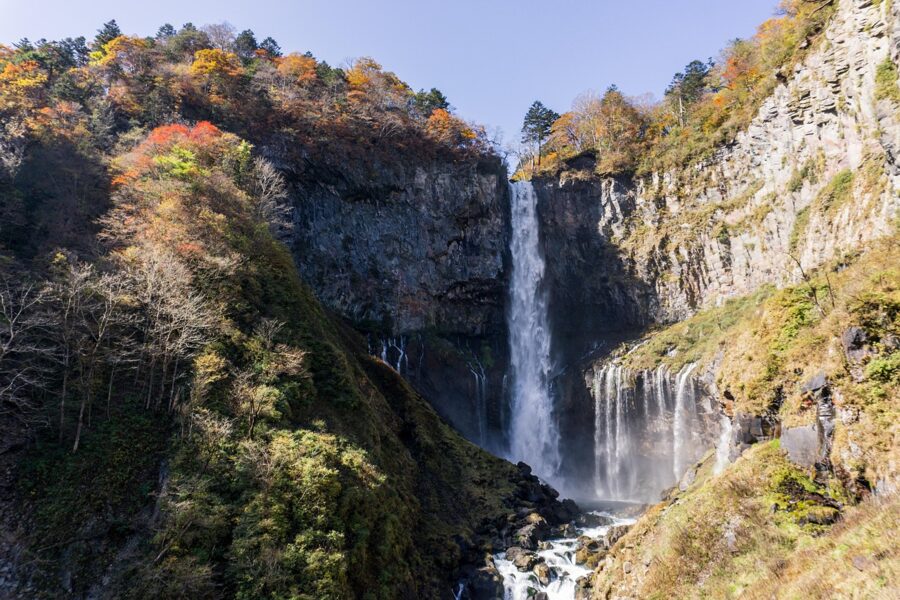
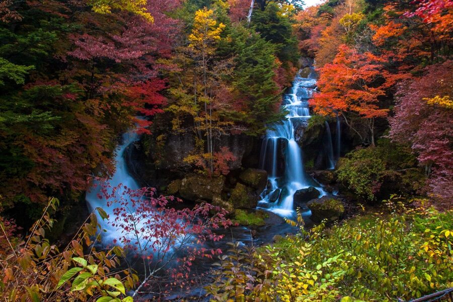
- October to November, autumn colour: Nikko turns from the top down, from early October at Lake Yunoko to mid-October at Lake Chuzenji and late October into November on the Irohazaka and in the town.
- December to February, winter: the Chichibu Night Festival on 2 and 3 December, and the clearest air of the year for Fuji.

Plans: day trips and a week beyond Tokyo
Day trips from Tokyo
- Kamakura and Enoshima: Yokosuka Line to Kita-Kamakura, walk to Tsurugaoka Hachimangu, Enoden to Hase and the Great Buddha, on to Enoshima, Odakyu back to Shinjuku. Starting from Shinjuku, do it in reverse on the Odakyu freepass.
- Kawagoe: half a day from Ikebukuro; pair it with an afternoon in Tokyo.
- Narita-san and Sawara: Keisei to Narita, the temple, then the JR Narita Line to Sawara. Good for the day you arrive or leave.
- Chichibu and Nagatoro: Laview out, Chichibu Railway down the valley, Seibu back.
- Mito and Hitachi Seaside Park: only in season, and on a weekday.
- Tomioka and Takasaki: shinkansen to Takasaki, Joshin Dentetsu to the mill.
Nikko and Hakone can be done in a day, but I would not. Both lose their best hours, early and late, to the journey.
A week outside Tokyo
This loop runs clockwise and lets a three-day Tokyo Wide Pass cover the middle of it, with the private railways at either end.
- Day 1: Kamakura and Enoshima; sleep in Yokohama.
- Day 2: Yokohama’s Chinatown and Sankeien in the morning, then by train to Odawara and up to Hakone for the night.
- Day 3: the Hakone loop early, down to Odawara, then the JR Tokaido Line to Tokyo and the shinkansen to Takasaki (start the pass today).
- Day 4: Tomioka Silk Mill in the morning, then the JR Agatsuma Line and bus to Kusatsu for the night.
- Day 5: back through Takasaki and Omiya to Utsunomiya for gyoza, then the Nikko Line to Nikko, about 45 minutes.
- Day 6: Toshogu at opening time, then up the Irohazaka to Lake Chuzenji and Kegon Falls.
- Day 7: Tobu down to Asakusa, or in nemophila season across to Mito and the Joban Line home.
Add Narita-san and Sawara on the day you fly out of Narita. With the Mito ending, the week has stood in six of the seven prefectures and ridden through the seventh, Saitama, on the way to Gunma.
Finish, if the weather allows, on Mount Tsukuba. From the top the plain is still flat to the edge of sight, but it is no longer empty. The Tone runs east to Choshi where the Tokugawa sent it, Edo’s successor spreads across the south-west, and on a clear winter morning Fuji rises beyond the barrier that gave the whole region its name.