

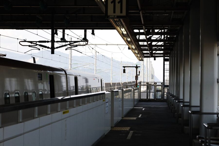
Somewhere after Karuizawa, the Hokuriku Shinkansen changes the electricity it runs on. Gunma is on 50 hertz, Nagano on 60, Niigata on 50 again and Toyama on 60, so a train from Tokyo to Kanazawa crosses Japan’s power divide three times in about two and a half hours. No other bullet train line has to do it.
The divide is a Meiji accident: Tokyo bought German generators in the 1890s and Osaka bought American ones, and the two cycles never met. But the middle is real. It runs through Chubu (中部), the nine prefectures of central Honshu, where the island is widest, the mountains highest, and the line between eastern and western Japan has been drawn and redrawn by geologists, dialect maps and electricity boards ever since.
That is the reason to come, and the reason it is hard to plan. Chubu holds every Japanese mountain over 3,000 metres, Fuji included, plus Kanazawa, Takayama, Matsumoto, the thatched villages of Shirakawa-go and two coasts that face opposite seas and keep opposite winters. Very little of it lines up on one railway.

In this guide
What Chubu is, and why it splits three ways
Chubu means “central part”, and it began as a leftover. Meiji geographers had Kanto round Tokyo, Kinki round Kyoto and Osaka, Tohoku to the north, and a mountainous band in between that fitted none of them. “Central” was a stopgap label, and it stuck. There is still no legal definition; the school version is nine prefectures, with Mie handed to Kinki.
The prefectures have never felt like one place. Mountains run down the middle, so each side looks outward: Yamanashi and much of Nagano towards Tokyo, Gifu and Aichi towards Nagoya, Fukui towards Kyoto. What people use instead of “Chubu” are three older names, each with a road behind it.
Hokuriku, Koshinetsu, Tokai
Hokuriku (北陸, “northern land”) is the Sea of Japan coast along the old Hokurikudo highway: Niigata, Toyama, Ishikawa and Fukui. In everyday speech it often means only the western three, which share a winter, a fishing coast and long ties to Kansai.
Koshinetsu (甲信越) takes a syllable each from the old provinces of Kai, Shinano and Echigo: Yamanashi, Nagano and Niigata, the three that look to Tokyo. School textbooks prefer a different middle band, the Chuo Kochi (中央高地, central highlands), which swaps Niigata for the Hida half of Gifu. Niigata belongs to the coast or the mountains depending on who drew the map.
Tokai (東海, “eastern sea”) is the Pacific side along the old Tokaido road: Shizuoka, Aichi and the Mino half of Gifu, often with Mie added because Nagoya’s economy pulls it in. It is the warm, flat, industrial third, and the one most travellers cross at 285 kilometres an hour without stopping.
The Japanese Alps and the Fossa Magna
The mountains between them have an English name. William Gowland, a British mining engineer who surveyed the Hida range, called them the Japanese Alps in a guidebook of 1881, and the missionary Walter Weston made the name famous by climbing them. The alpinist Kojima Usui later split them into the Northern Alps (Hida range), Central Alps (Kiso range) and Southern Alps (Akaishi range). The highest are Kitadake in the south at 3,193 metres and Okuhotaka in the north at 3,190.
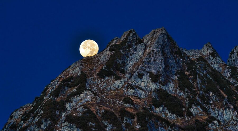
Under them is a crack in the country. In 1885 the German geologist Edmund Naumann worked out that a trough of young rock cuts Honshu in two, and called it the Fossa Magna, Latin for “great ditch”. Its western wall is the Itoigawa–Shizuoka Tectonic Line. West of it the rocks are hundreds of millions of years old; inside, they are mostly younger than 25 million years, and Fuji, Yatsugatake and the Myoko volcanoes have grown on top.
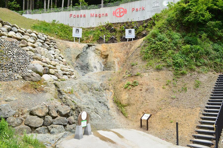
Maps of dialect and custom draw an east–west boundary close to the same line, from Itoigawa down to the Oi river in Shizuoka, and the power grid splits along the Fuji River and the Itoigawa coast. The soup-stock border (dark soy east, light west) falls a little further west, around Sekigahara in Gifu. Chubu is where all of these overlap, which is why a week here can feel like two countries.
Fuji on the border
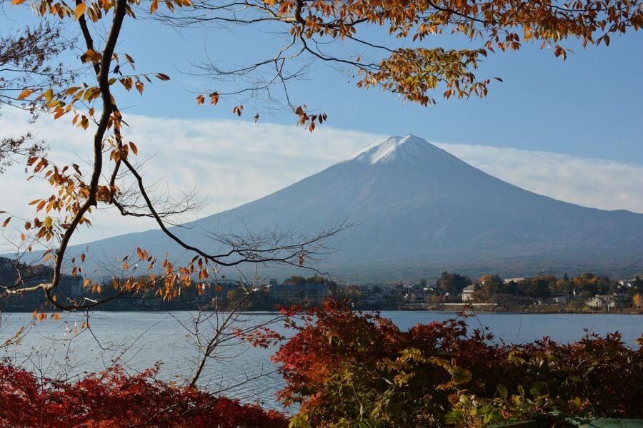
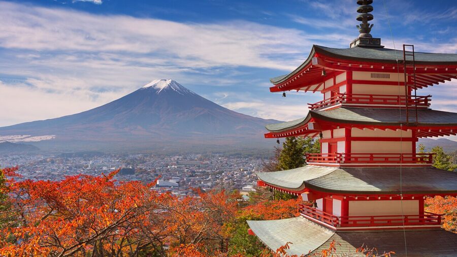
Fuji (富士山), 3,776 metres, sits at the southern end of the Fossa Magna on the Yamanashi–Shizuoka border. It last erupted in 1707, and the Japan Meteorological Agency keeps it at Level 1, its lowest alert, as it did every other Chubu volcano in November 2026. That calm is not a promise: Ontake erupted without warning in September 2014 and left 63 people on its summit dead or missing.
Fuji has been a World Heritage Site since 2013, listed for its shrines, pilgrim trails and painters rather than its geology. The climbing season runs from early July to 10 September. Since 2025 every climber pays ¥4,000 on all four trails, and the Yoshida trail closes its gate overnight to anyone without a hut booking.
Getting there and getting around
Two bullet-train lines frame the region. The Tokaido Shinkansen runs along the Pacific to Nagoya, about 1 hour 36 minutes from Tokyo by Nozomi (¥10,560 unreserved). The Hokuriku Shinkansen runs inland through Nagano and along the Sea of Japan to Toyama, Kanazawa and, since 16 March 2024, Fukui and Tsuruga. The fastest trains, the all-reserved Kagayaki, reach Nagano in 1 hour 17 minutes, Kanazawa in 2 hours 24 minutes and Tsuruga in 3 hours 6 minutes; Tokyo to Kanazawa is about ¥14,400 reserved.
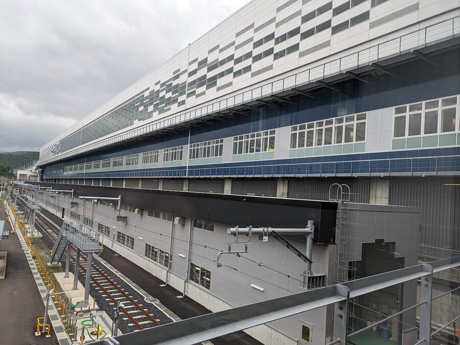

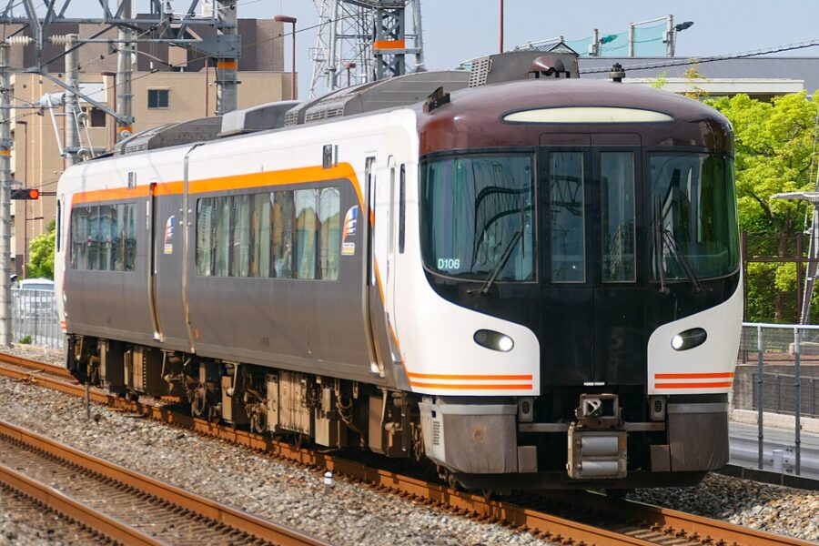
From Osaka the line is unfinished. The Thunderbird limited express runs to Tsuruga in about 1 hour 23 minutes (¥4,500), and you change there for Fukui and Kanazawa; Nagoya’s Shirasagi does the same. The extension to Shin-Osaka has a route proposed in 2024 and a construction estimate of about 25 years, so expect to change at Tsuruga for a long time.
Across the mountains by limited express
Between the shinkansen lines, the old JR trunk lines do the work, and they are some of the best rides in the country. The Hida climbs the Hida river gorge from Nagoya to Gero and Takayama in about 2 hours 35 minutes (¥5,610 unreserved) and continues to Toyama. The Shinano runs Nagoya to Matsumoto through the Kiso valley in about 2 hours 5 minutes (¥5,630). From Shinjuku, the Azusa reaches Matsumoto in about 2 hours 40 minutes (¥6,730 reserved).
Which rail pass pays
The national Japan Rail Pass costs ¥50,000 for seven days online and rarely pays here: Tokyo to Kanazawa and back is under ¥29,000. Regional passes do better. These are the 2026 prices.
- Alpine-Takayama-Matsumoto Area Tourist Pass: ¥24,500, five days. Nagoya to Takayama and Toyama, the whole Alpine Route, and back to Nagoya via Matsumoto. Valid only while the Alpine Route runs (15 April to 10 November in 2026).
- Takayama-Hokuriku Area Tourist Pass: ¥19,800, five days. Nagoya or Osaka to Takayama, the Nohi buses via Shirakawa-go to Kanazawa or Toyama, and the shinkansen from Toyama to Tsuruga.
- Hokuriku Arch Pass: ¥35,000, seven days. Tokyo to Kanazawa and Tsuruga by shinkansen, then on to Kyoto and Osaka: the cheapest way to arrive at one end of Japan and leave from the other.
- Hokuriku Area Pass: ¥7,000, four days, for Toyama, Ishikawa and Fukui only.
Buses into the Alps
Some of the best places have no railway. Shirakawa-go is reached by Nohi bus from Takayama, Kanazawa or Toyama; book ahead in autumn and winter. Kamikochi has been closed to private cars in summer since 1975 and all year since 1996, so everyone arrives by bus or taxi from Sawando on the Matsumoto side or Hirayu Onsen on the Gifu side. The road opens in mid-April and closes on 15 November.
Hokuriku: the Sea of Japan side
In winter, cold air from Siberia crosses the Sea of Japan, picks up moisture and drops it the moment it hits the mountains. Kanazawa gets about 2,400 millimetres of precipitation a year and only 62 hours of sunshine in an average January. That grey winter also fills the sea with crab and yellowtail and the paddies with snowmelt, and Hokuriku has lived well on both.
Kanazawa
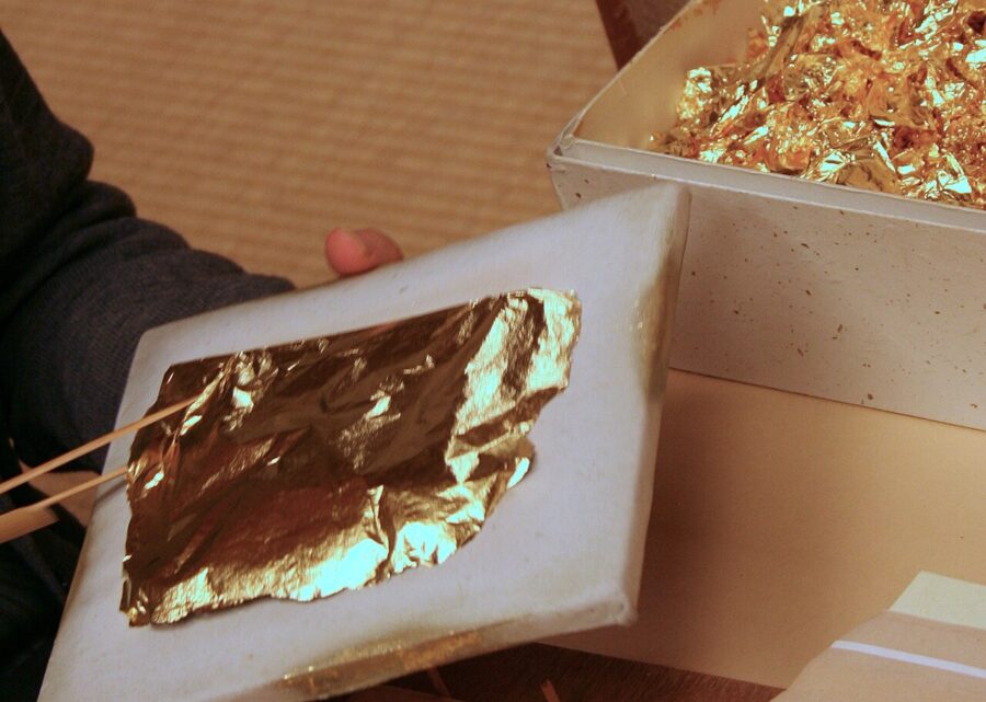
Kanazawa (金沢) was the castle town of the Maeda, whose Kaga domain was assessed at over a million koku, the rice measure that ranked every fief, second only to the shoguns themselves. Kept at a wary distance by the Tokugawa, the Maeda spent on gardens, tea, Noh and crafts rather than armies. The city escaped wartime bombing, so its teahouse streets and samurai lanes are original, and its workshops still beat almost all of Japan’s gold leaf.

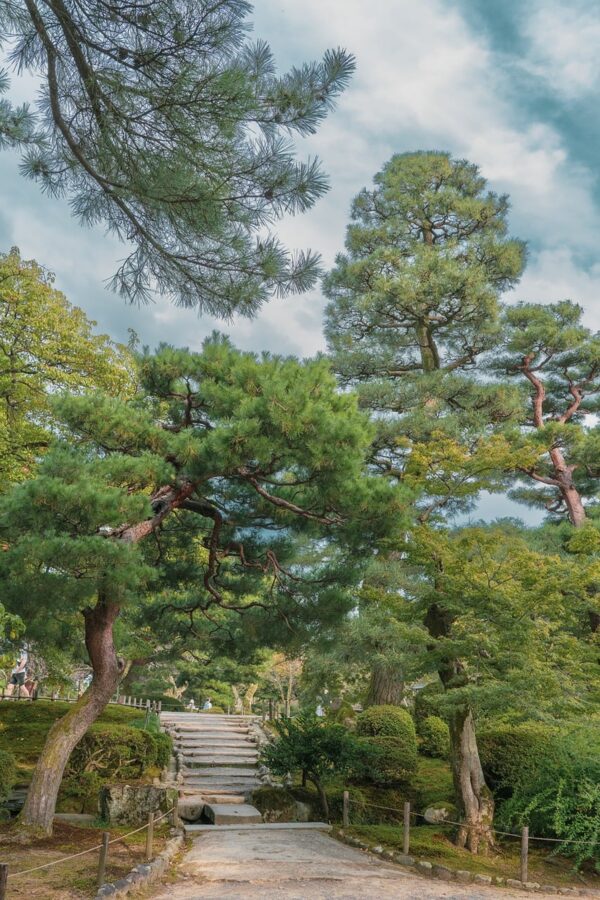
Kenrokuen (兼六園) began in 1676 as a villa garden beside the castle and opened to the public in 1874. The name means “combining six”, after six qualities a Song-dynasty text said no garden could hold together, among them spaciousness and seclusion. Entry is ¥320, 07:00–18:00 from March to mid-October and 08:00–17:00 otherwise. The detail few people use: two gates open free before the paid hours, from 04:00 in summer and 06:00 in winter.
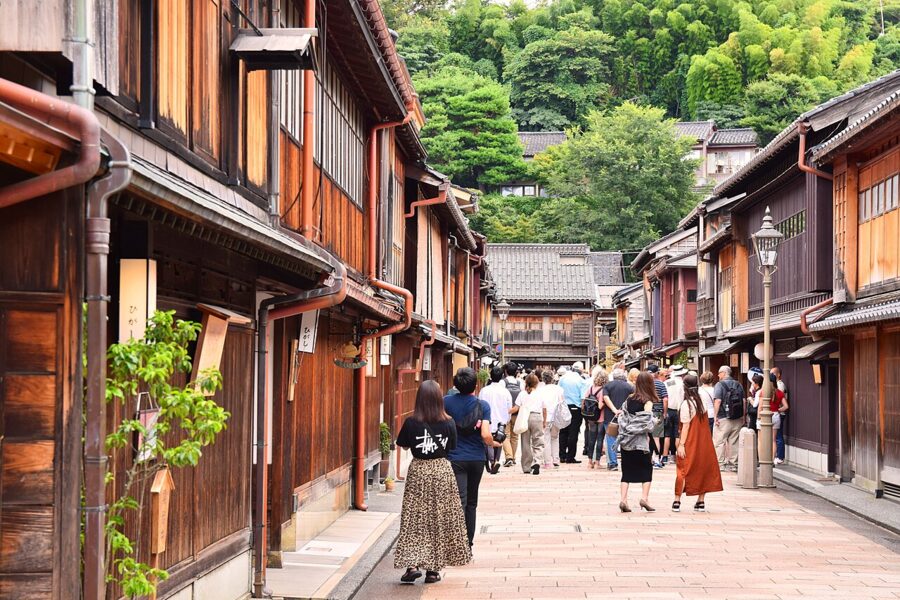
Across the Asano river, Higashi Chaya (ひがし茶屋街) is a street of teahouses with fronts of fine slats, called kimusuko, that let people inside see out and nobody see in. The Nagamachi samurai quarter, the 21st Century Museum of Contemporary Art and the castle park are all within a half-hour walk, which makes Kanazawa the easiest city in Chubu on foot.

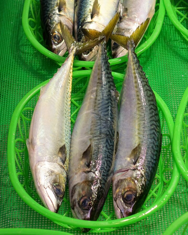
Omicho Market (近江町市場) has fed the city for about three hundred years. Crab season opens on 6 November, and by that morning the stalls are stacked with snow crab, the males called kano-gani here and the smaller females kobako. Go before 10:00 for the best of the catch and the shortest queues.
Toyama and the Alpine Route
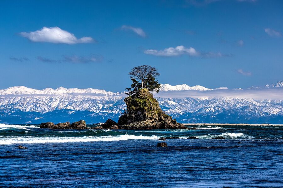
Toyama (富山) sits on a bay that drops to over 1,000 metres, with 3,000-metre mountains behind the city. The deep cold water gives two things eaten almost nowhere else: shiro-ebi, a translucent white shrimp, and hotaruika, firefly squid that rise to spawn in spring and flash blue in the nets. The city has good trams and the Toyama Glass Art Museum, but most people come for the mountains.

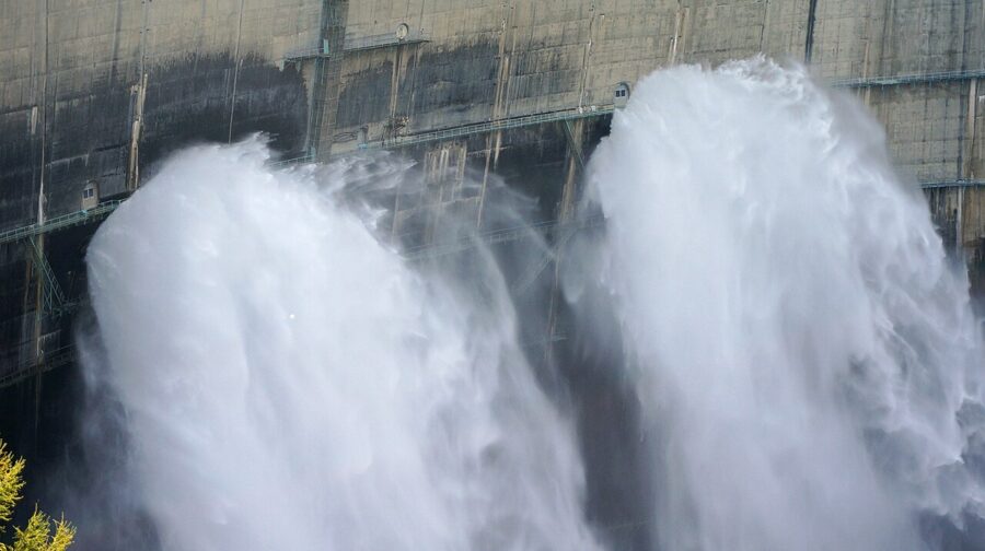
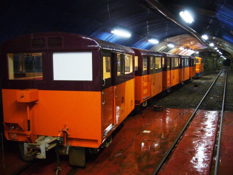
The Tateyama Kurobe Alpine Route (立山黒部アルペンルート) is a 37.2-kilometre chain of transport across the Northern Alps from Tateyama Station in Toyama to Ogizawa in Nagano, opened in full in 1971 on roads and tunnels built for the Kurobe Dam. In order: a cable car, a highland bus to Murodo at 2,450 metres, an electric bus under Mount Tateyama, a 1,710-metre ropeway with no support towers, an underground cable car, a walk across the dam and another electric bus. The Tateyama tunnel ran Japan’s last trolleybuses until 30 November 2024; both tunnels now use battery buses.
In 2026 the route opened on 15 April and closes on 30 November. Tateyama to Ogizawa is ¥10,940 one way, and Tateyama to Murodo and back ¥7,380 if you only want the plateau. In the busy weeks (late April to early May, mid-August, early October) queues at each change can reach an hour or two, so book timed web tickets.

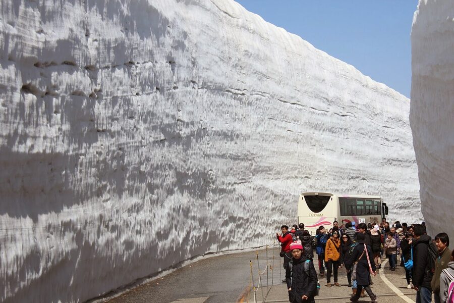
Murodo is the reason to break the crossing for a night. In the first weeks after opening, a stretch of the Yuki-no-Otani corridor is set aside for walkers; in summer the plateau is alpine meadow with ptarmigan and a climb of about two hours to Oyama, one of Tateyama’s three summits.
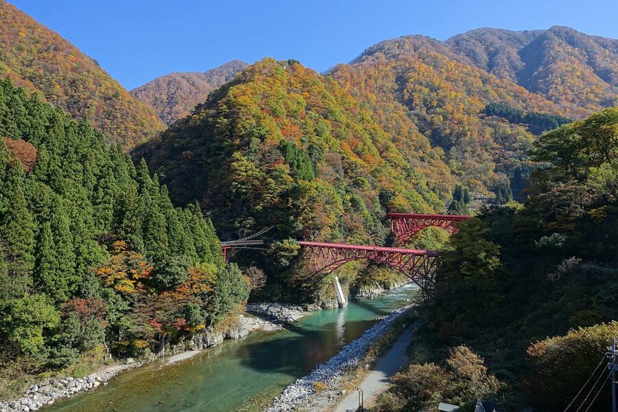
The gorge below has reopened too. The Kurobe Gorge Railway, the narrow-gauge line from Unazuki Onsen into the gorge, reopened all the way to Keyakidaira on 1 October 2026 after the 2024 earthquake damaged a bridge. A day later the Kurobe Unazuki Canyon Route, the power company’s private line onward to Kurobe Dam, opened to the public for the first time as a booked tour, so you can now travel through the mountain from the Alpine Route down to the sea.


Gokayama
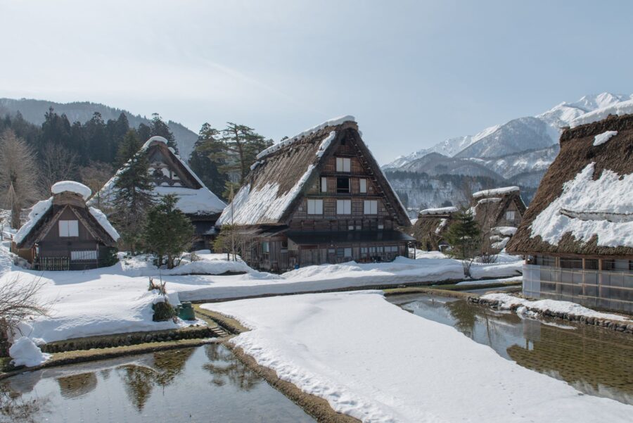
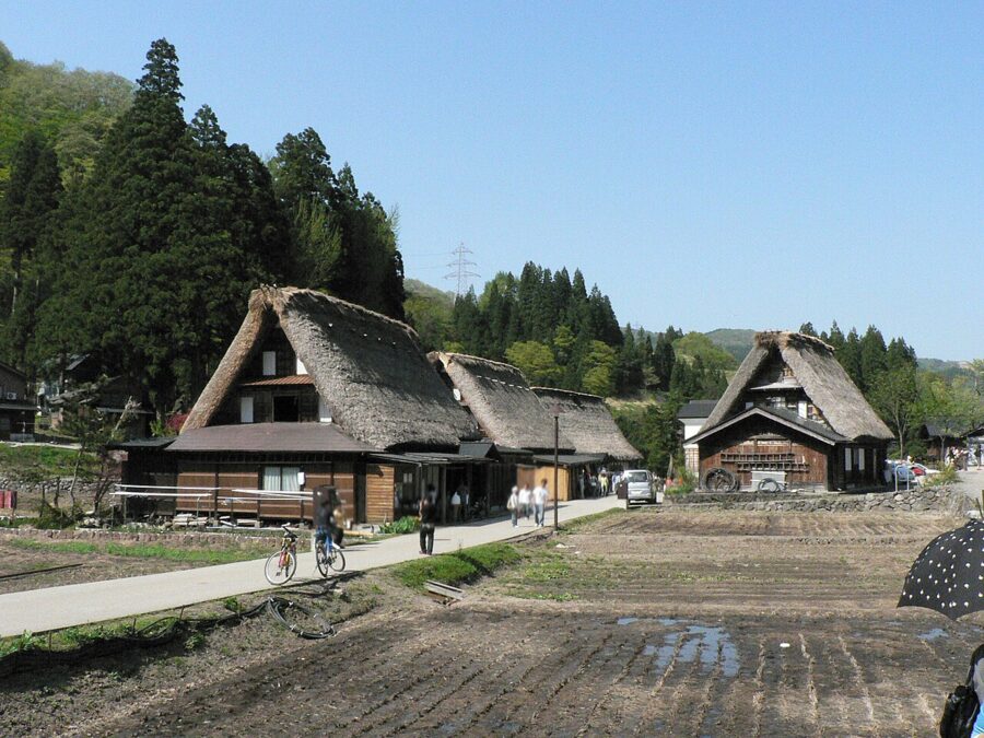
Toyama’s gassho villages are in Gokayama (五箇山), a deep valley of the Sho river south of Takaoka. Ainokura has about twenty thatched houses and Suganuma nine, against far more at Shirakawa-go upstream. If you want to sleep in a gassho house and hear the village go quiet at night, Gokayama is the easier place, and a minshuku, a family-run guesthouse, will feed you river fish and the local firm tofu.
The Noto Peninsula after the earthquake
At 16:10 on 1 January 2024, a magnitude 7.6 earthquake struck under the tip of the Noto Peninsula (能登半島), Ishikawa’s arm of land in the Sea of Japan. By June 2026 the count stood at 743 deaths, 515 of them from illness and hardship after the quake. The northern coast rose by up to four metres along about 100 kilometres, adding some 4.4 square kilometres of land. In September 2024, floods and landslides hit the same towns.
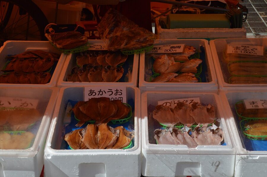
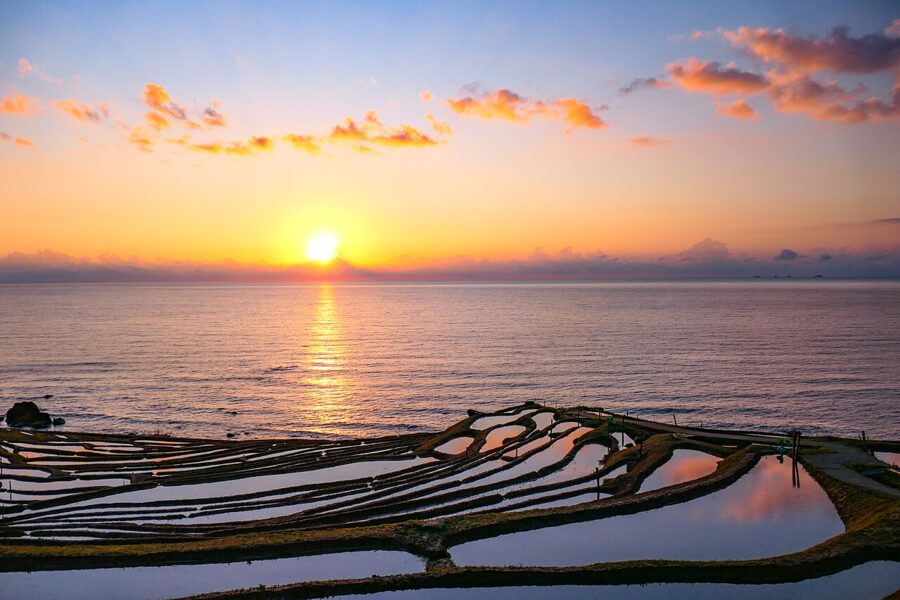
In Wajima, a fire burned about 300 buildings around the morning market street, a market that had run for over a thousand years. The stallholders now trade at a permanent temporary site in the Power City Wajima Y Plaza shopping centre, 09:00–13:00, closed most Wednesdays, and plan to return to a rebuilt street in 2029 or 2030. At Shiroyone Senmaida, where 1,004 tiny paddies step down to the sea, about four in five were damaged; around 120 were planted again in May 2024.


Travel is possible and wanted, if you plan around the rebuilding. The Noto Railway runs again between Nanao and Anamizu, and Noto Airport has flights to Haneda; since July 2026 it has carried the official nickname Noto Satoyama Pokemon with You Airport, in a campaign that has also given Wakura Onsen a Pokemon footbath. Nine of Wakura’s member inns had reopened by March 2026, and the best known, Kagaya, is rebuilding and aims to open by spring 2029. I’d base a first visit at Wakura or Nanao and go beyond Anamizu only with a car and a plan.
Fukui: Zen, cliffs and dinosaurs
Fukui (福井) is the prefecture most people pass through, and since 2024 it is 2 hours 49 minutes from Tokyo. It has three things nobody else has, each within 40 minutes of the city.
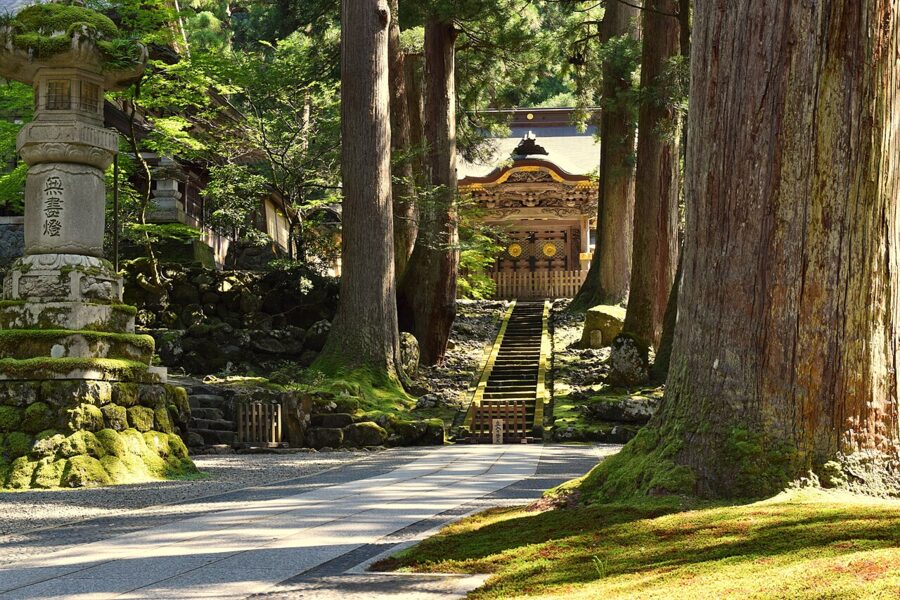
Eiheiji (永平寺), in cedar forest east of the city, was founded in 1244 by Dogen, who brought Soto Zen back from China. It is still a training monastery of about a hundred monks, and you walk its covered corridors between some seventy buildings in socks while they go about their day. Entry is ¥700, 08:30–16:30; buses from Fukui Station take about 30 minutes.

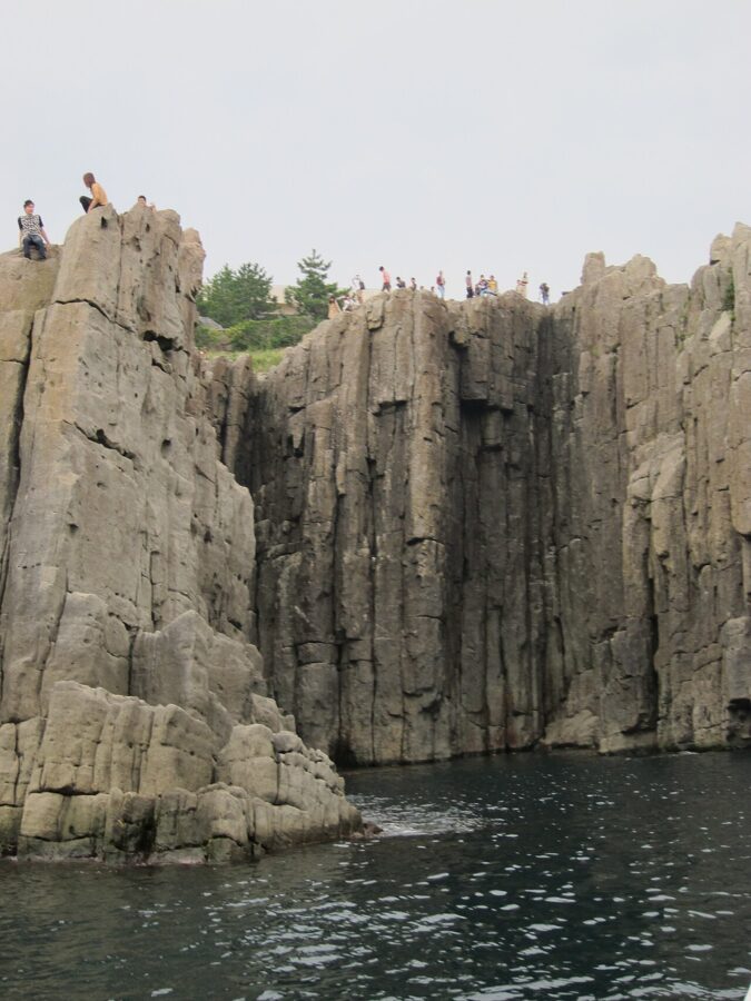
On the coast at Sakai, Tojinbo (東尋坊) is a kilometre of cliffs of pyroxene andesite, five- and six-sided columns that formed as molten rock cooled, with drops of around 25 metres to the sea. It is a Natural Monument, and it is often described locally as one of only three formations of its kind and scale in the world. It faces west, so come for the sunset.

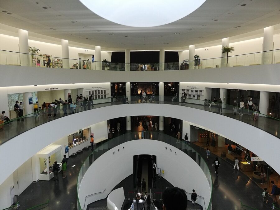
Inland at Katsuyama, the Fukui Prefectural Dinosaur Museum (福井県立恐竜博物館) sits near a riverside quarry that has yielded several new species since the late 1980s, Fukuiraptor among them. It reopened after an expansion in 2023 and sells timed tickets online (¥1,000); it closes on the second and fourth Wednesdays outside the summer holidays. Take the Echizen Railway to Katsuyama and a bus.
Fukui eats well: Echizen crab (the male season runs from 6 November to 20 March), oroshi soba with grated radish, and sauce katsudon, pork cutlet dipped in Worcestershire-style sauce. Tsuruga, at the end of the shinkansen, is the port where Jewish refugees carrying the visas of the diplomat Chiune Sugihara landed from Vladivostok in 1940 and 1941.
The mountains: Nagano and Gifu
Behind the coast everything climbs. Nagano (長野) borders eight prefectures, more than any other. Matsumoto, in a basin behind the Northern Alps, gets about 1,045 millimetres of precipitation a year, under half of Kanazawa’s, and 172 hours of January sunshine to Kanazawa’s 62. When the coast is grey, the mountains just behind it are often blue.
Matsumoto and Kamikochi
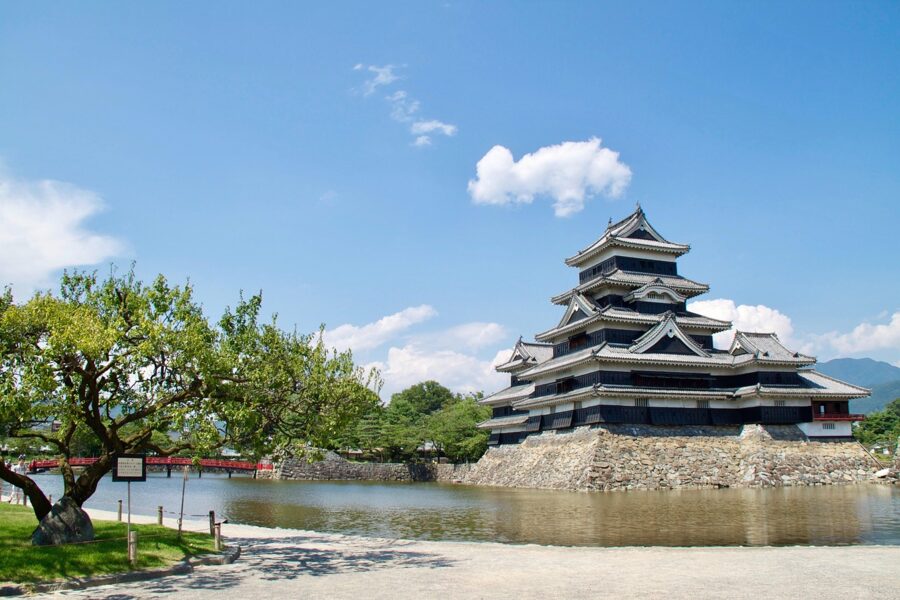
Matsumoto Castle (松本城) has the oldest surviving five-tier, six-storey keep in Japan, built in the 1590s by the Ishikawa family, retainers of Toyotomi Hideyoshi, and made a National Treasure in 1936. It was designed for gunfire, with 115 loopholes and walls about 29 centimetres thick, and its black boards earned it the nickname karasu-jo, crow castle. Admission is ¥1,300 at the gate or ¥1,200 with a timed e-ticket, 08:30–17:00.
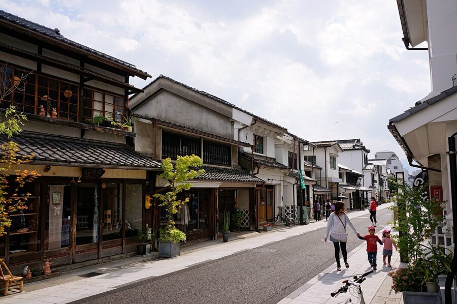
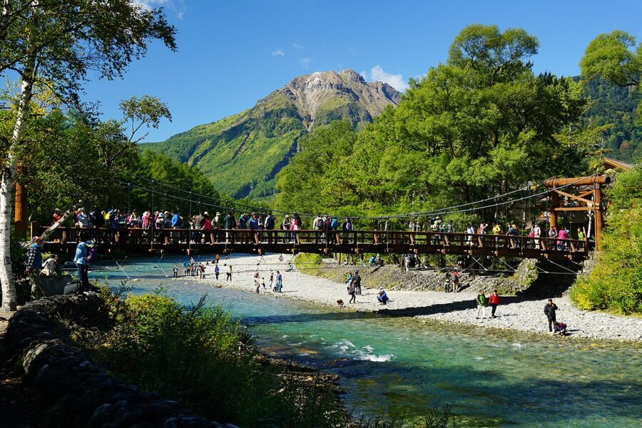
Matsumoto also has the white storehouses of Nakamachi and the Matsumoto City Museum of Art, with its galleries for Kusama Yayoi, who was born here. It is the base for Kamikochi (上高地), about 1 hour 40 minutes by train and bus via Shin-Shimashima: a flat valley floor at about 1,500 metres, walled by the Hotaka peaks, with the Azusa river running clear through larch and birch.

The usual walk is easy and very good. From the bus terminal it is a few minutes to Kappa-bashi, the suspension bridge with the classic view of Hotaka, then an hour upstream to Myojin pond and Hotaka Shrine’s inner sanctuary, where a boat festival is held every 8 October. Downstream, Taisho-ike pond was made in 1915 when an eruption of Yakedake dammed the river, and its drowned trees still stand.

Nagano, Zenkoji and the snow monkeys
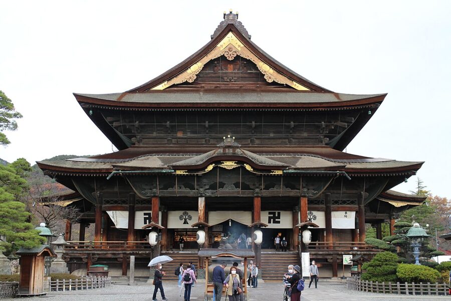
Nagano city grew up around Zenkoji (善光寺), founded in the seventh century for what is said to be the first Buddhist image to reach Japan. It belongs to no single sect and is run jointly by Tendai and Jodo priests. Under the main hall, a pitch-dark passage lets you feel along the wall for a latch said to be connected to the hidden image; find it, and salvation is promised.

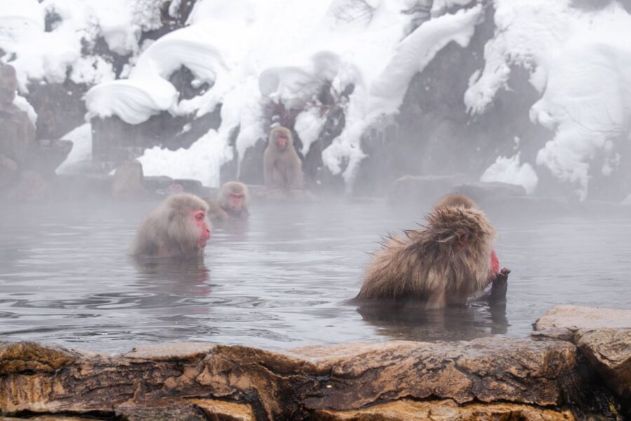
At Jigokudani Monkey Park (地獄谷野猿公苑), open since 1964, wild Japanese macaques bathe in a hot spring, mostly from December to February. Take the Nagaden train or express bus from Nagano to Yudanaka or Kanbayashi Onsen, then walk about 30 minutes on a forest path. Adult entry was ¥800 through November 2026 and rises from 1 December, with web tickets given priority in winter.
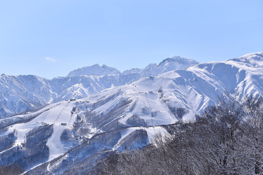
Nagano is also where Japan skis. Hakuba (白馬村), about an hour from Nagano by bus, held the downhill and ski jumping at the 1998 Winter Olympics and has ten resorts in one valley. The snow is dry and deep from late December to March, and in summer the gondolas carry hikers up to the Happo pond trail.

The Kiso valley post towns
The Nakasendo, the inland road between Edo and Kyoto, ran down the narrow Kiso valley through eleven post towns. When the railway came, several were left behind, and neglect saved them. Narai-juku (奈良井宿) keeps about a kilometre of two-storey wooden inns and lacquer shops along one street, with a station on the Chuo Main Line.
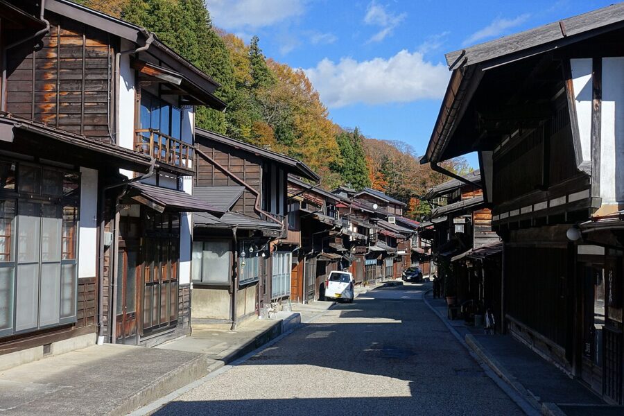

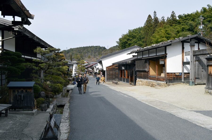
Further south, Tsumago (妻籠宿) and Magome (馬籠宿) are linked by just under eight kilometres of the original road, through forest and over a pass, and walking it is the best half-day in the valley. Tsumago’s residents agreed in a 1971 charter never to sell, rent or demolish their houses, so the street has no wires or signs in sight. Magome has been in Gifu since a 2005 merger.
Takayama, Shirakawa-go and Hida
Gifu (岐阜) has two halves: Mino, the plain around Gifu city, and Hida, the mountains to the north, a separate province famous for its carpenters. Hida’s carpenters were taken by the imperial court as a form of tax for centuries, and their descendants built the merchant houses of Takayama (高山). The old town is three lanes of dark wooden fronts, sake breweries marked by balls of cedar over the door, and the Takayama Jinya, the only surviving local office of the Tokugawa shoguns.
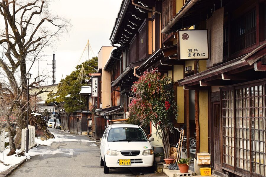

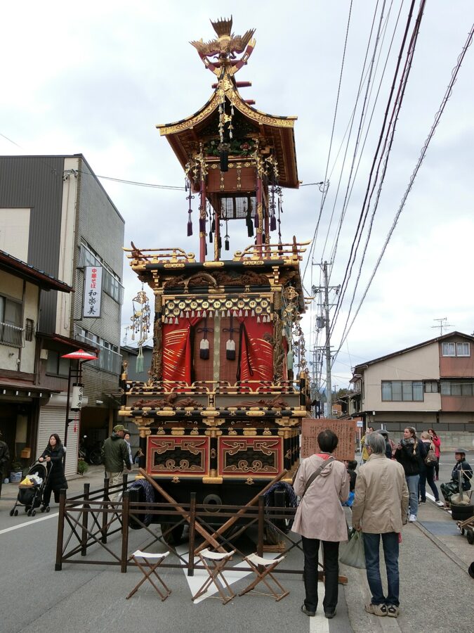
The Takayama Festival is really two: the Sanno Festival on 14–15 April and the Hachiman Festival on 9–10 October, each parading tall lacquered floats with mechanical puppets. Out of season, look for the yatai-gura in the old town, white-walled sheds with doors high enough to roll a float through. The dates are fixed, so rooms sell out a year ahead.
Shirakawa-go (白川郷) is 50 minutes by Nohi bus from Takayama. Climb to the Shiroyama viewpoint for the overview, and go inside one of the houses open to visitors to see the attic floors that held silkworm trays. The winter light-up can be reached only by reserved bus tour, car-park booking or a stay in the village; in 2027 it is on 11, 17, 24 and 31 January. It is a long day trip and a better overnight, and if you want fewer coaches, choose Gokayama.
Gujo Hachiman and Gero
Down in Mino, Gujo Hachiman (郡上八幡) is a castle town built on water: stone channels carry spring water past the houses, and people still wash vegetables in the communal basins. The Gujo Odori, a dance anyone can join, runs on 32 nights from mid-July to early September, and around Obon in mid-August it goes on all night.
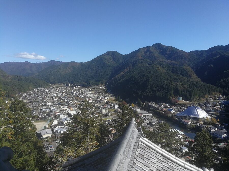

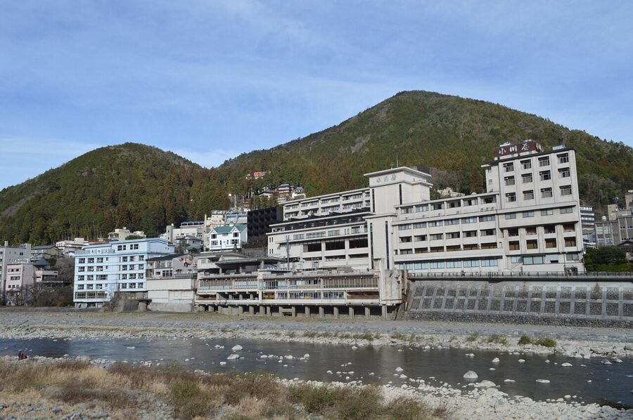
Gero Onsen (下呂温泉), on the Hida line, was ranked by the 17th-century scholar Hayashi Razan among Japan’s three finest hot springs, with Arima and Kusatsu. It is a town of large hotels along the Hida river, with free footbaths in the streets, and a good place to break the train journey to Nagoya.

Fuji and the Pacific side
South of the Alps the climate turns. Shizuoka gets 208 hours of sunshine in an average January, more than three times Kanazawa, and the winter sky over the Pacific is often clear for weeks. That is when Fuji is sharpest.
Yamanashi: the Fuji Five Lakes and wine
Yamanashi (山梨) holds the north side of Fuji and the Fuji Five Lakes (富士五湖), dammed long ago by lava. Kawaguchiko is the busiest, with hotels facing the mountain; Motosu, the deepest and clearest, is the view on the old ¥1,000 note. Highway buses from Shinjuku take about 1 hour 45 minutes to Kawaguchiko (¥2,200), and JR’s Fuji Excursion runs direct a few times a day.
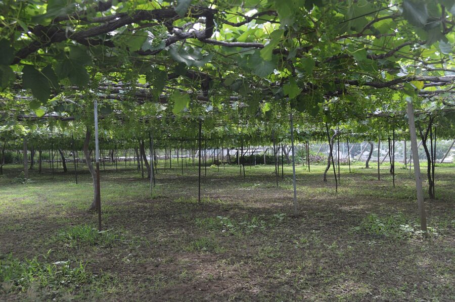
The Kofu basin grows more grapes than anywhere in Japan and has made wine since the 1870s. The native Koshu grape makes a crisp white that suits Japanese food, and the wineries round Katsunuma give tastings. Kofu was the seat of Takeda Shingen, the 16th-century warlord whose name is on half the souvenirs in the prefecture.

Shizuoka: Izu and tea
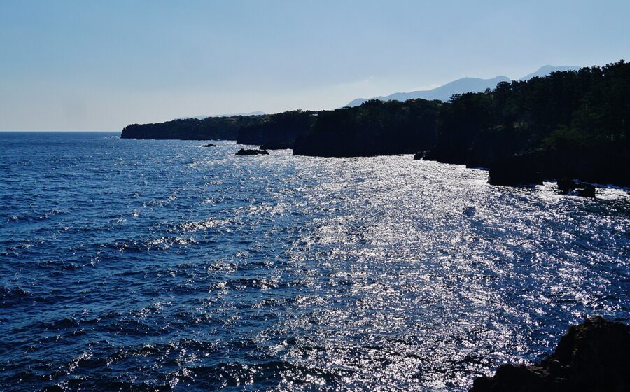
Shizuoka (静岡) is long, and most people see it only from the shinkansen. Its east end is the Izu Peninsula (伊豆半島), a volcanic block that collided with Honshu and is still pushing; the hot springs are one result. From Atami, and on some days Ito, jetfoils sail to Izu Oshima, the volcanic island about 45 minutes offshore. Shimoda, at the southern tip, was one of the first two ports opened to American ships under the 1854 treaty with Commodore Perry.

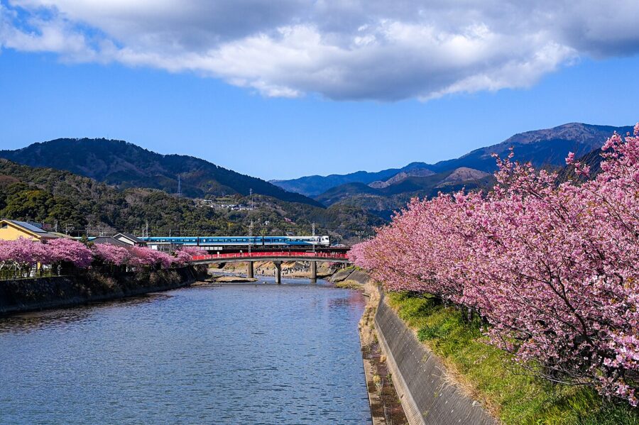
The Kawazu cherries are the earliest mass bloom on Honshu, a month ahead of Tokyo. Inland, Shuzenji is a quieter hot-spring town round a temple. The Odoriko and Saphir Odoriko limited expresses serve Atami, Ito and Shimoda directly from Tokyo.

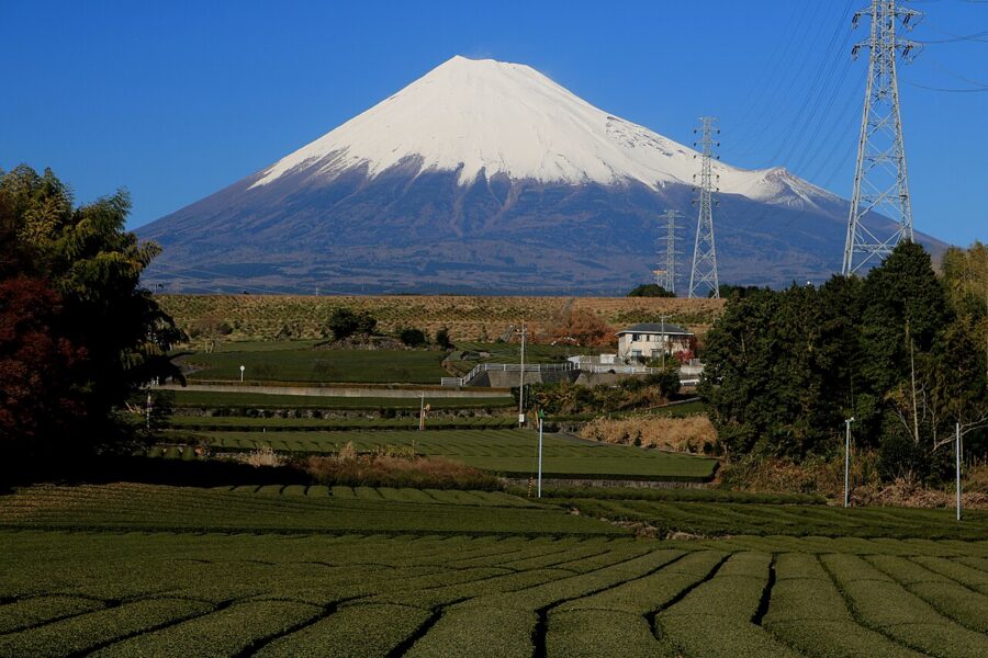
West of Izu, Shizuoka grows Japan’s tea. The Makinohara plateau is the biggest tea district, and Shizuoka led national output for decades, though Kagoshima passed it by value in 2019 and by volume in 2024. The fields are best in late April and May, when the first flush is picked.

Nagoya and Aichi, briefly
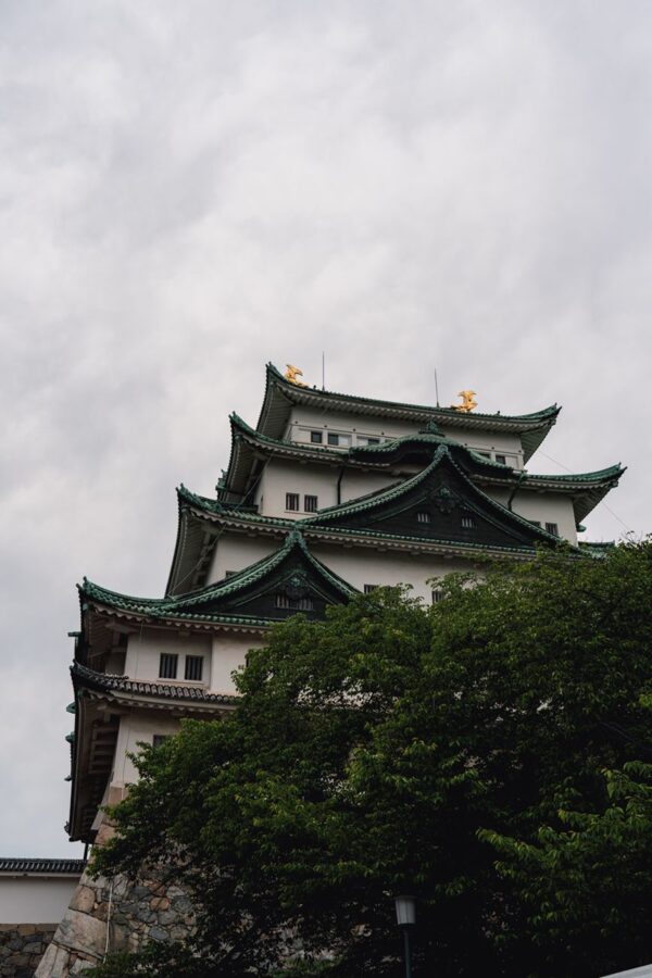
Nagoya (名古屋), Japan’s fourth city, is the Tokugawa castle town that became the home of Toyota. The castle’s 1959 concrete keep has been closed since May 2018 while the city argues about rebuilding it in wood, now not expected before the 2030s, but the Honmaru Palace beside it was rebuilt in cypress from the original plans and reopened in full in 2018. Atsuta Jingu holds the sacred sword Kusanagi, one of the three imperial regalia, which no one may see.
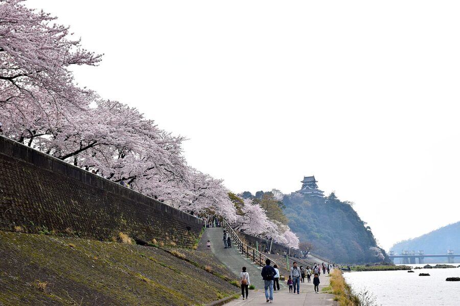
Thirty minutes north by Meitetsu train, Inuyama Castle (犬山城) stands above the Kiso river, and its keep is said to be the oldest of the twelve that survive from the age of castles. Until 2004 it was privately owned by the Naruse family, the domain’s former lords. I’d give Nagoya a night and spend it eating.

Niigata: snow country, rice and Sado
Niigata (新潟) has some of the snowiest inhabited ground on earth. Takada in Joetsu averages 413 centimetres of snowfall a year, 171 of it in January. Kawabata Yasunari set Snow Country at Yuzawa, where the Shimizu tunnel brings the railway out of the mountains into the snow; Echigo-Yuzawa is now about 1 hour 16 minutes from Tokyo by Joetsu Shinkansen (¥6,370 unreserved).
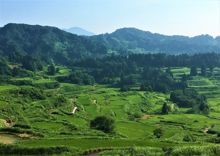
The same snow, melting slowly, waters Japan’s most famous rice, Koshihikari from Uonuma, and the dry, clean sake Niigata is known for; the prefecture has more breweries than any other. In the hills of Tokamachi, the Hoshitoge terraces fill with water in May and with mist on autumn mornings.

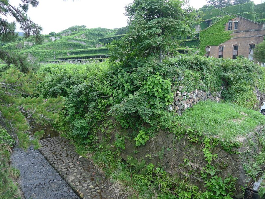
Sado (佐渡島), off the coast, has a history of exile and gold. An emperor, a Noh master and a Buddhist reformer were banished here, and from the 17th century its mines supplied much of the shogunate’s gold; they became a World Heritage Site in 2024. The jetfoil from Niigata reaches Ryotsu in about 1 hour 7 minutes (about ¥8,310); the car ferry takes 2 hours 30 minutes and costs much less.
Food, region by region
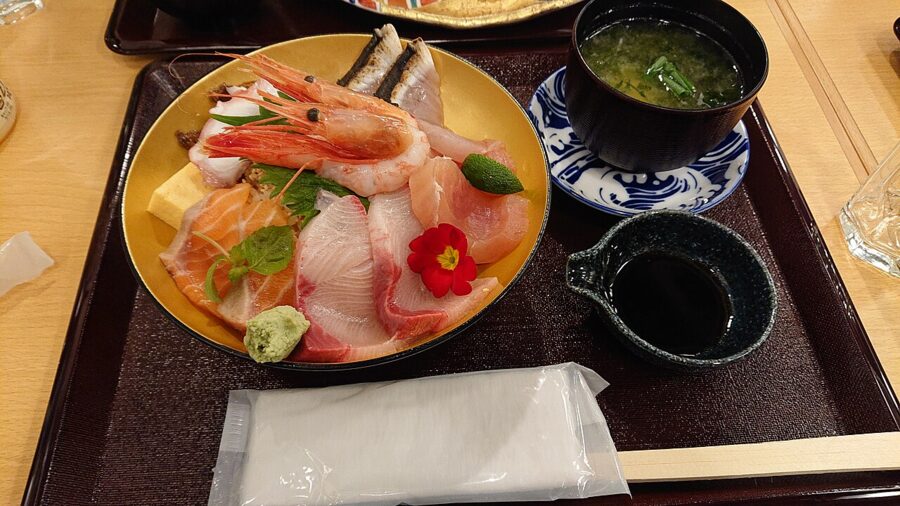
Each third of Chubu eats differently. The Sea of Japan side has snow crab and buri (yellowtail) in winter and white shrimp and firefly squid in spring, and Kanazawa adds castle-town dishes such as jibuni, duck simmered in a thickened broth. Toyama’s white shrimp, still peeled by hand, is eaten raw on rice or fried whole.

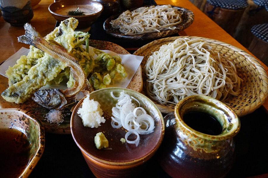
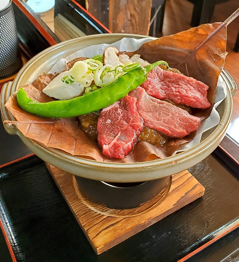
In the mountains, many valleys are too cold for good rice, and buckwheat grows instead. Shinshu soba, from Nagano, is the benchmark: cold with a dipping sauce in summer, hot in winter. Hida beef, from black cattle raised in Gifu for at least 14 months, is grilled on skewers in Takayama’s streets, and the farmhouse dish is hoba miso, miso and vegetables grilled on a dried magnolia leaf.

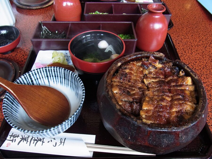
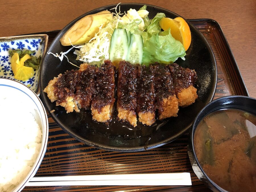
Nagoya does its own thing. Its dishes, sold as Nagoya-meshi, lean on hatcho miso, a dark soybean miso aged in cedar vats at Okazaki for two years or more, served as a thick sauce on pork cutlet (miso katsu) and in udon simmered in an earthen pot. The grand dish is hitsumabushi, grilled eel on rice eaten three ways: plain, with condiments, and drowned in broth.

Shizuoka adds green tea, wasabi from the Izu hills and eel from Lake Hamana. Yamanashi’s dish is hoto, flat noodles stewed with pumpkin in miso, which Takeda Shingen’s soldiers are said to have cooked on campaign. Niigata has hegi soba, buckwheat noodles bound with seaweed and laid in loops on a wooden tray.
The seasons
Spring comes late and in layers: Kawazu’s cherries in February, Tokyo’s in late March, Takayama’s in mid-April, the high valleys’ into May. The Alpine Route snow corridor is the event that sells out; the walls are tallest in the first two weeks, which are also the most crowded. I’d go in late May, when the queues have gone and the plateau is still white.
Summer is hiking season in the Alps, the time to sleep in a mountain hut above Kamikochi or at Murodo. It is hot and humid on the plains, and Fuji hides in cloud. Festivals fill the calendar: Gujo’s dancing, the Owara Kaze no Bon in Toyama’s Yatsuo in early September, fireworks over every river.
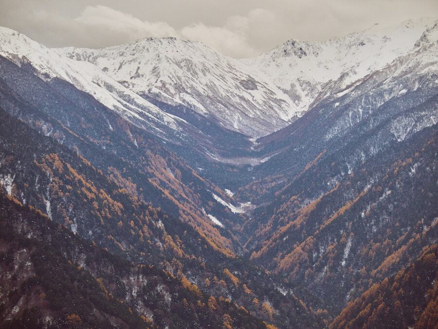
Autumn is my choice for a first visit. The colour starts on the high plateau at the end of September, reaches Kamikochi and the Kurobe gorge in October and comes down to Kenrokuen and Takayama in November, just as crab season opens. Winter means skiing, the snow monkeys, the Shirakawa-go light-up and Fuji at its clearest, along with closed mountain roads and a grey, heavy coast.
Plans for five days and for ten
Chubu rewards a loop rather than a line. Both of these start in Tokyo and end in Kyoto or Osaka; reverse them if you arrive the other way.
Five days
- Day 1: Shinkansen to Kanazawa. Kenrokuen, then Higashi Chaya at dusk.
- Day 2: Kenrokuen again at dawn, free; Omicho for breakfast. Nohi bus to Shirakawa-go and a night there or in Gokayama.
- Day 3: Bus to Takayama. Old town, a Hida beef dinner.
- Day 4: Morning market, then the Hida limited express south, with a bath at Gero, to Nagoya.
- Day 5: Nagoya Castle grounds and palace, hitsumabushi for lunch, then on to Kyoto or Osaka.
Buy single tickets for this one, or start from Nagoya and run it backwards on the Takayama-Hokuriku pass, which covers the Hida line and the Shirakawa-go buses.
Ten days
- Days 1–2: Shinkansen to Nagano. Zenkoji, then the snow monkeys (winter) or Togakushi’s cedar avenue (summer).
- Day 3: Shinkansen to Toyama; white shrimp for dinner.
- Days 4–5: The Alpine Route east from Tateyama, with a night at Murodo, to Shinano-Omachi and Matsumoto. From December to mid-April, swap this for Kanazawa and Fukui.
- Day 6: Matsumoto Castle, then Kamikochi for the night.
- Day 7: Bus via Hirayu to Takayama.
- Day 8: Shirakawa-go by bus, then on to Kanazawa.
- Day 9: Kanazawa, or a day trip to Eiheiji and Tojinbo.
- Day 10: Shinkansen to Tsuruga and the Thunderbird to Kyoto or Osaka.
The Kiso valley makes a good extra day out of Matsumoto, with a night in Tsumago, and Fuji can be added at the Tokyo end with a night at Kawaguchiko.
On the ten-day loop, the last change of current comes on day three. Somewhere west of Itoigawa the train switches to 60 hertz for good and slides over the tectonic line on a viaduct, with nothing in the carriage to mark it. By the time the Thunderbird leaves Tsuruga, you will have crossed and recrossed that line by train, bus and cable car, and you will know which side of it you liked better.