

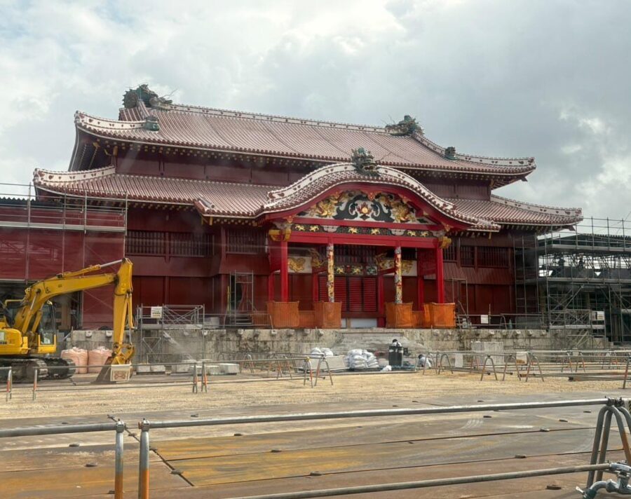
From noon on 23 November 2026 the main hall at Shuri Castle (首里城) is open to the public for the first time in seven years. The building behind them is new. Its frame is mainly hinoki cypress from the Japanese mainland, its carvings are Taiwanese cypress, and some of its red roof tiles were fired with crushed shards of the tiles that fell when the previous hall burned in the early hours of 31 October 2019.
That makes it the third rebuilding of the hall since 1709, after fires in that year, in the shelling of May 1945 and in 2019. It stands on a limestone hill above Naha (那覇) that was the seat of a kingdom until 1879, and the story of that kingdom is what makes Okinawa (沖縄) different from everywhere else in Japan. The beaches are what most people fly in for, but the hill explains the islands.

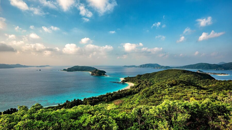
Okinawa Prefecture is about 160 islands strung out for roughly 1,000 kilometres between the southern tip of Kyushu and Taiwan; Ishigaki, in the far south-west, is closer to Taipei than to Naha. The name is usually read as “rope in the offing”, a long thing lying out at sea, though that is one reading among several. The islanders’ own word for home is Uchinaa.

In this guide
- A kingdom that faced China and paid Satsuma
- Weather, sea and typhoon months
- Getting there and getting around
- Naha and Shuri
- The south: Mabuni, Himeyuri and Sefa-utaki
- The centre: Chatan, Yomitan and the Katsuren peninsula
- The north: Motobu and Yanbaru
- The outer islands
- Sanshin, eisa and a little Uchinaaguchi
- Okinawa soba, champuru and awamori
- Five days, ten days
A kingdom that faced China and paid Satsuma
In the fourteenth century Okinawa Island was split between three rival lords, later called Hokuzan in the north, Chuzan in the middle and Nanzan in the south, each ruling from a gusuku, a stone-walled hilltop castle and sacred enclosure in one. In 1372 the king of Chuzan sent his first tribute mission to the new Ming court in China. That relationship decided almost everything that followed: tribute brought the right to trade, and trade brought money, scholars and Chinese ways of government to a kingdom with no gold, no silver and not much rice.
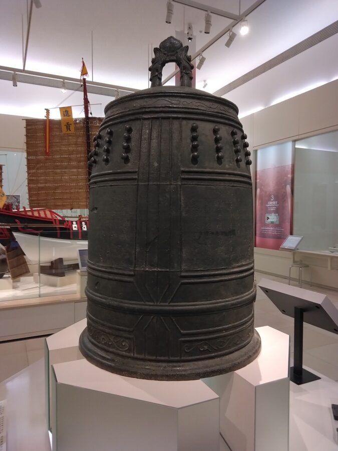
Sho Hashi of Chuzan took Nakijin in the north in 1416 and by 1429 ruled the whole island from Shuri. For the next century and a half the Ryukyu Kingdom (琉球王国) worked as a relay station, carrying Chinese silk and porcelain to Japan and Korea, Japanese swords to China, and pepper and sappanwood from Siam, Malacca and Java to all of them. A bronze bell cast for Shuri in 1458 describes Ryukyu as a ship that bridges all nations.

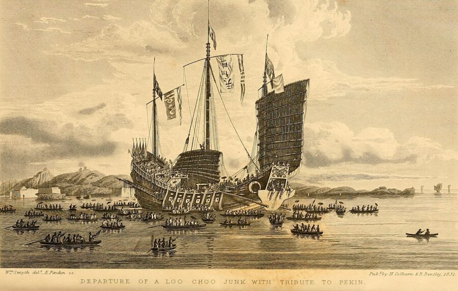
The trade made Ryukyu worth taking. In 1609 the Shimazu lords of Satsuma, based at Kagoshima, invaded with about 3,000 men, took Shuri within weeks and carried King Sho Nei away. Satsuma annexed the Amami islands outright and left the rest of the kingdom standing, because a kingdom that still sent tribute to China could still trade with China, and Satsuma wanted a share. For two and a half centuries Ryukyu answered to two masters, with Satsuma officials keeping out of sight when Chinese envoys came to Shuri.
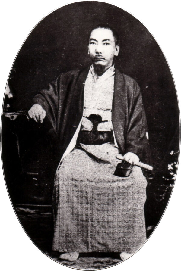
The Meiji government ended the arrangement. It declared the kingdom a domain in 1872 and in 1879 sent soldiers and police to Shuri, removed King Sho Tai to Tokyo and created Okinawa Prefecture. That came a decade after Ezo had been renamed Hokkaido and opened to settlement, and the two edges of the new state went through similar things, including pressure to drop their own languages. In Okinawan schools before the war, a child heard speaking the local language could be made to wear a wooden hogen-fuda, a dialect tag, until another child slipped up.
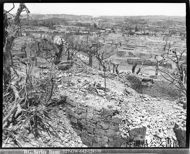
Then came 1945. The Imperial Japanese Army’s 32nd Army dug its headquarters into tunnels under Shuri Castle, and the island became the last large battlefield of the Pacific War. American forces landed on the Kerama Islands in late March and on the main island on 1 April; organised Japanese resistance ended in the south in late June. About 200,000 people died, more than half of them Okinawan, many of them civilians caught between the armies.
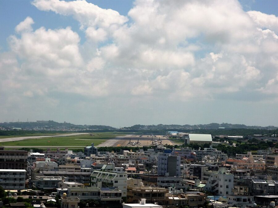
Okinawa stayed under American administration until 15 May 1972, twenty years longer than the rest of Japan. Cars drove on the right until 30 July 1978, when the prefecture switched sides overnight; older people still call it “Nana-San-Maru”, seven-three-zero. The bases stayed. As of January 2025 Okinawa, with about 0.6 per cent of Japan’s land, hosted about 70.3 per cent of the area of facilities reserved for US forces in Japan.

Weather, sea and typhoon months
Okinawa is subtropical. Naha’s annual mean temperature is 23.3°C, January averages 17.3°C and July 29.1°C, and about 2,160 millimetres of rain falls in a year, most of it in two seasons.
| Naha (1991–2020 normals) | Mean temp | Mean daily high | Rainfall |
|---|---|---|---|
| January | 17.3°C | 19.8°C | 102 mm |
| March | 19.1°C | 21.9°C | 143 mm |
| May | 24.2°C | 27.0°C | 245 mm |
| June | 27.2°C | 29.8°C | 284 mm |
| July | 29.1°C | 31.9°C | 188 mm |
| September | 27.9°C | 30.6°C | 275 mm |
| November | 22.5°C | 25.0°C | 119 mm |
The first is tsuyu, the early-summer rains, which in an average year run from about 10 May to 21 June, more than a month before they reach Tohoku. In 2026 they ended eight days late. The rain comes in heavy bursts rather than all day, but it is humid, grey and bad for boats.
The second is the typhoon season, roughly July to October and worst in August and September. A typhoon passing close stops ferries, buses and often flights for a day or two, and longer on the outer islands. Keep a spare day at the end of a trip in those months.
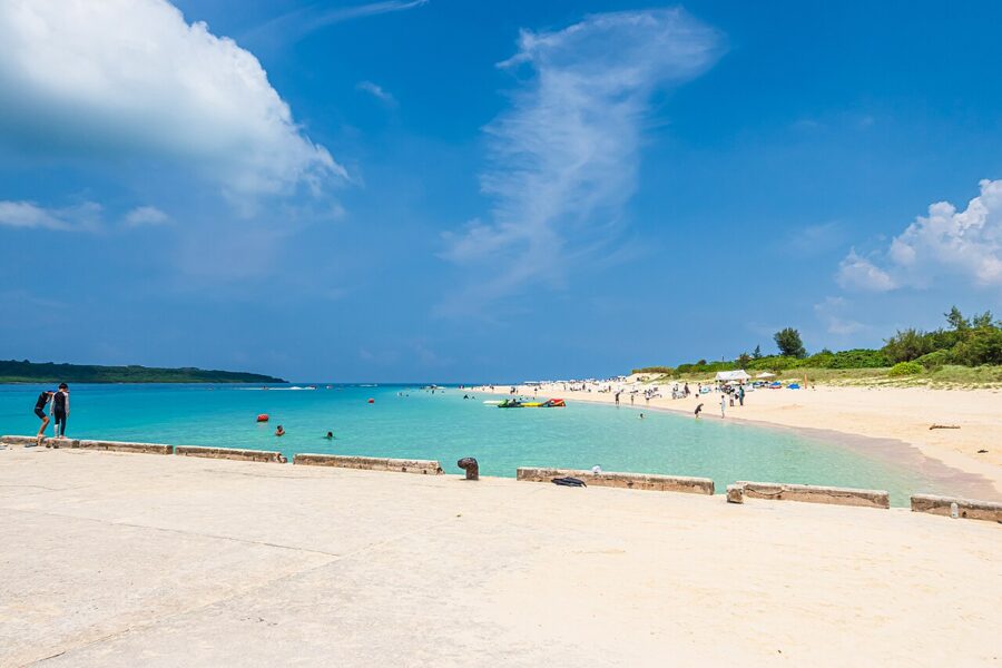

The sea is around 21°C in February and 29°C by August, warm enough to swim from about May to October. Humpback whales winter in the channel between Naha and the Kerama Islands from about January to March, and Japan’s first cherry blossoms open around Nakijin and Motobu in late January, more than three months before Hokkaido’s.
My choice would be late October to early December, or April: warm sea, few typhoons, no summer crowds. Winter is mild but often overcast with a cold north wind, which matters more than the thermometer suggests if you came for beaches.
Getting there and getting around
Almost everyone arrives at Naha Airport, about 2 hours 30 minutes from Tokyo Haneda, with international flights from Taipei, Seoul, Hong Kong and Shanghai among others. There are no JR lines in the prefecture, so a Japan Rail Pass is no use here.
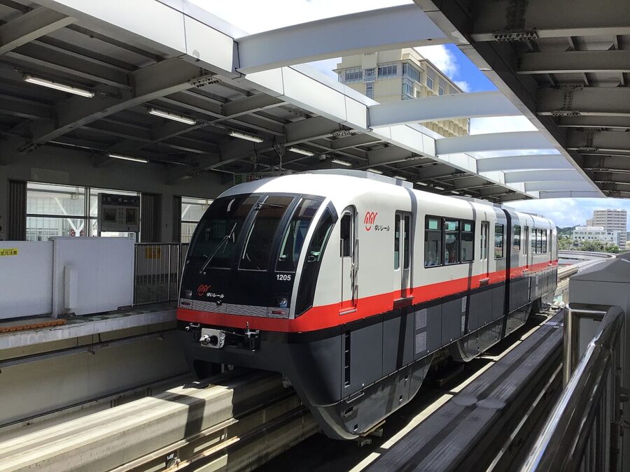

The one railway is the Yui Rail monorail, 19 stations from the airport through central Naha and Shuri to Tedako-Uranishi. Use Kencho-mae, Miebashi or Makishi for Kokusai-dori and Shuri for the castle, about 15 minutes’ walk. A 1-day QR ticket costs ¥1,000 and runs 24 hours from purchase; 2 days cost ¥1,800. The OKICA card works at the gates.
Express buses run from the airport and the Naha Bus Terminal up the west coast to the resort hotels, Nago and the aquarium in about two hours. They are fine for that corridor and, with patience, for the south. They are little use for the far north, the east coast or anywhere you want to be at sunrise.
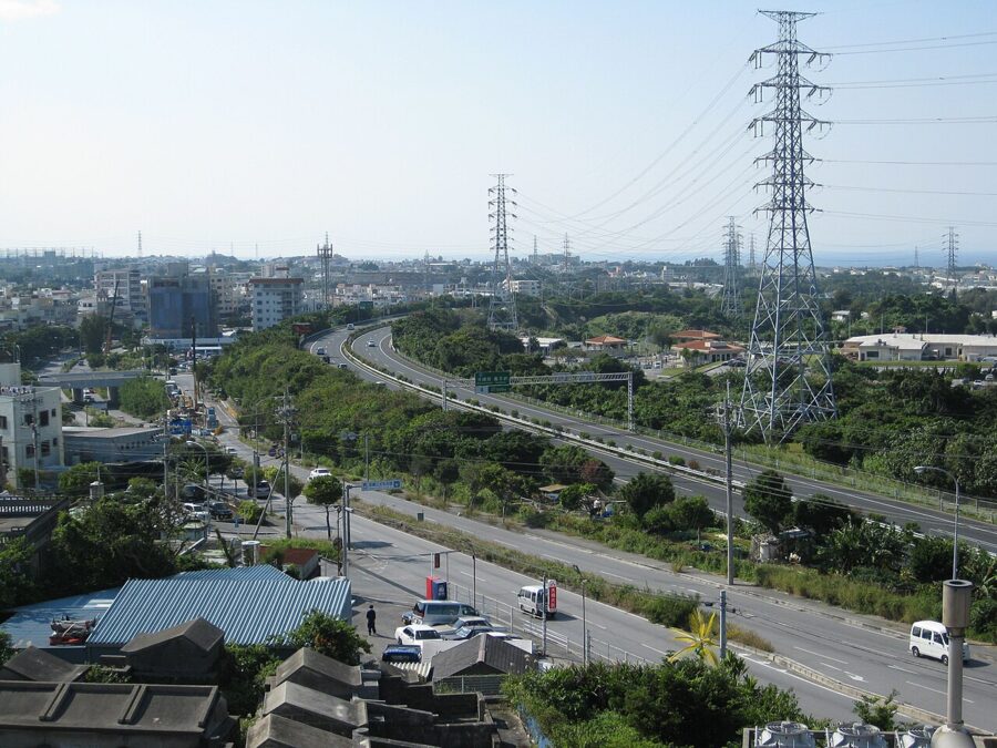

So for most people a car is the answer, picked up after the Naha days rather than before. You need an International Driving Permit (or an official translation for some licences), and Japan drives on the left. On Route 58 some lanes become bus-only at rush hour, which catches out rental drivers.
For the outer islands, the Kerama ferries leave from Tomari Port in Naha. Miyako and Ishigaki have no passenger ferry from Naha, so you fly: about 50 minutes to Miyako and an hour to Ishigaki, and both have direct flights from the mainland too.
Naha and Shuri
Naha, with about 310,000 people, is the only real city, and its centre was almost entirely destroyed in 1945. Most of what you see was built after the war, which is part of its story. Two or three nights here is right.
Shuri Castle
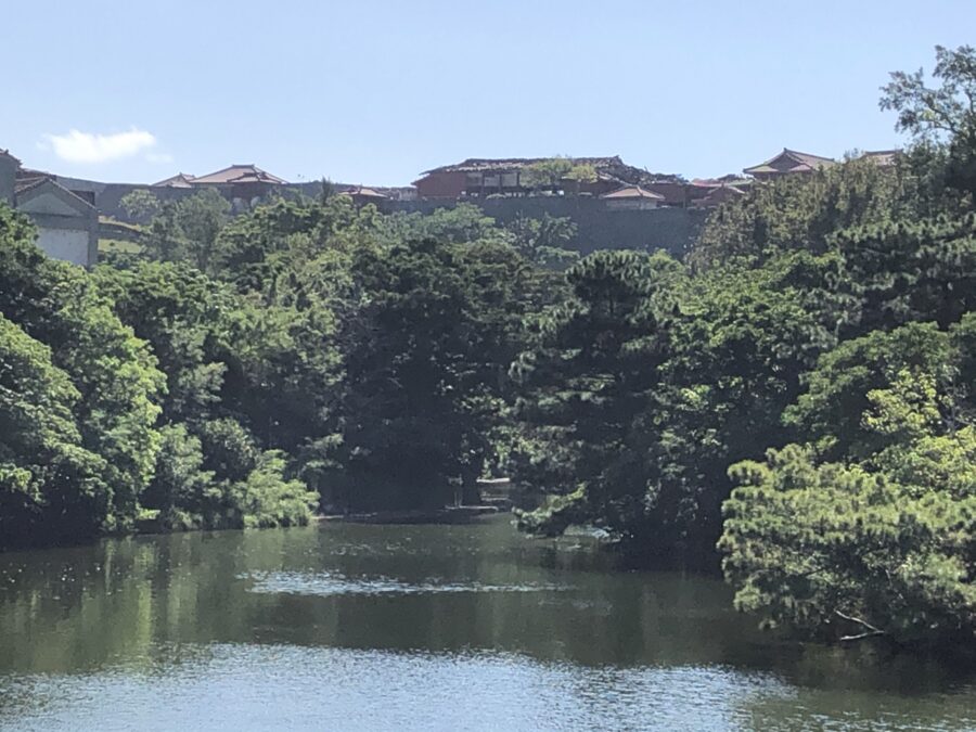
Shuri sits on a ridge about 4 kilometres east of the port, and the castle was the palace, government office and religious centre of the kingdom for some 450 years. What UNESCO listed in 2000, as part of the Gusuku Sites and Related Properties of the Kingdom of Ryukyu, is the remains: the curved limestone walls and the foundations. The red halls are reconstructions, first finished in 1992 and rebuilt again after 2019.
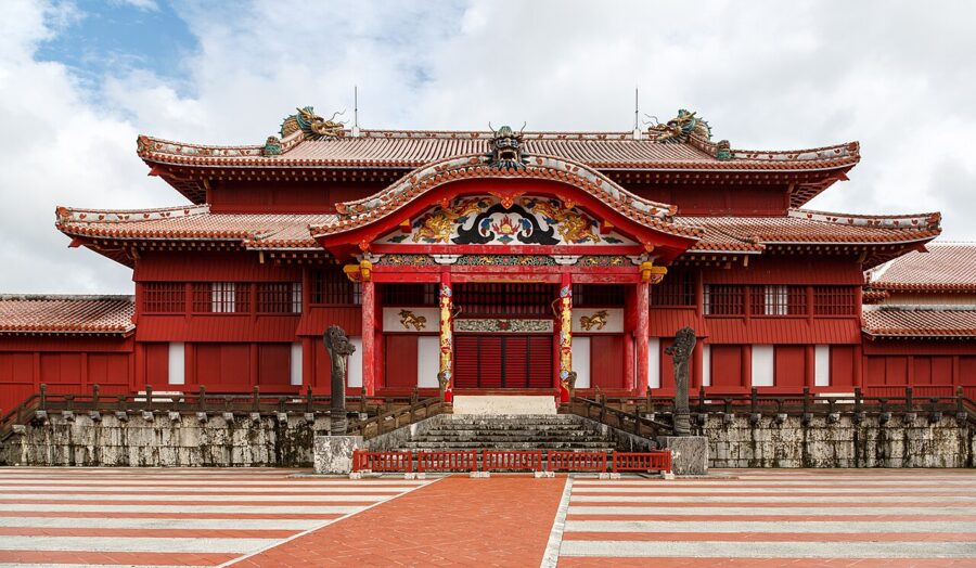

From 23 November 2026 the main hall can be entered again, but only with a timed ticket. Slots are 30 minutes long and sold online, and any left are sold at the Kofukumon ticket window until 15 minutes before each starts. Adult admission to the paid area is ¥1,000 from the same day; the rest of the paid area needs no booking. From January 2027, each month’s slots go on sale at 13:00 on the first day of the month two months ahead.
The paid area opens at 08:30 and, from July to November, closes at 19:00 with last tickets at 18:30. The free outer area opens at 08:00 and includes the Shureimon gate.
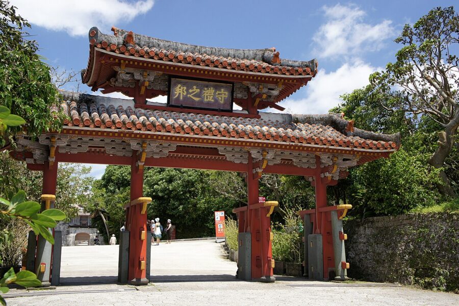

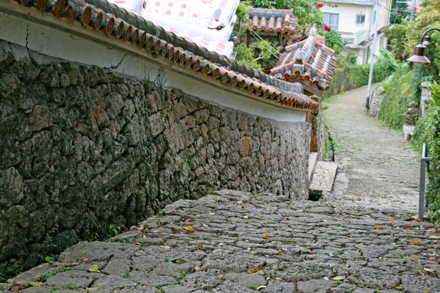
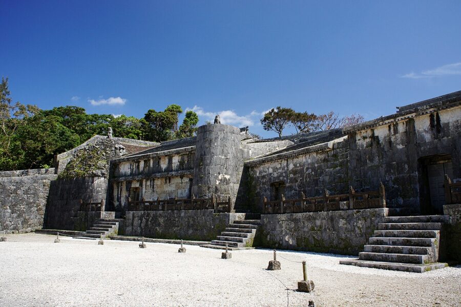
Give Shuri half a day. Below the castle, the Kinjo-cho stone-paved lane drops steeply between old walls, one of the few stretches of pre-war Shuri to survive; it was part of the road from the palace to the port. Nearby is Tamaudun, the mausoleum of the second Sho dynasty, built in 1501.

Kokusai-dori and the market
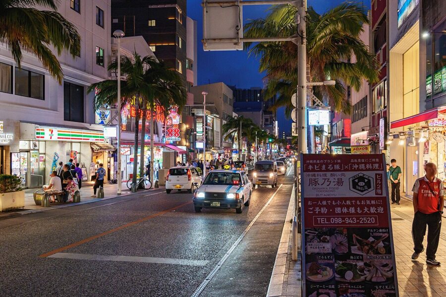
Kokusai-dori (国際通り) runs about 1.6 kilometres through central Naha. Its name, “International Street”, comes from a cinema, the Ernie Pyle International Theatre, that opened on it in 1948, and its quick rebuilding from ruins earned it the nickname of the Miracle Mile. Today it is mostly souvenir shops, and I would treat it as a street you pass through.

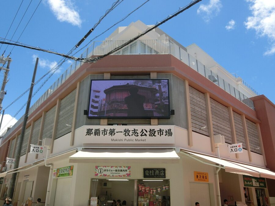
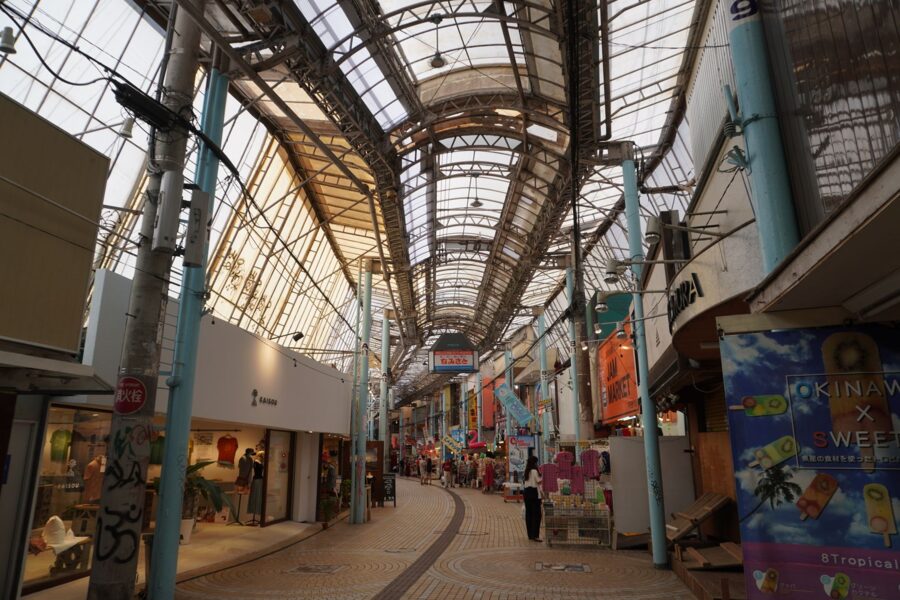
The interesting part is behind it. Covered arcades such as Heiwa-dori run south to the First Makishi Public Market, Naha’s food market since the post-war black market years, rebuilt in 2023. Downstairs are fish, pork in every cut and island vegetables; upstairs, restaurants will cook what you bought below for a set charge, a system called mochiage.
Tsuboya, the pottery quarter
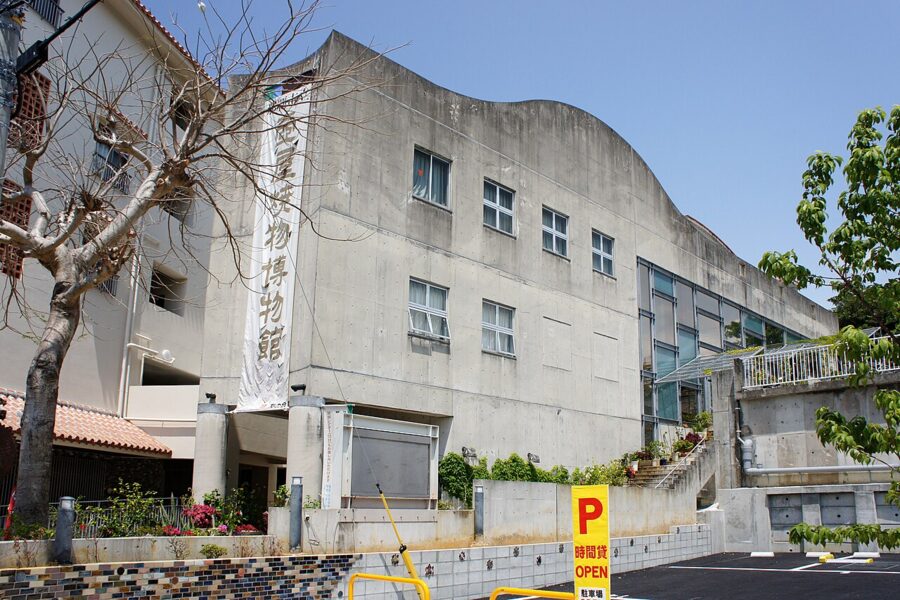
East of the market, Tsuboya (壺屋) has been Naha’s pottery district since 1682, when the royal government gathered potters from three kiln sites into one place. Okinawan pottery, yachimun, comes in two kinds: arayachi, unglazed, for water jars and awamori pots, and joyachi, glazed, for tableware. The Tsuboya Yachimun-dori is a short stone-paved street of workshops, with the Tsuboya Pottery Museum at one end.

With two more hours, the Okinawa Prefectural Museum and Art Museum at Omoromachi has the bell from 1458 and the best single account of the islands from prehistory to reversion.
The south: Mabuni, Himeyuri and Sefa-utaki
The south is where the Battle of Okinawa ended, and it is also where the kingdom’s most sacred site faces the sunrise. Both are a day trip from Naha by car.
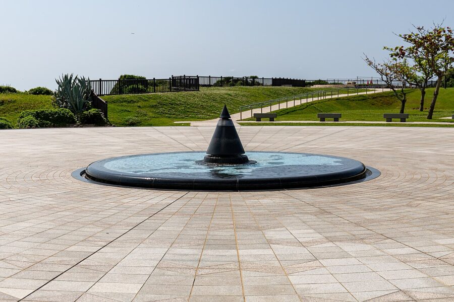
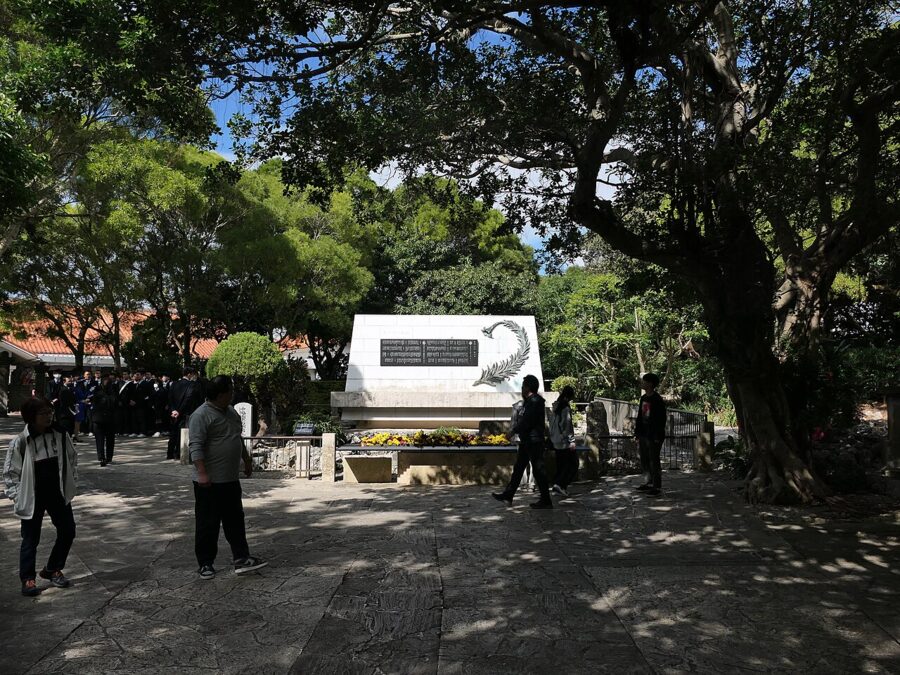
Okinawa Prefectural Peace Memorial Park sits on the coral cliffs of Mabuni (摩文仁) in Itoman, where the Japanese commanders died in late June 1945 and thousands of civilians were trapped against the sea. Its centre is the Cornerstone of Peace, unveiled in 1995: black granite walls carrying the names of everyone who died in the battle, of every nationality. In June 2026 the count was 242,659, and names are still added each year.
The Peace Memorial Museum on the same site tells the battle through survivors’ testimony. Adult admission is ¥300, 09:00–17:00. Allow two hours.

A short drive west, the Himeyuri Peace Museum tells one story in detail. In March 1945, 222 students and 18 teachers from two girls’ schools in Naha were sent to work as nurses in an army field hospital dug into caves. When the army dissolved the unit on 18 June, most had nowhere to go; 136 of the 240 died, the great majority after that order. Admission is ¥450, open daily 09:00–17:25.

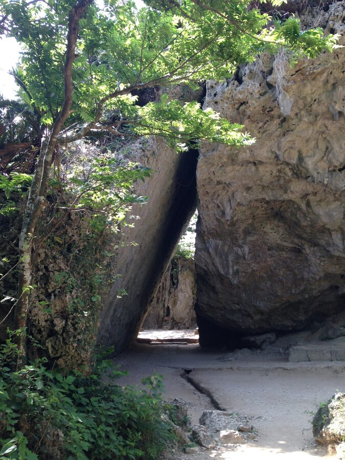
On the Chinen peninsula to the east is Sefa-utaki (斎場御嶽), the holiest of the kingdom’s utaki, sacred groves of the island’s own religion, which was led by women priests. The chief priestess was installed here and men were kept out of its inner places. A forest path leads between limestone outcrops to Sangui, where two huge rocks lean together.

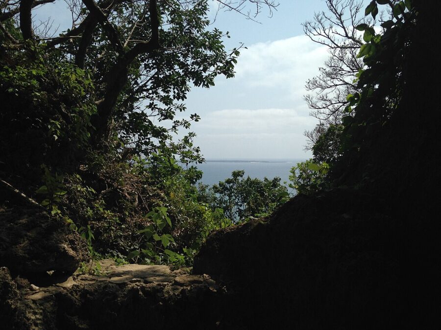
Through the gap is a worship point facing Kudaka Island (久高島), where the creator goddess Amamikiyo is said to have come down first. Tickets, ¥300, are sold at the Nanjo regional produce market by the main road, 10 minutes’ walk away. From November to February the site opens 09:00–17:30, last entry 17:00, and closes at 18:00 from March to October. It shuts for three days twice a year for rites set by the lunar calendar (in 2026, 15–17 June and 9–11 November).

The centre: Chatan, Yomitan and the Katsuren peninsula
The middle of the island is the most built up and the most American. It is where the US landings came ashore, and where two of the best castle ruins look out from either coast.
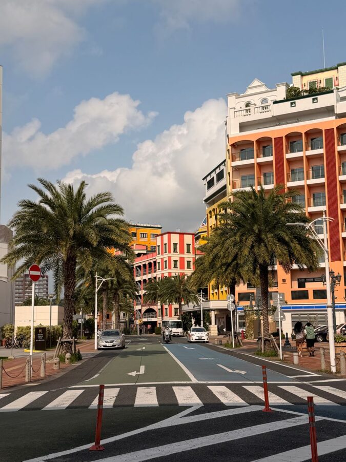
Chatan (北谷) is the easiest place to see the American layer. Mihama American Village, shops and restaurants around a Ferris wheel and a sunset beach, was built from the late 1990s on reclaimed land and ground handed back by the US military, and Kadena Air Base begins a few kilometres north. I would not cross the island for it, but it is on the way, and the sunsets are good.
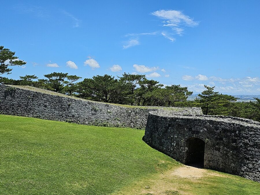
Further up, Yomitan (読谷) is a village of red-tiled houses, sugar cane and potters, many of whom moved here from Tsuboya in the 1970s when wood-fired kilns became a problem in the city. Zakimi Castle, built in the early fifteenth century by the general Gosamaru, has walls curved like the hull of a boat, and entry is free.

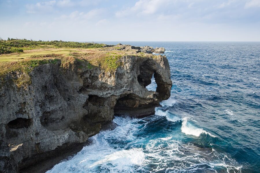
North on the west coast, Cape Manzamo in Onna is a grassy coral headland ending in a cliff shaped like an elephant’s trunk. The name means a meadow where ten thousand could sit, said to come from an eighteenth-century king.

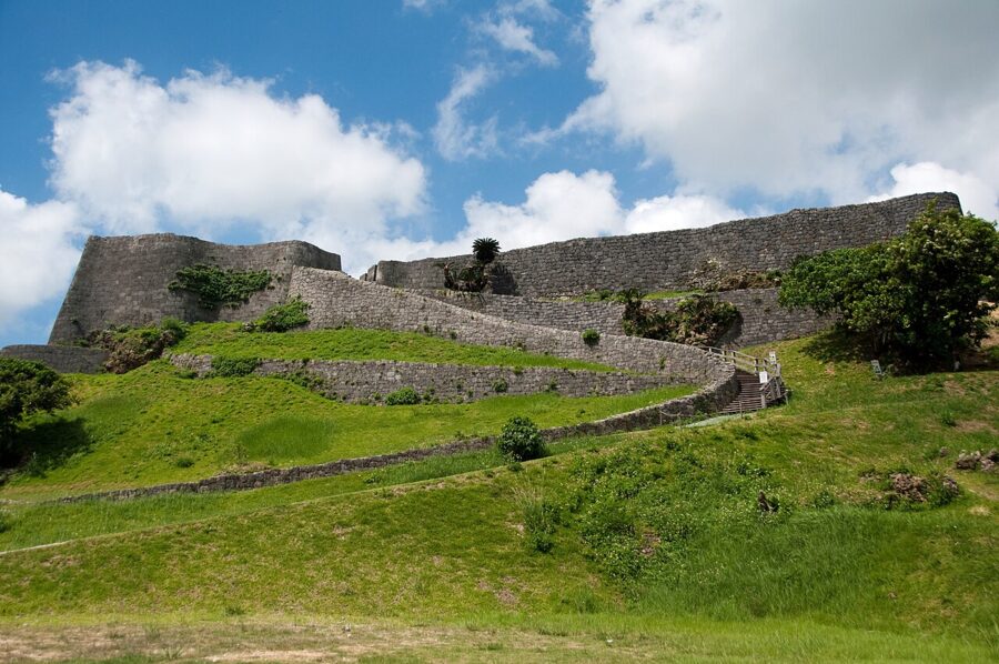
On the east side, Katsuren Castle (勝連城) climbs a ridge in a series of terraces. Its last lord, Amawari, grew rich on overseas trade and was defeated by the king’s forces in 1458; the official histories made him a villain and the town has since made him a hero. Entry is through the Amawari Park visitor centre at the foot, ¥600 including its museum.

The north: Motobu and Yanbaru
North of Nago the island narrows and the hills close in. The Motobu Peninsula juts west with the aquarium, a castle and an island reached by bridge; beyond it is Yanbaru (やんばる), the forested north.
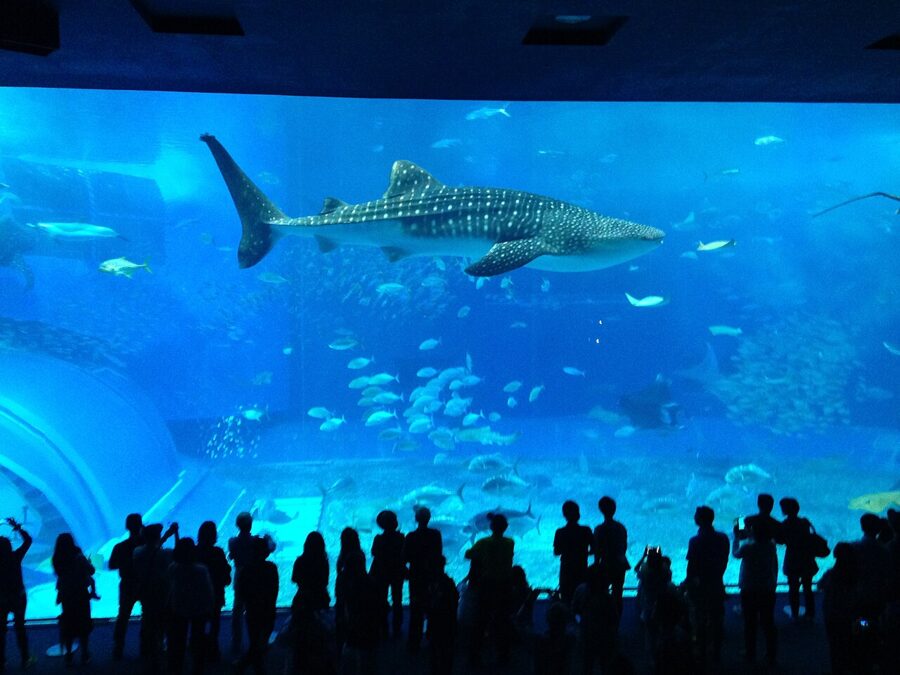
The Okinawa Churaumi Aquarium (chura, beautiful; umi, sea) stands in Ocean Expo Park, built for the 1975 exposition that marked the islands’ return to Japan. Its main tank, the Kuroshio Sea, holds 7,500 cubic metres of water, whale sharks and manta rays. Adults pay ¥2,180, and it normally opens 08:30–18:30 with last entry at 17:30. Arrive at opening, before the tour buses from Naha.

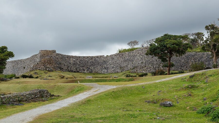
Nakijin Castle (今帰仁城), a few kilometres east, was the seat of the Hokuzan kings until 1416. Its outer wall winds for about 1.5 kilometres along the hillside, and in late January and February the approach is lined with dark pink cherry blossom.

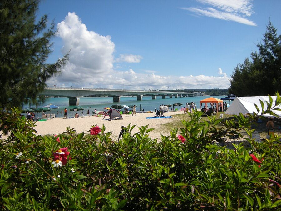
Kouri Bridge, 1,960 metres long and opened in 2005, crosses from Yagaji Island, near Nakijin, to Kouri Island, small enough to drive around in a quarter of an hour. The colour of the water under the bridge fills the car parks by mid-morning.

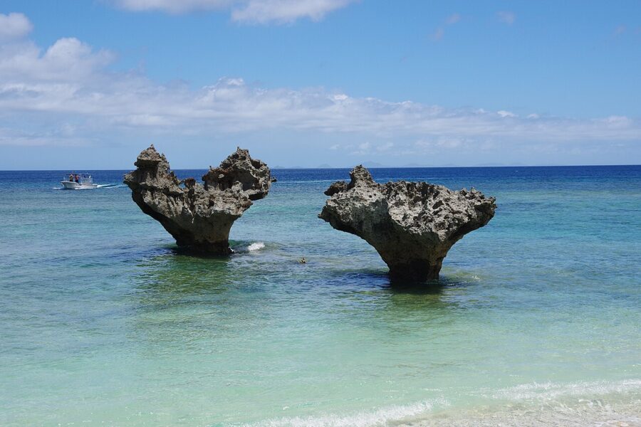

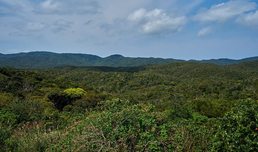
North of Motobu begins Yanbaru, written 山原, “mountain field”. The villages of Kunigami, Ogimi and Higashi share Japan’s largest subtropical evergreen forest, made a national park in 2016 and a World Natural Heritage site in 2021, together with Amami Oshima, Tokunoshima and Iriomote.

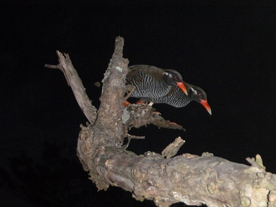
The best-known resident is the Okinawa rail, a flightless bird first described in 1981 and still endangered, mainly by cars and introduced mongooses. Road signs in Kunigami warn you to watch for it. The Okinawa woodpecker lives only here as well.
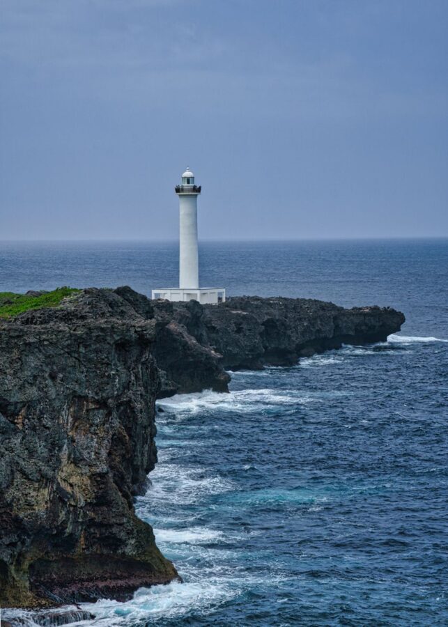
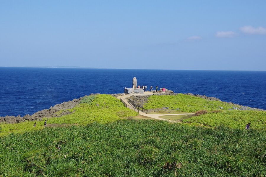
The coast road ends at Cape Hedo, a karst headland looking toward Yoron, the first island of Kagoshima Prefecture, about 23 kilometres away. Allow three hours to drive back to Naha.

The outer islands
Beyond the main island the prefecture falls into three groups: the Okinawa Islands, including the Kerama group; the Miyako Islands about 300 kilometres to the south-west; and the Yaeyama Islands beyond them. Each has its own dialect, its own soba and its own festivals.
The Kerama Islands
The Kerama Islands (慶良間諸島) are some twenty islands about 40 kilometres west of Naha, of which Tokashiki, Zamami and Aka are the ones people stay on. The water is famously clear, the reefs are a national park, and in late winter the humpbacks calve in the channels between them.
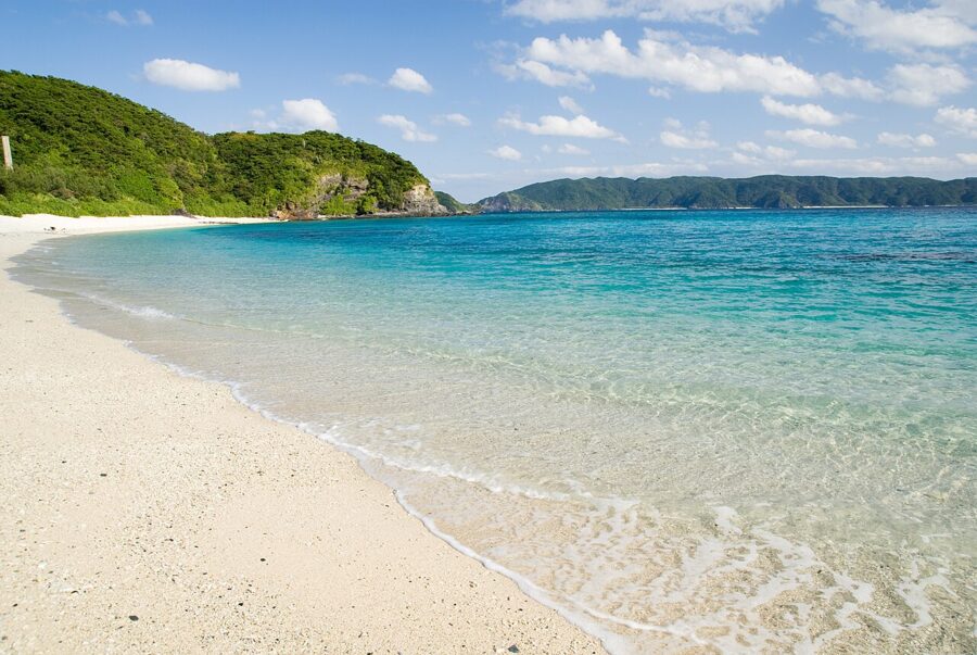

Ferries leave from Tomari Port. For Zamami and Aka, the village-run Ferry Zamami takes about two hours and costs ¥2,900 one way, and the fast Queen Zamami takes 50 minutes to an hour for ¥3,950. The Queen Zamami is out of service for dock maintenance until 3 December 2026. Tokashiki has its own fast boat, about 35 minutes, and ferry, about 1 hour 10 minutes; book ahead in summer.
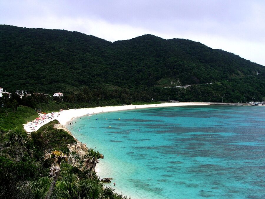

The American landings began here on 26 March 1945, and several hundred islanders on Tokashiki, Zamami and Geruma died in mass suicides under pressure from the Japanese military. The islands keep memorials to them, and how textbooks describe the army’s role was a national argument as recently as 2007.
Miyako
Miyako Island (宮古島) is flat and made almost entirely of coral limestone, with no real rivers; its water comes from underground dams that hold the rain inside the rock, and the lack of run-off is why the sea is so clear. The island has its own language, Miyako, as far from the Naha dialect as either is from Tokyo Japanese.
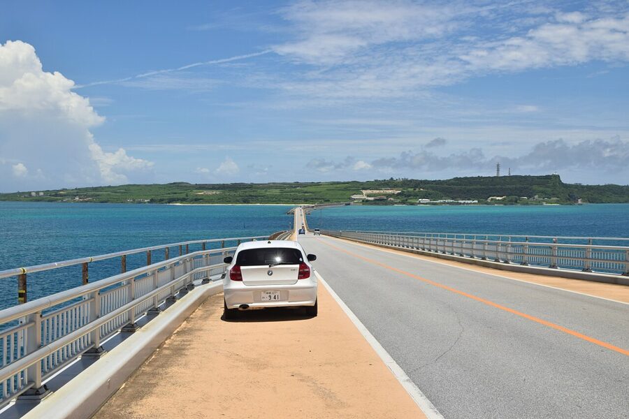

Beaches are the reason to come, and Yonaha Maehama in the south-west is the one on the posters, about 7 kilometres of white sand. Bridges link Miyako to Irabu, Ikema and Kurima, and the drives across them are the island’s other sight. Three days is plenty, with a car.

Ishigaki
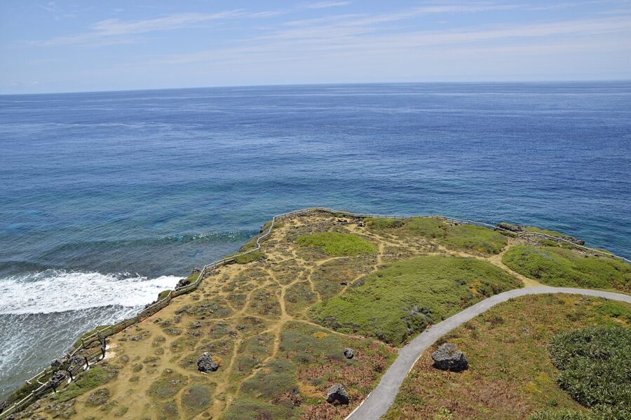
Ishigaki (石垣島) is the hub of the Yaeyama Islands, with a proper town around the port, direct flights from Tokyo and Osaka as well as Naha, and Mount Omoto, at 526 metres the highest peak in the prefecture. Its east coast reef at Shiraho holds one of the largest colonies of blue coral in the northern hemisphere.
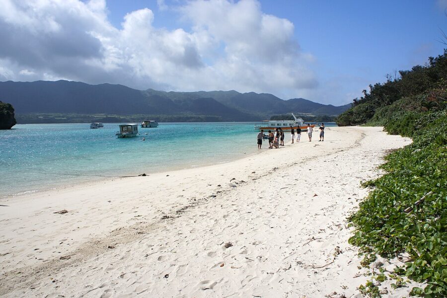

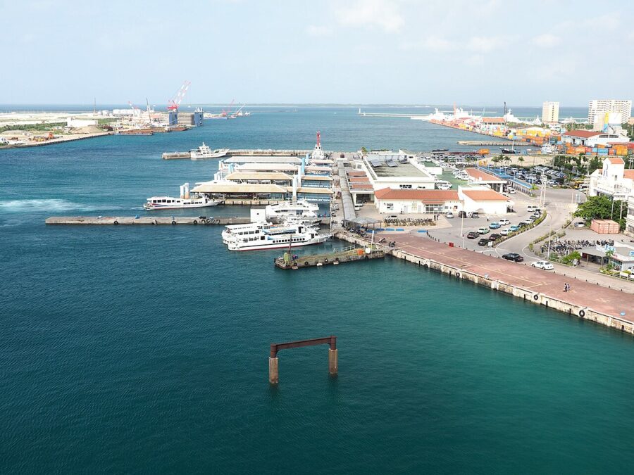
Above all, Ishigaki is the jumping-off point. The remote-island ferry terminal in the town centre has boats to Taketomi in about 15 minutes and to Iriomote in about 40 to 50.

Taketomi
Taketomi (竹富島) is a flat island of about 350 people, and its village was designated an Important Preservation District for Groups of Traditional Buildings in 1987. The houses are single-storey under red tiles set in white mortar, each behind a wall of grey coral stone, and the lanes are white coral sand swept every morning. The fare from Ishigaki is under ¥1,000 one way.
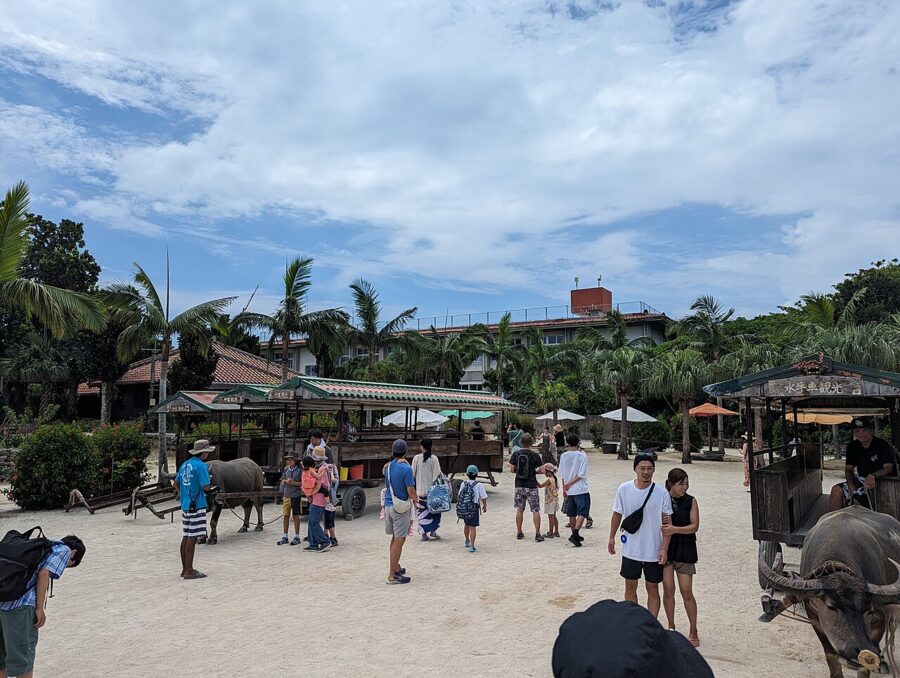
By bicycle you can see it all in a few hours: the village, Kondoi Beach with shallows that run out for hundreds of metres, and Kaiji Beach, where the sand includes tiny star-shaped shells. The island has collected a voluntary ¥300 entry fee since 2019, and in 2025 the town voted for a ¥1,000 visitor tax; check whether it is being collected when you go. Stay the night: an evening after the day boats leave is the best thing on the island.
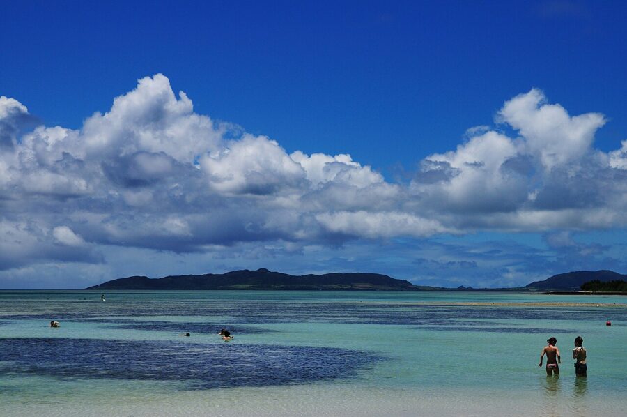

Iriomote
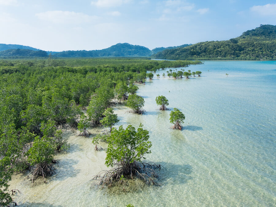
Iriomote (西表島) is the prefecture’s second-largest island, about 90 per cent forest, with mangroves along its rivers and a little over 2,000 people. It is the wildest place in Okinawa and the one I would add if I could add only one. Boats from Ishigaki reach Ohara in about 40 minutes or Uehara in about 50; the Uehara route is the one most often cancelled when the winter north wind blows.

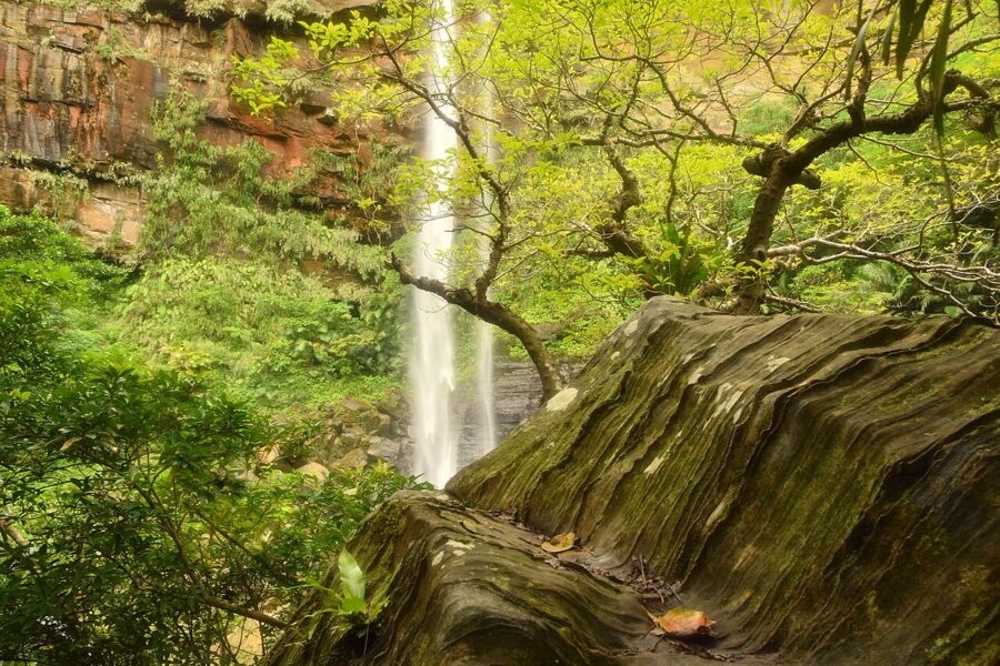
Pinaisara Falls, about 55 metres and the highest in Okinawa, is reached by kayak up the Hinai River and then on foot. Since 1 March 2025 five interior areas, the Hinai River among them, need an advance permit from Taketomi town, which administers Iriomote, and have daily caps: 200 people a day for the Hinai, with a registered guide. In practice, book a tour.

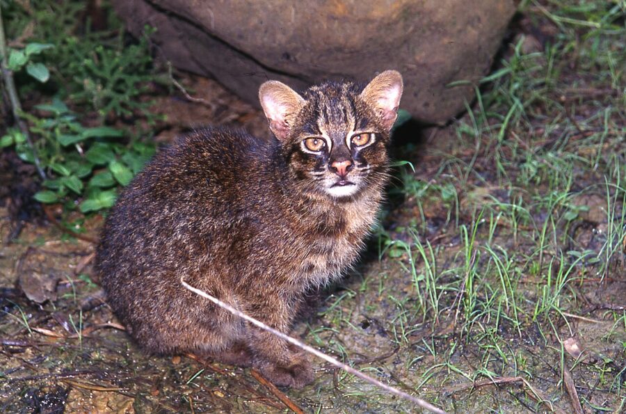
The island’s famous resident is the Iriomote cat, found nowhere else and numbering about 100. You will almost certainly not see one. Cars are the main threat to them, so drive as slowly as the signs ask.

The islands do not stop at the prefectural border: north of Cape Hedo the Amami chain belongs to Kagoshima, and ferries run from Naha through Amami to Kagoshima on Kyushu in about a day.
Sanshin, eisa and a little Uchinaaguchi
Okinawan music starts with the sanshin, a three-stringed lute with a body covered in python skin. It came from China’s sanxian during the trading years and went on from Ryukyu to the mainland, where it became the shamisen. In the evenings, folk music bars in Naha play island songs, and the audience usually knows the words.
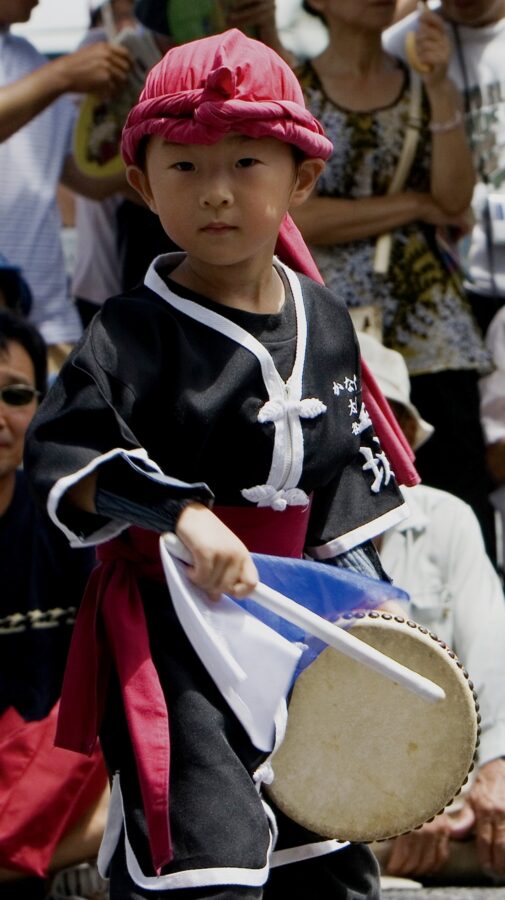
Eisa is the dance of the Bon season in late summer, when the ancestors’ spirits are welcomed home and sent away again. Young people dance through the streets with large and small drums while white-faced clowns run among them. The biggest gathering is in Okinawa City at the end of summer, but in August you can hear drum practice in car parks all over the island.
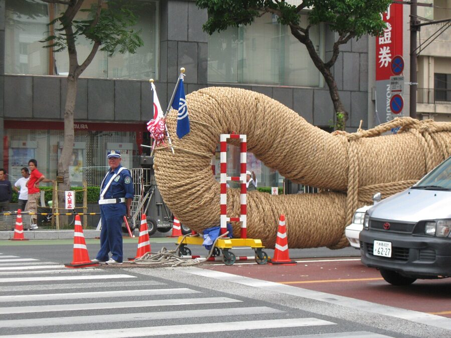
The Naha Great Tug-of-War, on a Sunday in October (11 October in 2026) on Route 58 in central Naha, uses a rice-straw rope about 200 metres long and around 40 tonnes in weight, pulled by thousands split into East and West. Anyone can join, and pieces of rope go home afterwards for luck.
The islands’ own languages, the Ryukyuan family, are separate from Japanese, and UNESCO lists all of them as endangered. On the main island it is Okinawan, Uchinaaguchi (ウチナーグチ). Words survive in daily use: mensoore, welcome; haisai, hello (from a man; haitai from a woman); nifee deebiru, thank you.
Once you know chura, beautiful, you see it everywhere. Nankuru naisa, it will work out, is the unofficial motto, and the phrase on memorials is nuchi du takara, life is the treasure. Okinawans are Uchinaanchu; people from the mainland are Yamatunchu.
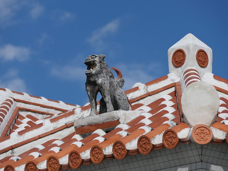
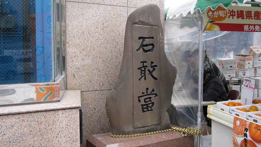
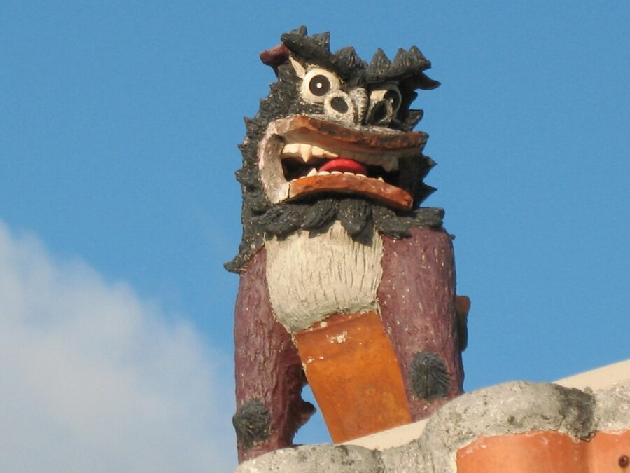
At T-junctions, look for small stones carved 石敢當, ishiganto. Evil spirits are said to travel in straight lines, so they hit the stone instead of the house. The shisa, the lion-dog on the roof, deals with whatever gets past.

Okinawa soba, champuru and awamori
Okinawan food is built on pork, kelp, island tofu, bitter melon and long contact with China, Southeast Asia and, after 1945, the United States. The best place to eat it is a shokudo, a plain diner with a long menu and short prices.
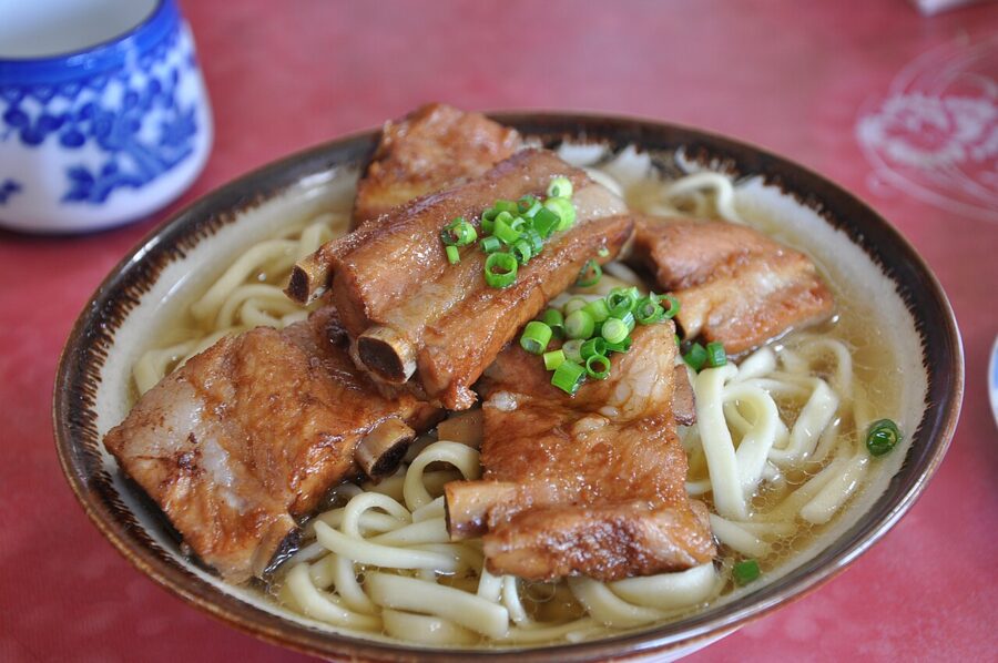
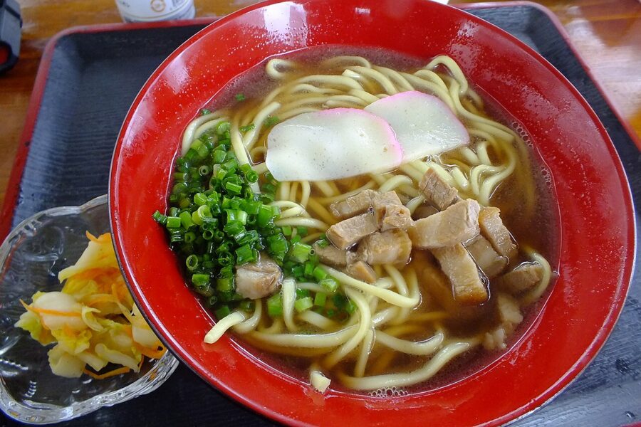
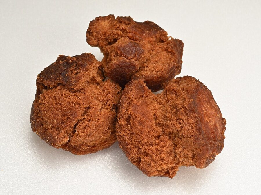
The staple is Okinawa soba, which contains no buckwheat. The noodles are wheat, thick and slightly chewy, in a pork-and-bonito broth with braised pork belly, fish cake and pickled ginger. Labelling rules say soba must be at least 30 per cent buckwheat, so the Fair Trade Commission questioned the name in 1976; on 17 October 1978 “authentic Okinawa soba” was approved as a special designation, and 17 October is now Okinawa Soba Day.

Yaeyama soba has thin, round noodles, and Miyako soba traditionally hides its toppings under the noodles. Look too for rafute, pork belly braised in awamori and soy; umibudo, sea grapes, a seaweed that pops like caviar; and taco rice, taco filling on rice, invented near the bases in the 1980s.

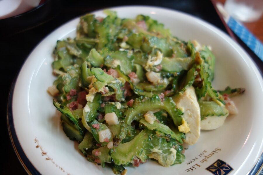
Champuru means a mixture, and goya champuru, stir-fried bitter melon, is the dish everyone eats at least once. The word gets used about the islands themselves too: Chinese, Japanese, Southeast Asian and American things stirred into one pan.

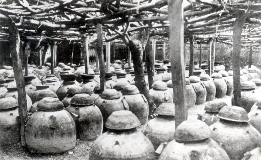
The local spirit is awamori, distilled once in a pot still from long-grain Thai rice fermented with a black koji mould native to Okinawa, a method that came from Siam in the fifteenth century. Aged three years or more it can be called kusu. Families kept sets of jars in which the oldest was topped up from the next oldest, a system called shitsugi.
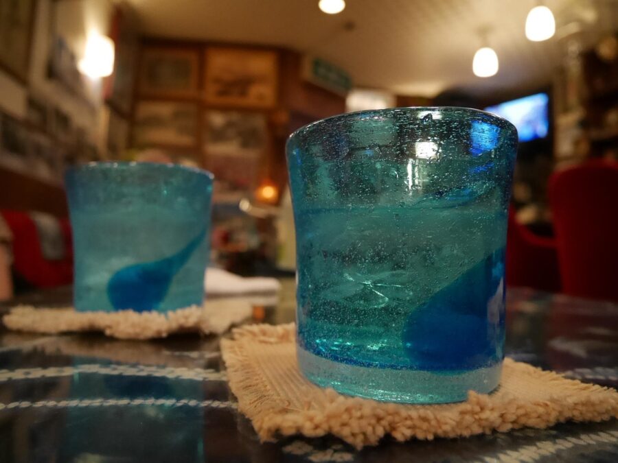
There were 47 distilleries in 2018. Drink it with water and ice, as most Okinawans do.
Five days, ten days
Five days on the main island
Day one: monorail into Naha, Kokusai-dori, the market arcades and Tsuboya, and dinner upstairs at the Makishi market. Day two: Shuri in the morning with a booked slot for the main hall, then the stone lane and Tamaudun, and the Prefectural Museum in the afternoon. Collect a car that evening.
Day three: the south. Sefa-utaki at 09:00, before the coaches, then the Himeyuri Peace Museum and Mabuni. Day four: north on the expressway, stopping at Zakimi or Katsuren, then Churaumi, Nakijin and Kouri, with a night on the Motobu Peninsula.
Day five: an early drive through Yanbaru to Cape Hedo and three hours back to Naha for a late flight. If you would rather swim, swap day five for a boat to Tokashiki or Zamami. American Village is what I would cut first.
Ten days with the islands
Days one to four as above. Day five: drive back south, return the car and take the afternoon boat to Zamami or Tokashiki for two nights, with whales in late winter and snorkelling the rest of the year. Day seven: morning boat to Naha and an afternoon flight to Ishigaki.
Day eight: Taketomi, staying the night. Day nine: Iriomote, with a guided kayak trip to Pinaisara booked and permitted well ahead. Day ten: fly home from Ishigaki, which has direct flights to Tokyo. If you prefer beaches to forest, give Miyako the last three days instead; there is no boat between Miyako and Ishigaki.
Whichever version you choose, start in Shuri. The hall on the hill is new timber, Okinawan clay and a few old shards ground into the tiles, standing on the foundations the kings used. Book the half-hour slot, stand in the courtyard for a while afterwards, then walk down the stone lane toward the sea, the way the tribute missions left for China.